Koča pri Savici - Planina Viševnik
Starting point: Koča pri Savici (653 m)
Starting point Lat/Lon: 46.2896°N 13.8022°E 
Time of walking: 3 h
Difficulty: difficult marked way
Difficulty of skiing: very demanding
Altitude difference: 972 m
Altitude difference (by path): 972 m
Map: Triglav 1:25.000
Access to starting point:
From highway Ljubljana - Jesenice we go to the exit Lesce and follow the road towards Bled and forward towards Bohinjska Bistrica. We continue driving towards the lake Bohinj (Ribčev laz), where we come to a crossroad, where we continue straight on the left (south) side of the lake in the direction of Ukanc and waterfall Savica. This more and more narrow road, we then follow to a large parking lot at the mountain hut Savica. The parking lot is payable.
Path description:
From the parking lot, we go right in the direction of the lake Črno jezero, mountain hut Koča pri Triglavskih jezerih and Hotel Zlatorog. The path at first leads on a macadam road which over a bridge crosses the river Savica. Only a little after the bridge, signs for Komarča point us to the left (straight Hotel Zlatorog) on at first quite wide and relatively gentle forest path. The path soon starts ascending steeper and a little higher brings us to the spot, where the path towards the source of Savica branches off to the left, and we continue right on the more and more steep path.
Well maintained and relatively wide mountain path, soon passes on very steep and for slipping dangerous slopes of Komarča (there's also a great danger of falling stones). The path ahead is steeply ascending on mostly forested wall of Komarča, where on harder spots we have fixed safety gear for help (mainly steel cables).
Higher from the path some views open up towards Bohinj, and the path brings us to short technically demanding spot, where with the help of stemples and a steel cable we cross otherwise not very exposed gully. The path ahead is for some time still steeply ascending and with the help of some fixed safety gear brings us to the top of Komarča, from where a beautiful view opens up on our starting point. Next follows a short moderately steep ascent, and then the path starts gently descending towards the lake Črno jezero, which we reach after less than 5 minutes of additional walking.
The marked path already few steps before the lake turns right and it quickly brings us to a crossing, where we continue right in the direction of the mountain pasture Viševnik and Pršivec (straight mountain hut Koča pri Triglavskih jezerih). The path ahead for some time runs through a dense forest, then crosses a short panoramic slope and then returns into the forest. Here we will on the right side, few ten meters below the path hear interesting karst source, which is immediately after the source descending over Komarča. (If we have time and a will we can descend to the source, but carefully because source ends with steep precipitous slopes).
The path which runs on little visited area named Dol pod Stadorjem, for a short time flattens and it brings us to a smaller valley, on the bottom of which often cold air is retained. Ahead path which is often quite wet goes into the forest, where it starts ascending steeper. Very peaceful path comes out of the forest only a little before the mountain pasture Viševnik to which we have only 5 more minutes of easy walking.
Trip can be extended to: Planina Blato
,
Dom na Komni
,
Planina Lopučnica
,
Planina Dedno Polje
,
Planina Ovčarija
,
Koča pri Triglavskih jezerih
,
Pršivec ( 45 min)
,
Mala Tičarica
,
Slatna
,
Velika Tičarica
,
Kopica
,
Čelo
Pictures:
 1
1 2
2 3
3 4
4 5
5 6
6 7
7 8
8 9
9 10
10 11
11 12
12 13
13 14
14 15
15 16
16 17
17 18
18 19
19 20
20 21
21 22
22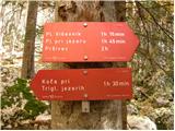 23
23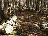 24
24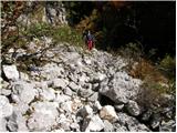 25
25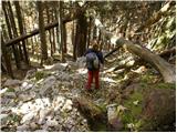 26
26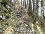 27
27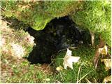 28
28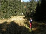 29
29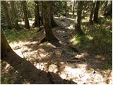 30
30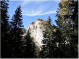 31
31 32
32 33
33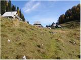 34
34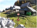 35
35