Starting point: Kočevje (464 m)
Starting point Lat/Lon: 45.633°N 14.8585°E 
Time of walking: 4 h
Difficulty: easy marked way
Difficulty of skiing: no data
Altitude difference: 577 m
Altitude difference (by path): 700 m
Map:
Access to starting point:
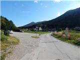
First, we drive to Kočevje, and then we look for street Podgorska ulica (which from the main road branches off to the right - direction of driving towards Delnice). At the end of the mentioned street we will notice signposts and by them a nicely settled parking lot.
Path description:
From the parking lot, we continue on the asphalt road which continues towards the foot of the hill, and at the smaller crossroad, we continue on the right road (left - ski slope). Only few steps ahead we get to a marked crossing of the mountain paths, and we choose the right path Kalanova pot, which few 10 strides continues on the asphalt road, and then signs for the mentioned path point us to the left, on a footpath which starts ascending through the forest. When we are in the forest, we quickly reach the cart track, and then we further follow a wide and well-beaten path which starts ascending steeper, and during the ascent it several times crosses a forest road.
From the path which is ascending through the forest, only rarely a view opens up a little towards Kočevje, and the path higher brings us to the spot, where the path branches off to the right towards the cave Jama treh bratov, and we continue straight, on the path which flattens. Follows few minutes of easy walking, and then we get to the next forest road which we follow slightly to the right (slightly left - cottage Koča pri Jelenovem studencu - 5 minutes).
We continue towards Ledenik, at first on the road which moderately ascends, and then descends to the nearby crossroad, where we continue slightly right, or straight (sharply left - a parking lot above cottage Koča pri Jelenovem studencu).
From the crossroad, we few more minutes walk on the road, and then signs for Ledenik point us to the left downwards, on a footpath which continues through the forest. The path quickly flattens, and then in a short ascent it brings us to another forest road which we follow to the left. Next follow two successive crossroads, and both times we continue on the right road, by the second crossroad there are signs for cave Eleonorina jama. Few 100 meters further, the blazes points us from the road which leads towards the cave Eleonorina jama, to the right on a cart track which continues through the forest, and at the crossings we follow the blazes. After few minutes, the blazes from the cart track point us to the right, on the path which starts ascending towards the summit of Ledenik, and we reach it after approximately 10 minutes of additional walking.
From Ledenik we still continue on Kočevje mountain trail, and it at first descends on the ridge and then for some time flattens. Next follows some descent, where we follow the blazes, and then we reach the end of the forest road, on which we continue the descent. When the road turns right, we continue left, on a marked path which still continues through the forest. A little lower we again reach one of the forest roads, and we reach it right at the stump with a projecting roof. Here we continue left and then before the forestry cottage Bivaki, the road turns right and starts semicircular turning towards the left. After the semicircle around the forestry cottage, the road turns a little to the right, and blazes lead us right, on the path which continues without large changes in altitude. A little further, we reach the cart track, on which we descend to the turning point of the next forest road. Further, we few minutes walk on the road, from which occasionally a view opens up towards the southwest, where we see Goteniška gora. After few minutes, we go from the road again to the right, and after a gentle ascent we reach another road which we only cross. Follows few minutes of a moderate ascent, and then we get below Slovenski vrh, where the path steeply ascends. The steep ascent quickly ends, because the path brings us on Slovenski vrh.
Kočevje - Ledenik 2:15, Ledenik - Slovenski vrh 1:45.
Description and pictures refer to a condition in the year 2016 (September).
Pictures:
 1
1 2
2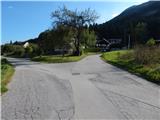 3
3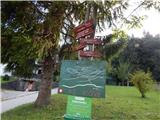 4
4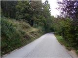 5
5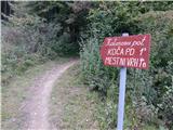 6
6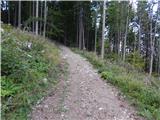 7
7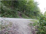 8
8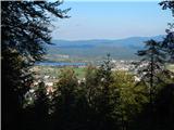 9
9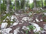 10
10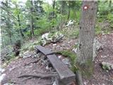 11
11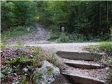 12
12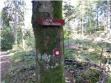 13
13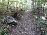 14
14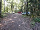 15
15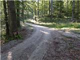 16
16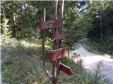 17
17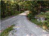 18
18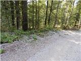 19
19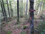 20
20 21
21 22
22 23
23 24
24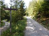 25
25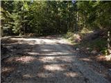 26
26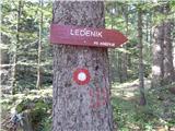 27
27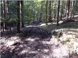 28
28 29
29 30
30 31
31 32
32 33
33 34
34 35
35 36
36 37
37 38
38 39
39 40
40 41
41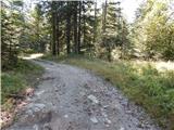 42
42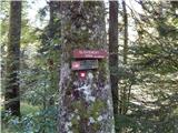 43
43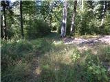 44
44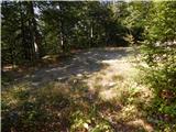 45
45 46
46 47
47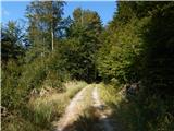 48
48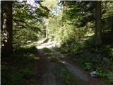 49
49 50
50 51
51 52
52 53
53 54
54 55
55