Kočna - Planina Obranica (od spomenika)
Starting point: Kočna (660 m)
Route name: od spomenika
Walking time: 1 h
Difficulty: easy marked way
Elevation gain: 375 m
Elevation difference along the route: 375 m
Map: TNP 1:50.000
Recommended equipment (summer):
Recommended equipment (winter): ice axe, crampons
Views: 6.608
 | 2 people like this post |
Access to starting point:
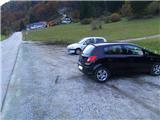
From the highway Ljubljana - Jesenice, we take the exit Lipce, where we turn left in the direction of "Blejska Dobrava and Spodnje Gorje". Soon, when we drive into the railway underpass, we are at the next crossroads, where we drive to the right - Bled, Kočna. Initially, the serpentine road ascends straight towards the west and soon in the left bend reaches the top or. settlement Kočna. Towards the end of the settlement, when the road descends a little, on the left we notice a guesthouse, and on the right a larger parking lot - our starting point.
Route description:
On the side of the road where we have parked, we step onto the cart track that leads towards the forest. Already after a few meters, we are at a slightly larger stone, on which there is a memorial plaque and the first trail blaze with the inscription Obranca, which directs us straight (westwards) into the forest. The path, which starts to ascend, in the forest first turns slightly left and soon after back into the same direction, straight, steeply upwards. At the first junction, we choose right, where the steepness increases even more. At the second, more indistinct junction, the blazes again direct us right into the steepness, where the path soon turns left and already soon again straight or into the slope, to a tree with a blaze, where it eventually gets lost a little. The path is supposed to turn right here, but due to overgrowth and fallen trees, we choose the steep direction straight ahead, where we soon encounter our path again - to the left. The steepness eases slightly for a short time, and the signs lead us to a larger quantity of fallen trees. Since we cannot continue the path following the blazes, a few meters before the mentioned fallen trees we direct ourselves right into the steepness, along the already somewhat cleared bypass. When we encounter the signs again, they direct us left, transversely towards the valley or wide gully, which we cross. From there onwards, we ascend again on a greater steepness, and the path directs itself more and more to the right towards the top of the steep, less tree-covered valley, through the middle of which we climb to the fence on the edge of the mountain pasture Obranca. We continue either into the little slope on the left, where there is a viewpoint, or westwards, past the monument across the pastures, to the shepherd's hut.

Photos:
 1
1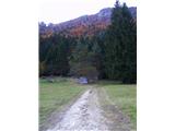 2
2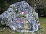 3
3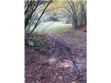 4
4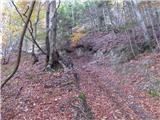 5
5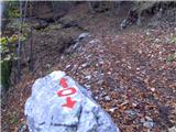 6
6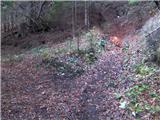 7
7 8
8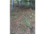 9
9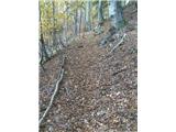 10
10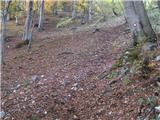 11
11 12
12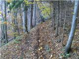 13
13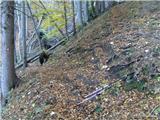 14
14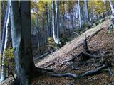 15
15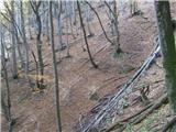 16
16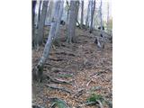 17
17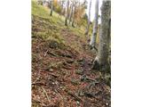 18
18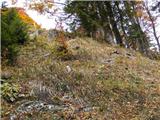 19
19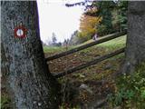 20
20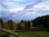 21
21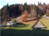 22
22
Discussion about the trip Kočna - Planina Obranica (od spomenika)
|
| Jon3. 10. 2011 |
The path is not easy as written in the path description. It is very steep (the vast majority of the path), and at times dangerously steep, especially on the return.
|
|
|
|
| heinz3. 10. 2011 |
Jon, with regard to the general criteria on the difficulties of European hiking trails, which also apply here, a path that does not require the use of hands for progression anywhere (gripping wire ropes, pegs, rocks, holds etc.) is considered -easy as described above. That's how it is. It is true, however, that it is quite steep in places..
Regards,
|
|
|
|
| Jusk12. 02. 2020 |
It really is a decently steep trail, you get a good workout  today I went along this trail to Obranica and further to Planski vrh, at the natural bridge I turned back and via another trail past the snow cave back to Obranica and down to Kočna. The trail is mostly dry, no special features, only further towards Planski vrh occasionally a bit icy. today I went along this trail to Obranica and further to Planski vrh, at the natural bridge I turned back and via another trail past the snow cave back to Obranica and down to Kočna. The trail is mostly dry, no special features, only further towards Planski vrh occasionally a bit icy.
|
|
|
|
| diana.jug25. 05. 2025 08:30:17 |
First time up this path, I did a loop - down past babe...
As already mentioned, the path is really steep. It gets lost a bit in places, but it's followable, a little overgrown, but with some orientation you manage. Definitely pleasant, a bit spiced up, precisely because of the steepness. 😀 Not recommended for descent. 
|
|
|
To post a comment you must log in:
If you do not yet have a username, you must first
register.