Kokra (Roblek) - Kalški greben
Starting point: Kokra (Roblek) (906 m)
Starting point Lat/Lon: 46.3167°N 14.5134°E 
Time of walking: 3 h 55 min
Difficulty: partly demanding marked way
Difficulty of skiing: no data
Altitude difference: 1318 m
Altitude difference (by path): 1318 m
Map: Kamniške in Savinjske Alpe 1:50.000
Access to starting point:
A) We drive to Preddvor or to the settlement Tupaliče, which is situated by the main road Kranj - Zgornje Jezersko, and then we continue driving in the direction of Jezersko. When we already get to the settlement Kokra, at the road sign between 10.5 km and 10 km we turn right downwards towards Spodnja Kokra (by the crossroad there are also signposts). Further, we drive on a narrow asphalt road, that runs between the church on the right and river Kokra on the left. The road then starts ascending, at the crossroads we follow it in the direction of farm Roblek. Mostly asphalted road higher brings us to the farm Roblek, where we park on an appropriate place.
B) From Jezersko we drive towards Preddvor, at the road sign between 10 km and 10.5 km we turn left downwards towards Spodnja Kokra (by the crossroad there are also signposts). Further, we drive on a narrow asphalt road, that runs between the church on the right and river Kokra on the left. The road then starts ascending, at the crossroads we follow it in the direction of farm Roblek. Mostly asphalted road higher brings us to the farm Roblek, where we park on an appropriate place.
Path description:
From the starting point, we continue on the road which on the right side bypasses farm, and then we cross also a grazing fence. Gentle road then leads us through the pasture, from where beautiful views opening up mainly towards the mountains above the right bank of river Kokra. On the other side of the pasture road goes into the forest and changes into a cart track. Immediately, when the cart track passes into the forest from the right joins the marked path from the valley, and we continue on at first still quite gentle cart track. After few minutes, we get to valley Grda dolina, where the cart track turns a little to the left, and here we continue slightly right, on a marked footpath which starts ascending steeper through the forest. Further, we are quite steeply ascending, and the path leads us on an area named Roblekov kot. Higher, the path brings us by the torrent ditch, which a little ahead we also cross. On the other side of the torrent partly on the scree we are getting closer to the walls of Krvavec, where the path becomes exposed to falling stones. Further Roblekov kot narrows, so that the path gradually leads towards the rocky jump Lojtra. Well secured, mostly also relatively wide path then leads us through the mentioned passage, where there is also site of edelweiss and Zois' bellflower. Next follows also few minutes of quite steep ascent, and then the path gradually flattens. When the path flattens even more, also forest gets thinner and the path brings us on the lower part of the mountain pasture Dolga njiva. On pleasant grassy terrain we quickly get to a crossing, where from the right side joins the path from Krvavec, and we continue straight to the near older shepherd hut and also a little further to a newer hut.
Above the hut, by the edge of dwarf pines, we look for continuation of the footpath which continues a little to the right. We quickly get into a smaller valley, through which we are at first gently, and then moderately ascending. From the small valley we quickly pass on a crumbly slope, which we cross diagonally towards the right. After the passage, which technically isn't demanding, the path passes into a series of smaller grassy valleys, surrounded by dwarf pines. Next follows few minutes of a light ascent and the path brings us to a crossing on Škrbina, from where a nice view opens up on the main Grintovci.
Here we continue left in the direction of Kalški greben and mountain hut Cojzova koča on the path which already after few additional strides, it brings us to the next crossing. We continue slightly left (right Kalška gora and mountain hut Cojzova koča) on a path which starts slightly ascending on the more and more panoramic slopes. A pleasant path, which can be in the middle of the day very hot at first leads near the smaller ridge and then gradually turns a little more to the left and from dwarf pines brings us on beautiful meadows, on which we will find various types of flowers. The wide slope on which we walk then narrows and meadows are gradually replaced by rocks. Higher, the path brings us on a panoramic main ridge, which we then follow to the peak, which is often full of sheep droppings.
Roblek - Dolga njiva 2:10, Dolga njiva - Škrbina 30 minutes, Škrbina - Kalški greben 1:15.
Pictures:
 1
1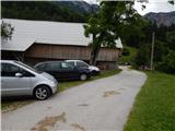 2
2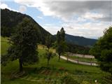 3
3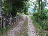 4
4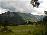 5
5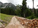 6
6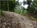 7
7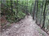 8
8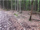 9
9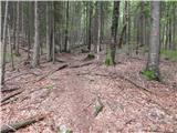 10
10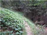 11
11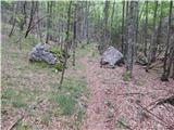 12
12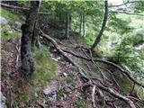 13
13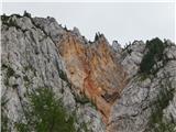 14
14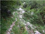 15
15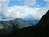 16
16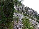 17
17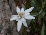 18
18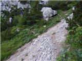 19
19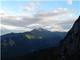 20
20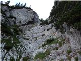 21
21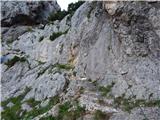 22
22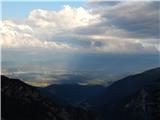 23
23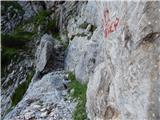 24
24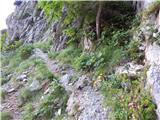 25
25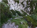 26
26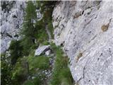 27
27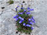 28
28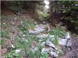 29
29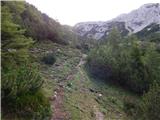 30
30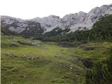 31
31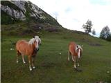 32
32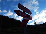 33
33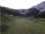 34
34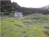 35
35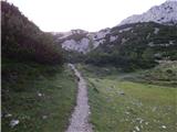 36
36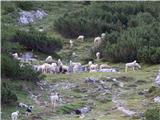 37
37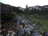 38
38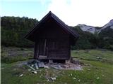 39
39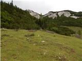 40
40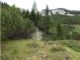 41
41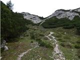 42
42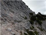 43
43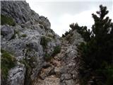 44
44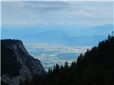 45
45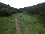 46
46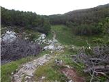 47
47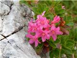 48
48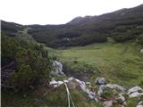 49
49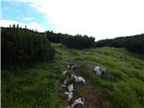 50
50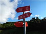 51
51 52
52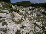 53
53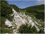 54
54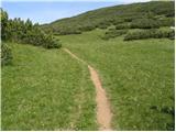 55
55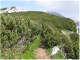 56
56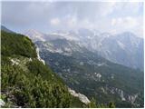 57
57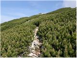 58
58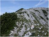 59
59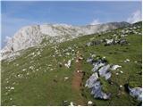 60
60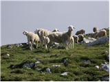 61
61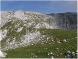 62
62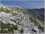 63
63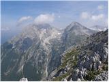 64
64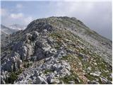 65
65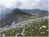 66
66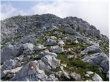 67
67 68
68