Kokra (Roblek) - Planina Dolga njiva (Krvavec)
Starting point: Kokra (Roblek) (906 m)
Starting point Lat/Lon: 46.3167°N 14.5134°E 
Time of walking: 2 h 10 min
Difficulty: partly demanding marked way
Difficulty of skiing: no data
Altitude difference: 782 m
Altitude difference (by path): 782 m
Map: Kamniške in Savinjske Alpe 1:50.000
Access to starting point:
A) We drive to Preddvor or to the settlement Tupaliče, which is situated along the main road Kranj - Zgornje Jezersko, and then we continue driving in the direction of Jezersko. When we already get to the settlement Kokra, at the road sign between 10.5 km and 10 km we turn right downwards towards Spodnja Kokra (by the crossroad there are also hiking signs). Further, we drive on a narrow asphalt road, which runs between the church on the right and the river Kokra on the left. The road then starts ascending, and at the crossroads we follow it in the direction of the farm Roblek. The mostly asphalted road brings us higher to the farm Roblek, where we park in an appropriate place.
B) From Jezersko we drive towards Preddvor, at the road sign between 10 km and 10.5 km we turn left downwards towards Spodnja Kokra (by the crossroad there are also hiking signs). Further, we drive on a narrow asphalt road, which runs between the church on the right and the river Kokra on the left. The road then starts ascending, and at the crossroads we follow it in the direction of the farm Roblek. The mostly asphalted road brings us higher to the farm Roblek, where we park in an appropriate place.
Path description:
From the starting point, we continue on the road which on the right side bypasses the farm, and then we cross also a pasture fence. The gentle road then leads us through the pasture, from where beautiful views open up mainly towards the mountains above the right bank of the river Kokra. On the other side of the pasture the road goes into the forest and changes into a cart track. Already immediately, when the cart track enters the forest, a marked path from the valley joins us from the right, and we continue the path on the initially still quite gentle cart track. After a few minutes we arrive in Grda dolina, where the cart track turns somewhat to the left, and here we continue slightly to the right on the marked footpath, which starts to ascend more steeply through the forest. Further on we ascend quite steeply, and the path leads us through the area named Roblekov kot. Higher the path brings us beside the torrent gully, which a little further we also cross. On the other side of the torrent, partly over scree, we approach the walls of Krvavec more and more, where the path becomes exposed to falling rocks. Further on Roblekov kot narrows, so the path gradually leads us towards the rocky step Lojtra. The well secured, mostly also relatively wide path then leads us over the mentioned passage, where there is also a stand of edelweiss and Zois' bellflower. A few more minutes of quite steep ascent follow, then the path gradually flattens. When the path flattens even more, the forest also thins out and the path brings us to the lower part of the mountain pasture Dolga njiva. Over the pleasant grassy sward we quickly reach a junction, where the path from Krvavec joins from the right, and we continue straight to the nearby older shepherd hut and a little further to the newer hut.
Description and pictures refer to the condition in the year 2017 (July).
Pictures:
 1
1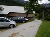 2
2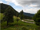 3
3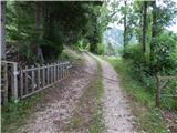 4
4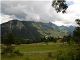 5
5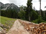 6
6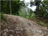 7
7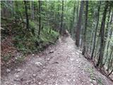 8
8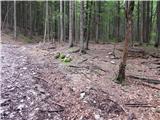 9
9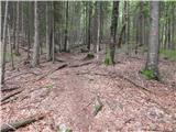 10
10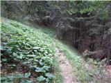 11
11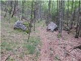 12
12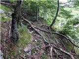 13
13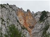 14
14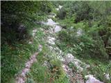 15
15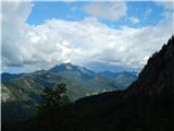 16
16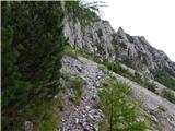 17
17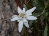 18
18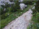 19
19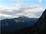 20
20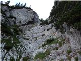 21
21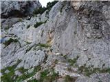 22
22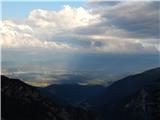 23
23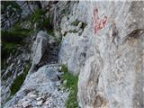 24
24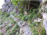 25
25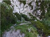 26
26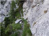 27
27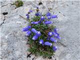 28
28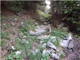 29
29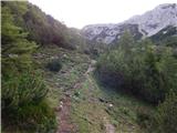 30
30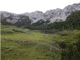 31
31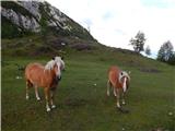 32
32 33
33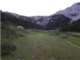 34
34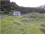 35
35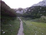 36
36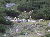 37
37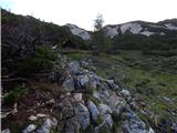 38
38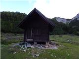 39
39