Koprivna (Kumer) - Planina Luža
Starting point: Koprivna (Kumer) (1172 m)
| Latitude/Longitude: | 46,49030°N 14,72840°E |
| |
Walking time: 25 min
Difficulty: easy marked way
Elevation gain: 78 m
Elevation difference along the route: 78 m
Map: Kamniške in Savinjske Alpe 1:50.000
Recommended equipment (summer):
Recommended equipment (winter):
Views: 2.505
 | 1 person like this post |
Access to starting point:
A) First, we drive to Luče (from Kamnik to here over the mountain pass Volovjek (Kranjski Rak) or from the Štajerska highway and past Mozirje and through Ljubno ob Savinji), then we continue driving in the direction of Logarska dolina. When we arrive in Solčava, we leave the main road and continue driving right towards Črna na Koroškem. Further on, we drive along an ascending road, which at the crossroads we follow in the direction of Črna na Koroškem and the mountain pass Spodnje Sleme. From the pass onwards, the road starts descending, and we follow it to the place where we join the road Črna na Koroškem - Koprivna. Here we continue left, then at the next crossroad approximately 1 km further right towards the mountain hut on the farm Kumer. Further, we ascend along the stream Koprivna, and we follow the road to the crossroad where the road branches off sharply to the left towards the previously mentioned hut, straight ahead the road continues towards the mountain pasture Luža, and to the right a marked mountain path branches off to Peca (the latter initially also follows the road). We park in a suitable place by the road.
B) From Koroška, we first drive to Črna na Koroškem, then we continue driving towards Podpeci and Koprivna. At the crossroad where the road towards Podpeci branches off to the right, we continue slightly left, and likewise at the next crossroad where the road branches off to the right into the valley Topla. Further on, we drive along the river Meža for some time, then we first arrive at the crossroad where the road branches off to the left towards the mountain pass Spodnje Sleme and further towards Logarska dolina. Here we continue straight, then at the next crossroad approximately 1 km further right towards the mountain hut on the farm Kumer. Further, we ascend along the stream Koprivna, and we follow the road to the crossroad where the road branches off sharply to the left towards the previously mentioned hut, straight ahead the road continues towards the mountain pasture Luža, and to the right a marked mountain path branches off to Peca (the latter initially also follows the road). We park in a suitable place by the road.
C) First, we drive to Šoštanj, then we continue driving along a winding road towards Črna na Koroškem. In Črna na Koroškem, we continue left in the direction of Podpece and Koprivna. At the crossroad where the road towards Podpeci branches off to the right, we continue slightly left, and likewise at the next crossroad where the road branches off to the right into the valley Topla. Further on, we drive along the river Meža for some time, then we first arrive at the crossroad where the road branches off to the left towards the mountain pass Spodnje Sleme and further towards Logarska dolina. Here we continue straight, then at the next crossroad approximately 1 km further right towards the mountain hut on the farm Kumer. Further, we ascend along the stream Koprivna, and we follow the road to the crossroad where the road branches off sharply to the left towards the previously mentioned hut, straight ahead the road continues towards the mountain pasture Luža, and to the right a marked mountain path branches off to Peca (the latter initially also follows the road). We park in a suitable place by the road.
Route description:
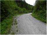
From the starting point, we continue straight ahead, that is, along the road that ascends parallel to the nearby stream. The path further leads us past Žegnani studenec and a little higher past the turn-off of the cart track to St. Ana. Higher up, the road makes a sharp left bend, beside which there are information boards; right at that spot we leave it and continue straight onto a poorer road, which shortly afterwards crosses the state border. Once we enter Austria, we continue for a short time along the poorer road, then we join a wider macadam road, along which we walk in a few minutes to the central part of the mountain pasture Luža.

The trip can be extended to the following destinations: Sveta Ana in Koprivna,
Mountain hut on farm Kumer,
Govševa planina,
Planina Rep (Repija),
Šoparjev vrh,
Planina Zgornja Luža (1 h),
Čofatijev vrh,
Topitza (1 h 45 min),
Govca (Olševa),
Wackendorfer Spitze (2 h 30 min),
Končnikov vrh,
Feistritzer Spitze (2 h 30 min),
Petzen (Kordeschkopf) (Peca (Kordeževa glava))
Photos:
 1
1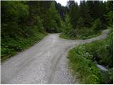 2
2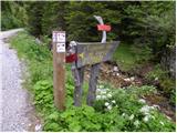 3
3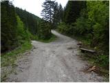 4
4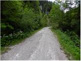 5
5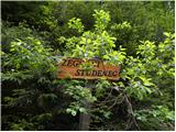 6
6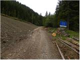 7
7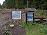 8
8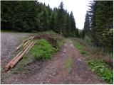 9
9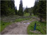 10
10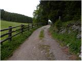 11
11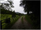 12
12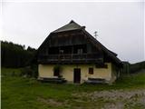 13
13
Discussion about the trip Koprivna (Kumer) - Planina Luža
To post a comment you must log in:
If you do not yet have a username, you must first
register.