Koprivnik v Bohinju - Vodnikov razglednik
Starting point: Koprivnik v Bohinju (971 m)
| Latitude/Longitude: | 46,30590°N 13,98320°E |
| |
Walking time: 15 min
Difficulty: easy marked way
Elevation gain: 46 m
Elevation difference along the route: 60 m
Map: TNP 1:50.000
Recommended equipment (summer):
Recommended equipment (winter): crampons
Views: 13.730
 | 2 people like this post |
Access to starting point:
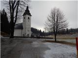
A) From the Ljubljana-Jesenice highway, take the Lesce exit, then continue driving towards Bled and further to Bohinj. After the settlement Bitnje, which the main road bypasses on the left side, continue sharply right in the direction of Jereka and Pokljuka. Further, the road first ascends steeply, then after Koriti gradually flattens and brings us to a crossroads by the bus station, where we continue right in the direction of Pokljuka, Koprivnik and Jereka (straight Srednja vas). Immediately after the crossroads, we arrive in Jereka, and from the crossroads in front of the church we continue straight towards Pokljuka (left Podjelje). After Jereka the road again starts ascending more steeply, higher it flattens and continues along the Mrzli potok stream. At the bus station signs for Koprivnik direct us to the left, and from the mentioned crossroads we drive less than 200 m and then park on the parking lot near the parish church.
B) From Železniki or Podbrdo drive to Bohinjska Bistrica, then continue driving in the direction of Bled. Soon after the Petrol gas station, which is located just a little after Bohinjska Bistrica, continue driving left in the direction of Pokljuka and Jereka. Further, the road first ascends steeply, then after Koriti gradually flattens and brings us to a crossroads by the bus station, where we continue right in the direction of Pokljuka, Koprivnik and Jereka (straight Srednja vas). Immediately after the crossroads, we arrive in Jereka, and from the crossroads in front of the church we continue straight towards Pokljuka (left Podjelje). After Jereka the road again starts ascending more steeply, higher it flattens and continues along the Mrzli potok stream. At the bus station signs for Koprivnik direct us to the left, and from the mentioned crossroads we drive less than 200 m and then park on the parking lot near the parish church.
Route description:
From the parking lot at the church on Koprivnik we continue along the road in the direction of Vodnikov razglednik. The road first leads us across a meadow, then after a small bridge we continue slightly left along the road, which is closed to public traffic by a traffic sign. After a short ascent we arrive at the fire station, behind it signs for Vodnikov razglednik direct us to the right road, which first loses its asphalt surface and then turns into a footpath. The path ahead leads us briefly through the forest, then across a hay meadow we reach another asphalt road, which we follow to the right. We walk along the road briefly, then before a lonely house we continue slightly right onto the path that bypasses the house and outbuilding on the right.
When the buildings behind the house end, a path from Jereka joins from the right, and we continue straight onto the path that enters the forest. There follows a few minutes of steeper ascent, aided by a wooden fence (easy), and the path brings us to Vodnikov razglednik.
Description and pictures refer to the condition in 2016 (January).

Photos:
 1
1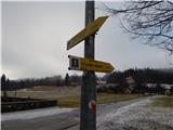 2
2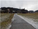 3
3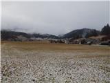 4
4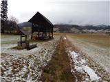 5
5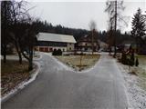 6
6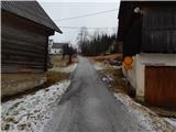 7
7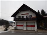 8
8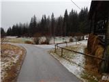 9
9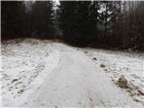 10
10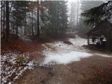 11
11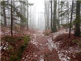 12
12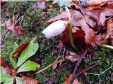 13
13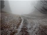 14
14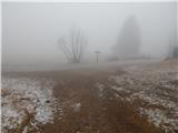 15
15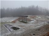 16
16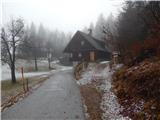 17
17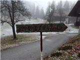 18
18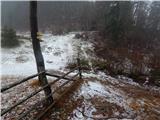 19
19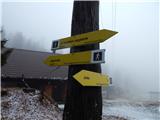 20
20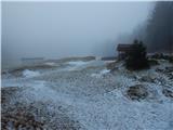 21
21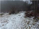 22
22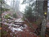 23
23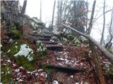 24
24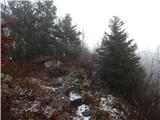 25
25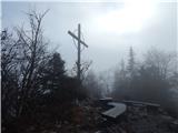 26
26 27
27
Discussion about the trip Koprivnik v Bohinju - Vodnikov razglednik
|
| modrook121. 01. 2017 |
We were at the viewpoint on 29. 12. 2016. Wonderful path, even better views. Children enjoyed it.
|
|
|
To post a comment you must log in:
If you do not yet have a username, you must first
register.