Kozjak nad Pesnico - Tojzlov vrh
Starting point: Kozjak nad Pesnico (267 m)
Starting point Lat/Lon: 46.63104°N 15.62633°E 
Time of walking: 2 h 5 min
Difficulty: easy marked way
Difficulty of skiing: no data
Altitude difference: 436 m
Altitude difference (by path): 480 m
Map:
Access to starting point:
We drive into Spodnja Kungota, and then we follow the road towards Zgornja Kungota. In the settlement Kozjak nad Pesnico we turn left towards Gaj and Urban and then we park on an appropriate place. Best somewhere on part, where the road passes into the forest.
Path description:
From the main road Spodnja Kungota - Zgornja Kungota we go on the road which leads towards Gaj nad Mariborom and Sveti Urban. The path at first leads on the flat part, and by the edge of the forest we continue on the right wider road. 50 meters ahead we go left and then we start ascending through the forest, and soon blazes point us to the right on a footpath which ascends to the ruins of the castle Pahlejev grad, which we bypass on the left side. After the castle we gradually return on the asphalt road, on which we then continue to a crossing, where from the right side also the path from Zgornja Kungota joins.
When we return into the forest we again leave the road because blazes point us to the right, where we for some time ascend steeper. A little further, the path flattens and in few steps descends to the road which we reach at a smaller crossroad.
We continue on a marked road which few more minutes continues through the forest, and when we leave the forest, we continue on a panoramic ridge, where the path leads us past few houses. Further from the ridge we again pass on a slope and we get to a triangular crossroad in the middle of which there is a religious symbol.
Here the marked path branches off to the left (road), which leads towards Sveti Urban, and we continue straight, where on the left side we bypass the homestead Nabašec. Here we descend a little and then we get to a marked crossroad, where also the driving road branches off to the left towards Sveti Urban.
Here we continue straight as well and only a little further at the smaller crossroad we go once again straight. Next follows some light descent, and then we get to the next marked crossroad, where we go left in the direction of Bresternica (right - driving road towards Gaj nad Mariborom) and then we go immediately right on the road, by which there are signs for path Večernikova smer on Tojzlov vrh.
From the crossroad, we diagonally ascend on a macadam road, and when we leave the forest we bypass homestead Večernik on the right side. Behind the homestead the road for some time flattens, and from the road a nice view opens up towards the church of the Holy Cross in Gaj nad Mariborom. The path ahead leads us also past the chapel, behind which we return into the forest, through which we ascend steeper. The steepness decreases, when we reach an asphalt road which we follow to the left, and there we quickly get to the settlement Gaj nad Mariborom. Follows only easy ascent through the settlement and we get to the cemetery, where we turn left, and immediately after the crossroad we are already at the church of the Holy Cross, where by the road there is an inscription box.
We continue past the church and we follow the blazes for Tojzlov vrh. Settlement Gaj nad Mariborom soon ends, and the nearby farm we bypass on the right side. Only few 10 strides ahead we go from the road left on a cart track which ascends by the edge of the forest, and at the chapel we cross an asphalt road. Further, we are still ascending by the edge of the forest and then we go also past the homestead Iglič, behind which after a short descent, we return on the asphalt road.
Next follows for approximately a minute easy descent and from the right joins the path from the homestead Šiker.
We continue straight and we are ascending on a panoramic part, where from the left joins another path from the settlement Šober.
For a short time, we still walk on a panoramic road, from which a nice view opens up towards Sveti Urban and surrounding hills, and then the road returns into the forest. Follows few minutes of a moderate ascent and we get to Planinski dom Kozjak or Planinski dom Obrtnik on Tojzlov vrh.
Before the hut we go right on a cart track, by which there are signs for the peak. After few steps the path goes into the forest, through which it is lightly ascending and after few minutes brings us on with a forest covered peak, where there are an inscription box and NOB monument.
The starting point - Sveti Križ 1:35, Sveti Križ - Planinski dom Kozjak 0:25, Planinski dom Kozjak - Tojzlov vrh 0:05.
Description and pictures refer to a condition in November 2021.
Pictures:
 1
1 2
2 3
3 4
4 5
5 6
6 7
7 8
8 9
9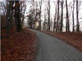 10
10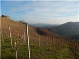 11
11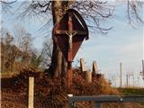 12
12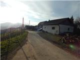 13
13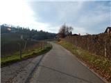 14
14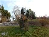 15
15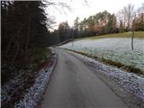 16
16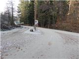 17
17 18
18 19
19 20
20 21
21 22
22 23
23 24
24 25
25 26
26 27
27 28
28 29
29 30
30 31
31 32
32 33
33 34
34 35
35 36
36 37
37 38
38 39
39 40
40 41
41 42
42 43
43 44
44 45
45 46
46 47
47 48
48 49
49 50
50 51
51 52
52 53
53 54
54 55
55 56
56 57
57 58
58 59
59