Kraljev dol - Ojstrica (via Mala Ojstrica)
Starting point: Kraljev dol (1400 m)
Starting point Lat/Lon: 46.3389°N 14.6855°E 
Path name: via Mala Ojstrica
Time of walking: 3 h 45 min
Difficulty: difficult marked way
Difficulty of skiing: no data
Altitude difference: 950 m
Altitude difference (by path): 1050 m
Map:
Access to starting point:
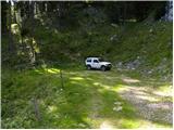
A) First, we drive to Kamnik, and then we continue driving towards Stahovica and mountain pass Črnivec. Few 100 meters before the mountain pass Črnivec we leave the main road which leads towards Gornji Grad and we continue driving sharply left in the direction of the mountain pass Volovljek (Kranjski Rak). From the mentioned mountain pass we continue straight (left road which leads on Velika planina, right Štajerski Rak) and start descending towards Luče. Lower the road flattens a little and brings us into a valley Podvolovljek. Further at first we drive past the turn-off of the road which leads into a valley Lučka Bela, after that also past Bar pri Gamsu. After the bar, we need to pay attention, because only few 100 meters further road which leads towards the mountain pasture Podvežak and Ravne and farm Planinšek branches off to the left (by the spot, where we leave the main road, there is a road sign approximately 11 km). Further, we drive on at first still asphalt road which is then ascending towards the plateau Dleskovška planota. Higher, the road towards Planinšek branches off to the right, and here we continue on the left upper road, and a little further it brings us to the next crossroad, where we continue straight in the direction of the mountain pasture Ravne (left mountain pasture Podveža). After 9 km of driving from the main road (of this 8 km of the macadam) we will get to the sharp right turn in the middle of which a road branches off to the left, which is already at the very beginning closed with a grazing fence. We go on the mentioned road which we then follow to a turning point by the end of the road. We park on an appropriate place by the end of the road.
B) First, we drive to Luče, and then we continue driving towards Kamnik. When by the road we notice a sign road which shows 10.5 km, we need to pay attention to the right turn off, because only a little further to the right a road towards the mountain pasture Podvežak and Ravne and farm Planinšek branches off. Further, we drive on at first still asphalt road which is then ascending towards the plateau Dleskovška planota. Higher, the road towards Planinšek branches off to the right, and here we continue on the left upper road, and a little further it brings us to the next crossroad, where we continue straight in the direction of the mountain pasture Ravne (left mountain pasture Podveža). After 9 km of driving from the main road (of this 8 km of the macadam) we will get to the sharp right turn in the middle of which a road branches off to the left, which is already at the very beginning closed with a grazing fence. We go on the mentioned road which we then follow to a turning point by the end of the road. We park on an appropriate place by the end of the road.
Path description:
From the end of the road, we cross the fence and then immediately after it we continue right next to it steeply upwards. The path soon goes into the forest, where it is for some time steeply ascending, and then it gradually flattens. Next follows few minutes walk through a thinner forest and a relatively gently sloping path quickly brings us to decaying shepherd cottage on the mountain pasture Vodole.
From renovated (renovated few years ago) shepherd hut we continue on the bottom of the mountain pasture, on the path which leads us past a smaller swamp. On the other side of the mountain pasture the path starts slightly ascending and after few minutes of additional walking brings us to a boulder, on which we notice already quite faded signs for Korošica, which point us slightly right, on the path which goes into the forest and gradually starts ascending steeper. Considerably overgrown path which runs through dwarf pines, higher joins a much wider path, which comes from the mountain pasture Podvežak.
We continue in the direction of Korošica, on the path which crosses a grazing fence and after few additional strides, it brings us to a well Inkretov studenec, which is situated just few meters from the path.
Follows only a light ascent, and then the path again flattens and brings us below relatively steep and in snow for an avalanche dangerous slopes Tolsti vrh. A little further pleasant path brings us to a marked crossing, where we continue slightly left in the direction of Korošica (slightly right chapel on Molička peč (mountain pasture)). The path ahead for some time crosses slopes below Tolsti vrh, and then it passes on a plateau terrain of Dleskovška planota, which is crisscrossed with numerous abysses and caves. The path which continues with some shorter ascents and descents then quickly brings us to a crossing, where from the right side joins the path from Robanov kot and mountain pasture Ravne.
We continue in the direction of Korošica on the path which ascends diagonally on the saddle between less known Koroški vrh on the left and Mala Ojstrica on the right.
From Sedelce (1900 meters) we continue right on the path Kocbekova pot in the direction of Ojstrica and Mala Ojstrica (straight downwards mountain hut Kocbekov dom na Korošici). From the saddle, the path at first slightly descends over a pleasant grassy slope, and then turns right, where it starts ascending diagonally towards the east. After a short ascent, the path brings us on the ridge of Mala Ojstrica (here from the right side joins the path from the mountain pasture Molička planina), where it turns sharply to the left and is then ascending by a very panoramic ridge. The path which is further ascending by the left side of the ridge, in few additional minutes of walking, it brings us below an indistinct peak of Mala Ojstrica, which we recognize by miniature Aljaž turret (ascent on Mala Ojstrica is only a minute from the path). The marked path bypasses the mentioned peak on the left side and only a little further again brings us on the ridge, where we cross steep and for slipping dangerous slopes. Ahead path avoids the ridge to the left, crosses a short very steep slope, and then brings us on pleasant grassy slopes. After few minutes of pleasant walking, we step into a short crumbly, but not very steep part of the path. Further, the path again flattens, crosses one more grassy slope, and then in a moderate ascent, that runs over more and more rocky slope brings us below the upper slope of Ojstrica. The path ahead starts steeply ascending on rugged rocks and starts turning more and more to the left. Further path slightly flattens, crosses very steep slopes, and then with the help of iron spikes again starts ascending steeply. The path which offers numerous (mainly) natural holds, soon brings us below the secondary peak, from which follows relatively difficult descent into a notch between the both peaks. From the notch follows a short steep ascent on a crumbly slope and a more panoramic path quickly brings us to the summit of Ojstrica.
Pictures:
 1
1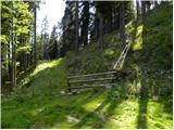 2
2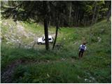 3
3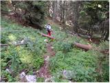 4
4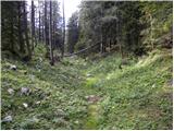 5
5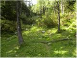 6
6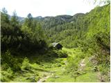 7
7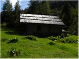 8
8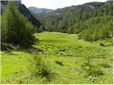 9
9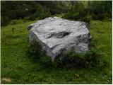 10
10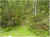 11
11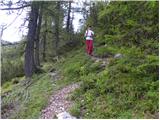 12
12 13
13 14
14 15
15 16
16 17
17 18
18 19
19 20
20 21
21 22
22 23
23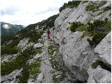 24
24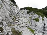 25
25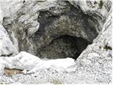 26
26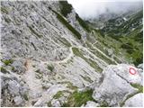 27
27 28
28 29
29 30
30 31
31 32
32 33
33 34
34 35
35 36
36 37
37 38
38 39
39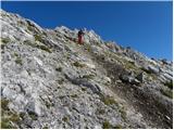 40
40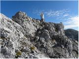 41
41 42
42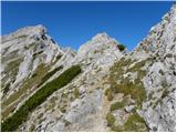 43
43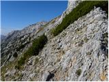 44
44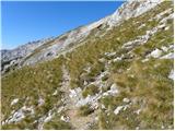 45
45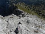 46
46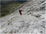 47
47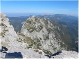 48
48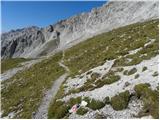 49
49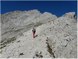 50
50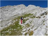 51
51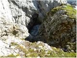 52
52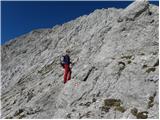 53
53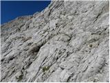 54
54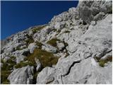 55
55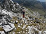 56
56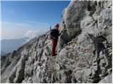 57
57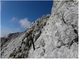 58
58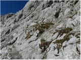 59
59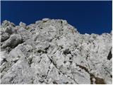 60
60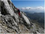 61
61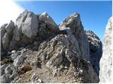 62
62 63
63 64
64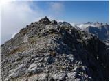 65
65 66
66