Kraljev hrib - Gradišče (Velika planina) (via Rigelj)
Starting point: Kraljev hrib (540 m)
Starting point Lat/Lon: 46.3061°N 14.6088°E 
Path name: via Rigelj
Time of walking: 3 h
Difficulty: difficult unmarked way
Difficulty of skiing: no data
Altitude difference: 1126 m
Altitude difference (by path): 1130 m
Map: Kamniške in Savinjske Alpe 1:50.000
Access to starting point:
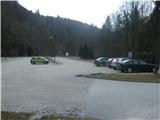
First, we drive to Kamnik, and then we continue driving in the direction of Kamniška Bistrica and cableway on Velika planina. In Stahovica we continue left (direction Kamniška Bistrica and cableway Velika planina) and we follow moderately ascending road to a large parking lot near the bottom cableway station on Velika planina (parking lot is located on the right side of the road).
Path description:
The path over Rigelj is a partly marked hunting footpath.
From the parking lot, we go on a wide and settled macadam, which leads to the inn Kraljev hrib. We leave the road right before it turns on the yard of an inn and we step on a cart track, that starts by the transformer. Here few cars can be parked. We follow the cart track to a large feed site, where it turns sharply left, and we continue straight on a nicely beaten and routed footpath. It gently crosses a slope on the right and later starts ascending steeper in zig-zags. We have to be careful, that we don't miss a crossing, which is otherwise nicely marked, but more in a hunting way. We recognize it by a thick beech, which is written all over with carved signs. Here the footpath is sharply breaking on the left and the right. Right goes towards Sivnik and further over Gamsove streže on Kisovec and mountain pasture Mala planina. Here we turn left towards Rigelj. That we are really on the right path tells us a bent beech tree, which is the first tree under which we go.
The footpath is in zig-zags steeply ascending through grassy slopes and through the forest. From the left we are surrounded by a mighty rocky massif, and few times a really nice view opens up on a valley Kamniška Bistrica and peaks above it. The footpath for a long time doesn't have any crossing and it isn't hard to follow the it.
Already quite high footpath splits into two parts, but they are separated only few meters. One branch goes on a vantage point on which it is definitely worth to go. From there is a nice view towards a valley Konjska dolina, bottom part of Kamniška Bistrica and Ljubljana basin.
When we leave the vantage point after few meters on a saddle footpath splits. Right goes gently downwards towards Sivnik, and straight steep uphill towards Rigelj. In direction of upwards it is hard to get lost, but on a way back a lot easier, because footpath splits and every branch goes on its own into a valley.
Not to be mistaken, from the viewpoint we go straight steeply uphill. The footpath on one spot is even secured with a wooden fence. And we soon also come to a border of Velika planina, wich we know because of a fence over which we have to. From there are already visible first cottages above Šimnovec. The footpath gradually splits on at least three branches, but it doesn't matter on which we go, because after few minutes we come on an ample pastures and we notice a chairlift, which goes almost perpendicularly to our route. To here we needed a little less than two hours and a half. From here we have at least three options. We can turn left below the chairlift and in a little less than ten minutes we are at the upper station of a cable car. We can go down to a car. The second option is, that we go straight, perpendicularly below the chairlift, right past the cottage Komatarjeva bajta on an unmarked footpath to the mountain pasture Planina Konjščica and ahead on a marked footpath over mountain pasture Dol back to the starting point. (good two hours).
If we have more time we can turn right by the chairlift uphill towards Zeleni rob and ahead to the summit (Gradišče) for which half an hour should be enough. From the top, we can continue circular trip through shepherd settlement, past the mountain hut Domžalski dom and Mala planina on a hunting footpath over Gamsove streže, Kačjek and Sivnik back to that famous beech tree at the crossing and back to the starting point on Kraljev hrib.
Pictures:
 1
1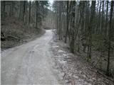 2
2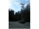 3
3 4
4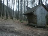 5
5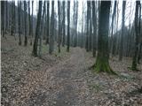 6
6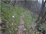 7
7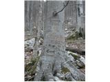 8
8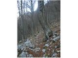 9
9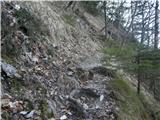 10
10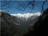 11
11 12
12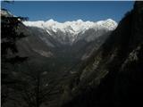 13
13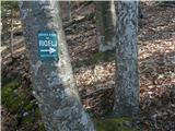 14
14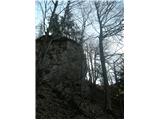 15
15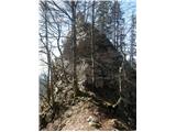 16
16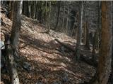 17
17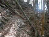 18
18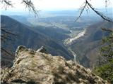 19
19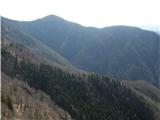 20
20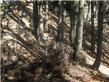 21
21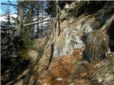 22
22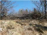 23
23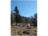 24
24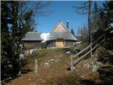 25
25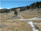 26
26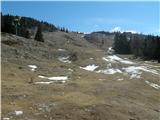 27
27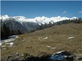 28
28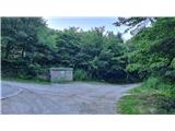 29
29 30
30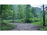 31
31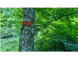 32
32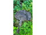 33
33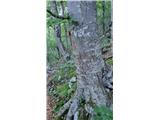 34
34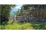 35
35