Križna jama - Križna gora
Starting point: Križna jama (645 m)
Starting point Lat/Lon: 45.7456°N 14.4672°E 
Time of walking: 35 min
Difficulty: easy marked way
Difficulty of skiing: no data
Altitude difference: 212 m
Altitude difference (by path): 220 m
Map: Snežnik 1:50.000
Access to starting point:
A) From highway Ljubljana - Koper we go to the exit Unec, and then we follow the road in the direction of Cerknica and ahead in the direction of Bloška Polica. In Bloška polica we leave the main road towards Nova vas and we continue right in the direction of Lož, and on the road towards the mentioned settlement we drive only few 100 meters and then signs for cave Križna jama point us to the right on a parallel macadam road. Macadam road is gradually descending, and then it brings us to a crossroad, where we continue straight in the direction of cave Križna jama (right Sveta Ana and Žerovnica). From the crossroad ahead we drive 300 more meters and then we get to the parking lot in front of the entrance into cave Križna jama.
B) We drive to Velike Lašče or Sodražica, and from there we continue driving in the direction of Nova vas on Bloke. From Nova vas we drive on the main road towards Cerknica, and we drive only to the settlement Bloška Polica, where at the crossroad we continue left in the direction of Lož, and on the road towards the mentioned settlement we drive only few 100 meters and then signs for cave Križna jama point us to the right on a parallel macadam road. Macadam road is gradually descending, and then it brings us to a crossroad, where we continue straight in the direction of cave Križna jama (right Sveta Ana and Žerovnica). From the crossroad ahead we drive 300 more meters and then we get to the parking lot in front of the entrance into cave Križna jama.
Path description:
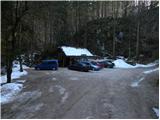
At the beginning of the parking lot, we notice yellow mountain signpost, which points us to the right on at first relatively steep footpath which starts ascending through the forest. The path ahead leads us on a less beaten footpath which is ascending diagonally through the forest and higher for some time joins an old forest cart track. A little higher we step on a macadam road which we reach at its end, and there we start lightly descending, but we walk there only a short time because then signs for Križna gora point us to the left on a moderately steep cart track. For some time we are ascending on an old cart track, and then it changes into a footpath, on which we then after few minutes of additional walking join the marked path from Bločice.
Here we continue sharply left and we continue the ascent on a moderately steep footpath, on which in few minutes we get to the top of Križna gora.
The path is at the crossings well-marked, otherwise mostly unmarked.
Pictures:
 1
1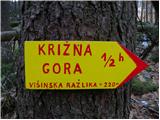 2
2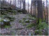 3
3 4
4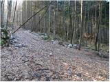 5
5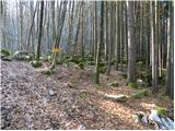 6
6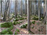 7
7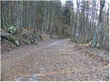 8
8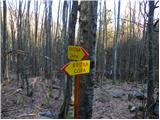 9
9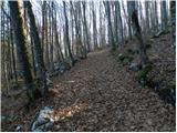 10
10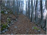 11
11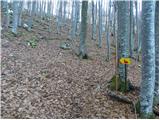 12
12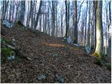 13
13 14
14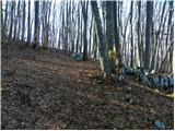 15
15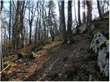 16
16 17
17 18
18 19
19 20
20 21
21