Krn - Vrh nad Peski (via planina Sleme)
Starting point: Krn (900 m)
Path name: via planina Sleme
Time of walking: 4 h 40 min
Difficulty: easy unmarked way
Difficulty of skiing: no data
Altitude difference: 1276 m
Altitude difference (by path): 1400 m
Map: Julijske Alpe - zahodni del 1:50.000
Access to starting point:
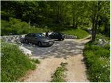
A) From the road Tolmin - Kobarid, a little before Idrsko road in the village Kamno branches off to the right. We go on the mentioned road, after we get to the village, we follow the signs for Vrsno. From Vrsno, where there stands the birth house of Simon Gregorčič, we continue on a narrow and steep road to the village Krn, where the road splits into two parts. To the left the road continues towards the mountain pasture Kuhinja, and we continue straight towards Mrzli vrh. We park above the last houses in the village, where there is nicely settled a smaller parking lot, where there is enough space for 4 to 5 cars.
B) We drive to Kobarid, and then we continue driving towards Drežnica. Immediately after the bridge over the river Soča, we turn right in the direction of village Ladra, Smast, Libušnje, Vrsno and Krn. When we get to the village Krn, we continue straight (left mountain pasture Planina Kuhinja), and we follow still narrow road to a smaller settled parking lot, which is located above the last houses in the village.
Path description:
From the parking lot, we continue on the road by which we've parked, and already after few steps it splits into two parts. We continue straight in the direction of Mrzli vrh and we continue on at first still wide cart track which gradually passes into a dense forest. Higher, the signs for Pretovč, Mrzli vrh and cave Puščavnikova jama point us to the left on a wide ascending footpath which quickly joins less beaten path from the mountain pasture Kuhinja. The footpath soon turns to the right and then it is ascending diagonally through the forest. A little further, we get to cave Puščavnikova jama, to which we have only few 10 strides of walking from the marked path.
We continue over occasionally a little thinner forest, moderately steep path brings us to a forest road which we follow left in the direction of the mountain pasture Sleme (right downwards Mrzli vrh and mountain pasture Pretovč). Only a little higher we get to the next crossroad, where from the right joins the path from the mountain pasture Polog.
We again continue in the direction of the mountain pasture Sleme, and the road which starts ascending steeper brings us into a lane of a dense forest. Higher, we step out of the forest and gradually less steep road brings us to the mountain pasture Sleme.
On the mountain pasture at the monument NOB we continue left on a panoramic grassy ridge, on which we walk to the former crossing. Here signs for Krn and Rdeči rob point us to the left on the lower path (upper path is because of impassibility closed for a long time), which crosses slopes towards the left. The path ahead quickly brings us to steep and wide gully, over which leads very well-settled path (if path is damaged then the passage is deadly dangerous). The path ahead passes on grassy slopes, crosses another smaller gully, over which the path is also well-settled. After that, the path passes into a lane of a forest, where still crosses relatively steep slopes. The slope then flattens, and the path over a grazing fence brings us on a grazing area of the mountain pasture Leskovica, where the marked path starts vanishing. We diagonally descend a little towards the right, where we catch path from the mountain pasture Kuhinja towards the lake Jezero v Lužnici.
We continue in the direction of Krn and we continue steep upwards. Further, we are ascending on steep slopes between Maselnik (1906 meters) on the left and Veliki Stador (1903 meters) on the right. Higher, the path breaks and brings us into a smaller cirque, where the unmarked path on Rdeči rob branches off to the right (turn-off is marked). The marked path here turns to the left and it ascends over a short steep slope, and then it flattens and brings us on a small saddle between Maselnik and Škofič. Here we continue straight and then on the bottom path (right upper path bypasses the lake), in few minutes of descent we get to the lake Jezero v Lužnici, which we already see from the before mentioned saddle.
From the lake, we gently ascend on a poorly visible footpath (direction north), and then we join the path which on the right side bypasses the lake. Further, we are ascending on a nice high mountain valley (Peski po Lužnici), and then the path turns a little to the left and it ascends steeper. Next a short steep ascent follows and the path brings us on a ridge north from Srednji vrh. Here the path turns to the right and in few minutes brings us on Prag (2068 meters).
On the saddle Prag, where there is a marked crossing, we continue right in the direction of the mountain hut on the mountain pasture Razor (left Batognica and Krn, straight downwards lake Krnsko jezero) on the path which crosses slopes of Vrh nad Peski. After approximately 10 minutes of crossing the scree below Vrh nad Peski, we will come to a smaller crossing, where we continue left in the direction of "V. Peski". The path ahead in few minutes ascends on a smaller grassy saddle, and then continues on the more and more panoramic and occasionally also quite steep path. This panoramic and relatively steep path, we then follow all the way to the top of Vrh nad Peski, and we reach it after few minutes of additional walking.
Pictures:
 1
1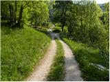 2
2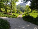 3
3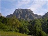 4
4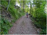 5
5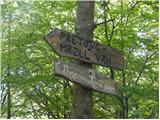 6
6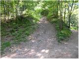 7
7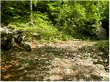 8
8 9
9 10
10 11
11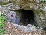 12
12 13
13 14
14 15
15 16
16 17
17 18
18 19
19 20
20 21
21 22
22 23
23 24
24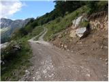 25
25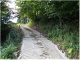 26
26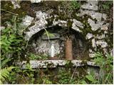 27
27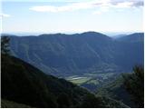 28
28 29
29 30
30 31
31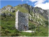 32
32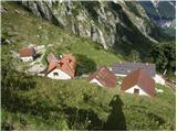 33
33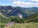 34
34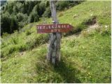 35
35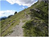 36
36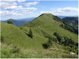 37
37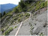 38
38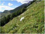 39
39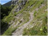 40
40 41
41 42
42 43
43 44
44 45
45 46
46 47
47 48
48 49
49 50
50 51
51 52
52 53
53 54
54 55
55 56
56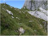 57
57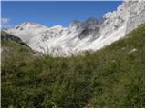 58
58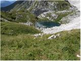 59
59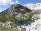 60
60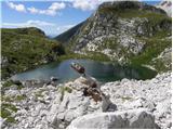 61
61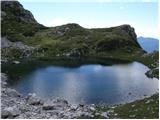 62
62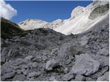 63
63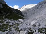 64
64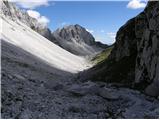 65
65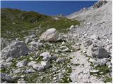 66
66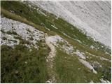 67
67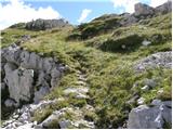 68
68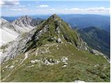 69
69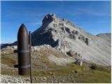 70
70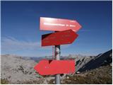 71
71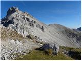 72
72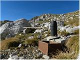 73
73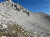 74
74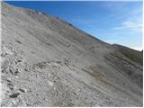 75
75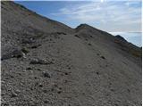 76
76 77
77 78
78 79
79 80
80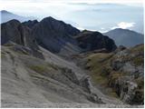 81
81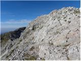 82
82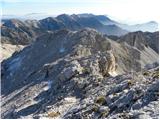 83
83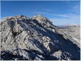 84
84 85
85 86
86