Krnica - Pokljuka Gorge (luknja)
Starting point: Krnica (660 m)
Starting point Lat/Lon: 46.3789°N 14.0419°E 
Time of walking: 1 h 30 min
Difficulty: easy marked way
Difficulty of skiing: demanding
Altitude difference: 170 m
Altitude difference (by path): 170 m
Map: TNP 1:50.000
Access to starting point:
From the Ljubljana-Jesenice highway, take the Lesce exit, from where we drive to Bled. From there we continue in the direction of "Pokljuka, Zgornje Gorje". At the end of the mentioned village, on the left we notice a bus stop, on the right the road turn-off towards Radovna, which we follow. Immediately after the mentioned turn-off, when the road descends, we turn left into the settlement, where we also notice the sign with the map of Pokljuška gorge. We continue driving through the settlement to the macadam surface, where after approx. 1 km the road descends to a bridge, over which we arrive at the parking lot or starting point.
Now it is no longer possible to reach the mentioned parking lot by car, so we park earlier, which extends our path. The arranged parking lot is located by the primary school in the settlement Zgornje Gorje and by the cemetery in the same settlement. Parking in the TNP area is allowed only at designated spots.
Path description:
From the settlement Zgornje Gorje, along the described path to the starting point, we walk in approximately half an hour to the former parking lot at the beginning of Pokljuška soteska. Here, on the left (southern) side of the parking lot, we notice the information board "Pokljuška soteska", where we follow the path leading to the destination. The partly ruined path leads us along and through the bed of the stream Ribščica uphill through the forest towards the gorge. Along the path, we are accompanied by blazes "P" and information boards. Soon we reach the wall with inscriptions and directional signs. Here we first turn left towards the gorge, the natural bridge, and the galleries. When we ascend a few meters, the wide space of the gorge first appears to us, where in the upper left direction we can notice the attractive natural bridge. The path continues into the picturesque narrow part of the gorge, through which we quickly ascend to the courtyard below the galleries (currently collapsed 10.6.2009, so do not try to climb up to them - deadly dangerous!).
Here, to the right in the alcove on benches, we can rest, or proceed a few more meters higher in the direction of "Zatrnik", from where we look into the space below us, later returning towards the previously mentioned wall with inscriptions. When we are there, we head right of the inscriptions (straight uphill) towards the so-called "Luknja". We reach this attractive cave or large rocky natural passage already after a few tens of meters of further uphill walking, which continues in the passage itself. Towards the top, the path ascends more steeply, becomes somewhat exposed, and turns left (from here we can continue towards Pokljuka), but we end our trip here and return along the same path to the starting point.
Pictures:
 1
1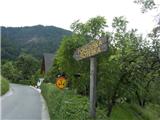 2
2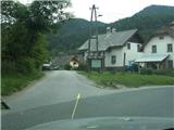 3
3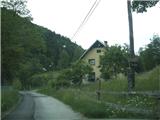 4
4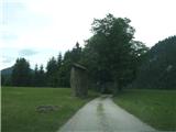 5
5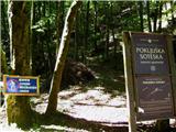 6
6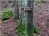 7
7 8
8 9
9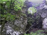 10
10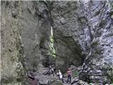 11
11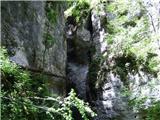 12
12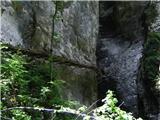 13
13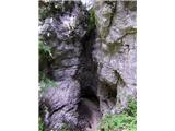 14
14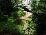 15
15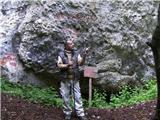 16
16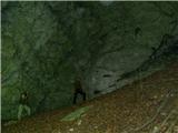 17
17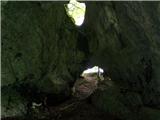 18
18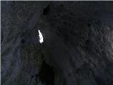 19
19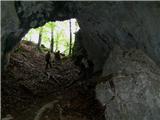 20
20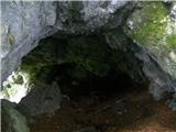 21
21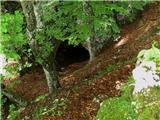 22
22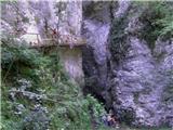 23
23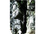 24
24 25
25