Lech da Sompunt - Col de Puez / Puezkofel (path 11)
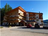
Starting point: Lech da Sompunt (1455 m)
Starting point Lat/Lon: 46.59636°N 11.89473°E 
Path name: path 11
Time of walking: 5 h 30 min
Difficulty: easy unmarked way, partly demanding marked way
Difficulty of skiing: no data
Altitude difference: 1270 m
Altitude difference (by path): 1470 m
Map: Tabacco 07 1:25.000
Access to starting point:
A) Access from Gorenjska: Through the Karawanks Tunnel, we drive to Avstria, and then we continue driving towards Spittal and forward towards Lienz (a little after Spittal highway ends). Further, we drive on a relatively nice and wide road through Drau valley, which brings us in Italy. The road further leads past Dobbiaco / Toblach and Brunico / Bruneck. Only a little after the last-mentioned town, past which leads a bypass road, we turn left into a valley Val Badia. Further, we drive through the mentioned valley to La Villa where only few meters after the sign, which marks settlement we turn right towards the lake Lech da Sompunt. Then we follow an ascending road to Hotel Sompunt, which is located by the mentioned lake.
B) From Primorska side: From Nova Gorica, we drive to Italy and drive forward on the highway to Portogruaro, where at the highway junction we turn in the direction of Belluno. We follow the highway to its end (we don't turn in the direction towards Belluno), and then we continue driving towards Cortina d'Ampezzo. When we get into Cortina d'Ampezzo, we follow the signs for Alpine mountain pass Passo Falzarego. On the mountain pass Passo Falzarego (2105 m) we turn right towards the neighbouring mountain pass Passo Valparola (2192 m), from there we descend into the valley Val Badia. In La Villa we turn right towards Brunico / Bruneck. Only few meters before the sign, which marks the end of the settlement La Villa we turn left towards the lake Lech da Sompunt. Then we follow an ascending road to Hotel Sompunt, which is located by the mentioned lake.
Path description:
At the parking lot by the lake we go left on a footpath following the signs »Sponata, Ütia de Puez«. The path quickly brings us to the road where there is a marked crossing. We go right and we continue on the road which leads on a ski slope upwards. Further, we are ascending on a ski slope from which beautiful views start to open up towards the valley Val Badia and on the mountain group Lavarella. Higher for a short time mountain bike track joins that is also pointed out by the signs by the path. We continue ascending on a ski slope and we soon notice a mountain hut Rifugio Sponata to which only a short ascent follows.
From the mountain hut where a view towards Marmolada opens up for a short time, we continue on a gently sloping macadam road, after that signposts point us right upward on a ski slope. After a short ascent marked path leaves ski slope and ascent through the forest right from the ski slope follows. The path then brings us to a crossing where the path from the upper cableway station joins. At the marked crossing where there is also the beginning of the mountain bike track, we continue on the path number 5 towards the mountain hut Rifugio Gherdenacia.
Here we enter into nature park Puez-Odle and well-settled path starts ascending steeply through thinner and thinner forest. After that, the path turns a little to the left and starts crossing quite steep slopes towards the south. At the crossing at first the path is still ascending, later it becomes less steep and on some spots, it also slightly descends. The path then brings us out of the forest on the mountain pasture Munt de Gherdenacia where a mountain hut Gherdenacia is also located.
At the mountain hut where there are signposts, we continue towards the west following the signs »Ütia de Puez«. The path soon starts ascending and turns a little to the right into thin larch forest and it brings us to a marked crossing. Left leads the path towards the summit Sassongher, and we continue straight and continue ascending by increasingly rare larches. A short time we are then slightly ascending on a grassy slope with a nice view, and then we come to a narrow valley where there is another crossing.
Left leads the path number 15 towards the mountain hut Puez, and we continue on the mentioned narrow valley upwards on the path number 11, which also leads towards the mountain hut Puez.
Further, we are for quite some time ascending through the mentioned valley and occasionally also beautiful views open up mainly towards the mountain group Lavarella. The path here runs towards the northwest all the way to a marked crossing near the peak Ciampani.
At the crossing, we continue left, right leads the path number 1 towards Badia Abtei. The path from the crossing runs towards the west and becomes less steep. The more and more scenic path then brings us below the slope of the peak Muntejela. The path here turns slightly to the left and then descends a little on grassy slopes on the south side of the mentioned peak. The path further continues to run towards the west and is still mostly slightly descending all the way to the mountain hut Puez.
At the mountain hut, we continue towards the west following the signs »Pizes de Puez, Puezspitz«. After few ten meters we come again to a crossing where the path number 2 towards the valley Langental branches off to the left. We continue slightly right and start ascending steeper. The path brings us on shorter ridge which brings us below the southern slopes of the peak Col de Puez. Here the path turns left and then some time crosses steep slopes towards the northwest. Slopes are on some spots pretty steep, there's also some gravel on the path therefore some caution is needed on this part. Such a path then brings us on the west side of the peak Col de Puez where there is also a little poorly visible crossing.
Left leads a marked path towards the peak Piz de Puez, and we go right on an unmarked path towards peak Col de Puez. The path here runs on the western slope of the mountain, which isn't too steep. The path otherwise isn't best beaten but we can follow it without problems all the way to the top.
Pictures:
 1
1 2
2 3
3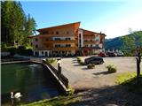 4
4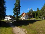 5
5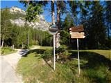 6
6 7
7 8
8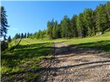 9
9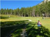 10
10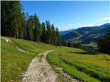 11
11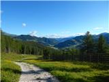 12
12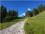 13
13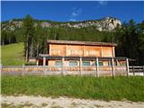 14
14 15
15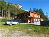 16
16 17
17 18
18 19
19 20
20 21
21 22
22 23
23 24
24 25
25 26
26 27
27 28
28 29
29 30
30 31
31 32
32 33
33 34
34 35
35 36
36 37
37 38
38 39
39 40
40 41
41 42
42 43
43 44
44 45
45 46
46 47
47 48
48 49
49 50
50 51
51 52
52 53
53 54
54 55
55 56
56 57
57 58
58 59
59 60
60 61
61 62
62 63
63 64
64 65
65 66
66 67
67 68
68 69
69 70
70 71
71 72
72 73
73 74
74 75
75 76
76 77
77 78
78 79
79 80
80 81
81 82
82 83
83 84
84 85
85 86
86 87
87 88
88 89
89 90
90 91
91 92
92 93
93 94
94 95
95 96
96 97
97 98
98 99
99 100
100 101
101 102
102 103
103 104
104 105
105 106
106 107
107 108
108 109
109 110
110 111
111 112
112 113
113 114
114 115
115 116
116 117
117 118
118 119
119 120
120 121
121