Ledinsko Razpotje - Marutnik (east path)
Starting point: Ledinsko Razpotje (702 m)
Starting point Lat/Lon: 46.0281°N 14.0477°E 
Path name: east path
Time of walking: 50 min
Difficulty: easy marked way, easy unmarked way
Difficulty of skiing: no data
Altitude difference: 190 m
Altitude difference (by path): 210 m
Map: Škofjeloško in Cerkljansko hribovje 1:50.000
Access to starting point:
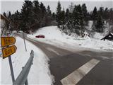
A) From Železniki, Kranj or Medvode we drive to Škofja Loka, and from there we continue driving in the direction of Gorenja vas in the valley Poljanska dolina and Žiri. In Žiri or at the end of Žiri (Stare Žiri), we leave the main road towards Rovte and Logatec and we continue right in the direction of Idrija. After approximately 6 km of driving from the crossroad in Žiri, we get to Ledinsko razpotje, where there is a smaller crossroad and next to it hiking signposts. We park about 50 meters ahead in the direction of Idrija, on a little large parking lot by the next crossroad. The parking lot is located right next to several mountain signposts and boarding house Kmečki hram Fortuna.
B) From Horjul or Polhov Gradec we drive to Šentjošt above Horjul, and from there we continue driving towards Smrečje. When we reach the main road Podlipa - Žiri, we follow it to the right, and we are driving there to Žiri. When in Žiri, we reach the main road Škofje Loka - Logatec, we follow it to the left, and we are driving there past the parish church and inn and pizzeria Lenger. After the inn we get to a crossroad, where we leave the main road towards Logatec and we continue driving in the direction of Idrija. After approximately 6 km of driving from the crossroad in Žiri, we get to Ledinsko razpotje, where there is a smaller crossroad and next to it hiking signposts. We park about 50 meters ahead in the direction of Idrija, on a little large parking lot by the next crossroad. The parking lot is located right next to several mountain signposts and boarding house Kmečki hram Fortuna.
C) From highway Ljubljana - Koper we go to the exit Vrhnika, and when we reach old road Ljubljana - Logatec, we continue in the direction of Logatec, but only a short time because already at the next crossroad we continue right in the direction of Horjul. The road ahead short time still leads through Vrhnika, later through periphery of Stara Vrhnika, and then we soon leave the road towards Horjul and we continue driving slightly left in the direction of Smrečje. After Smrečje the road starts descending towards Račeva and Žiri. When in Žiri, we reach the main road Škofje Loka - Logatec, we follow it to the left, and we are driving there past the parish church and inn and pizzeria Lenger. After the inn we get to a crossroad, where we leave the main road towards Logatec and we continue driving in the direction of Idrija. After approximately 6 km of driving from the crossroad in Žiri, we get to Ledinsko razpotje, where there is a smaller crossroad and next to it hiking signposts. We park about 50 meters ahead in the direction of Idrija, on a little large parking lot by the next crossroad. The parking lot is located right next to several mountain signposts and boarding house Kmečki hram Fortuna.
D) From highway Koper - Ljubljana we go to the exit Logatec, and when we reach old road Logatec - Vrhnika we follow it to the right (first exit from the roundabout), and there we drive only a short time because then signs for Rovte and Žiri point us to the left. After Rovte the road starts descending towards Žiri, and when we reach the mentioned settlement, we soon turn left in the direction of Idrija. After approximately 6 km of driving from the crossroad in Žiri, we get to Ledinsko razpotje, where there is a smaller crossroad and next to it hiking signposts. We park about 50 meters ahead in the direction of Idrija, on a little large parking lot by the next crossroad. The parking lot is located right next to several mountain signposts and boarding house Kmečki hram Fortuna.
E) From the road Idrija - Spodnja Idrija, immediately after the end of Idrija we turn right (if we come from the direction Spodnje Idrija, still before Idrija we turn left) through a bridge over the river Idrija towards store Eurospin. On the other side of the bridge we get to the settlement Mokraška vas, and we stick to the main road which leads towards Ledinsko Razpotje and Žiri. Higher, the road leads us through few hairpin turns, and then we get to the settlement Ledinsko Razpotje, where at the first crossroad we turn right and we park on a little larger parking lot. The parking lot is located right next to several mountain signposts and boarding house Kmečki hram Fortuna.
Path description:
From the starting point is we go on the road in the direction of Idršek - Gore, Zagodov vrh and Idrija and we continue on trail Idrijsko - Cerkljanska planinska pot (ICPP). The path at first leads past Kmečki hram Fortuna, where a marked footpath branches off to the right towards Idrija, and we walk on an asphalt road to the nearby crossroad, where we continue on a slightly left road in the direction of dispersed settlement Idršek (slightly right - western path).
We continue on the road which for a short time continues without large changes in altitude, and then it starts moderately ascending on the more and more panoramic slope, from which a nice view opens up on Gradišče and Sivka. Higher, the road leads us past few houses, and then flattens a little. Next follows few minutes of walking alternately through the forest and partly on panoramic slopes, and then it starts slightly descending, where on the right side we bypass the nearby house. When the descent ends, from the left joins a narrower road which leads to the nearby houses, and only a little further, at the left turn, we leave the road and by the spot, where there is usually a woodpile, we continue right on a cart track which few 10 meters higher passes to the edge of the forest. Few minutes we are ascending by the edge of the forest and then clearing on the right ends and well-marked path passes into the forest, through which continues on a cart track. Higher, we cross a panoramic meadow, and behind it we get to a lonely house, behind which we step on an asphalt road and where the western path joins.
Immediately after we step on the road we go right towards the nearby house, and then still before the house left in the forest on an easy to follow, but unmarked path. On the mentioned path we start ascending through the forest, and higher we cross a panoramic meadow, from which a nice view opens up on Škofjeloško hribovje. When the path returns into the forest, past NOB monument we walk to the nearby peak.
Description and pictures refer to a condition in the year 2016 (January).
Pictures:
 1
1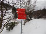 2
2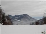 3
3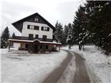 4
4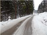 5
5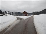 6
6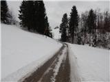 7
7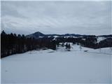 8
8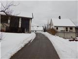 9
9 10
10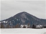 11
11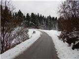 12
12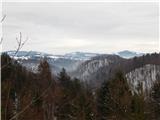 13
13 14
14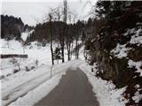 15
15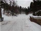 16
16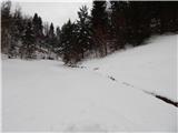 17
17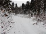 18
18 19
19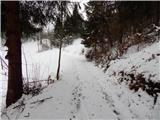 20
20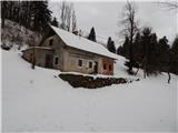 21
21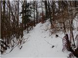 22
22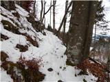 23
23 24
24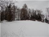 25
25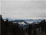 26
26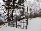 27
27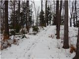 28
28 29
29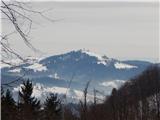 30
30