Starting point: Lengar (699 m)
Starting point Lat/Lon: 46.4795°N 13.8696°E 
Time of walking: 3 h
Difficulty: partly demanding unmarked way, easy pathless terrain
Difficulty of skiing: no data
Altitude difference: 1000 m
Altitude difference (by path): 1000 m
Map: Kranjska Gora 1:30.000
Access to starting point:
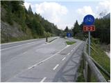
From Kranjska Gora, we drive towards Jesenice. Soon after the village Gozd Martuljek, we will notice on the right side old railway bridge (today cycling path) and next to it settled parking lot.
If we come from the direction of Jesenice, we can't get to the mentioned starting point, because we are not alowed to turn left. Therefore we have to drive to Gozd - Martuljek (possible also a little before) there turn around and then drive in the direction of Jesenice. Further, follow the upper description.
Path description:
From the parking lot, we step on a cycling path, we cross a railway bridge and then at the crossroad we continue right. After few steps of walking on a macadam road, we will get to a crossroad at TNP sign. Here we continue right on a worse forest road which after few minutes of walking, it brings us to a mighty torrent. We cross a torrent, and then we step into a short lane of a forest, where we again find forest road. We follow the road few 10 strides, and then it brings us to other torrent. Here the road finally ends, and we go slightly left over an extensive gravel terrain, so that we walk by the right edge of the torrent (looking from bottom to top). After few minutes of walking, we will on the right side of the torrent notice forest footpath (at the beginning of the path is usually a cairn), which at first ascends by the torrent, and then turns to the right. Further, we are ascending on a wide and easy to follow hunting path, which after a short ascent brings us to a smaller viewpoint.
Here the path turns a little to the right and is then gently ascending diagonally. After few minutes of crossing, we come on partly marked crossing, where we continue straight on the bottom path (sharply right mountain pasture Zaprete and a log cabin Pri Ingotu), which only few steps further crosses a steep and for slipping dangerous torrent. When we stride across mentioned torrent, the path is getting closer to a stream Beli potok. During the further ascent we more and more hear roaring of waterfalls of the stream Beli potok (Skočniki), to which a little higher we get very close to (if we step few meters from the path to the left we can also notice two waterfalls, which steeply falling in successive pools - dangerous for slipping!). And only a little further, the path brings us above Skočniki, so that upper waterfall we can also see from its mouth.
Here the path turns sharply right past old bench and then starts moderately ascending through the forest. Easy followable hunting path we follow for approximately 20 minutes, we then leave it and we continue the ascent left on easier pathless terrain. During the ascent on pathless terrain, we will here and there notice a poorly beaten footpath and few smaller cairns. Higher "path" brings us to smaller scree, where it becomes a little easier to follow. Ahead we steeply ascend over the mentioned scree, and then we pass into a lane of bushes, where the path is easy to follow, but not passable. When we break through a lane of bushes we again step on the scree, and we follow it to a small saddle, where there is an unmarked crossing. We continue right (left viewpoint to mountain walls of Martuljek mountains - 20 minutes, straight downwards cirque Za Akom) and on an undemanding ridge path in few minutes of additional walking, we get to the top of Rutarski Vršič.
Pictures:
 1
1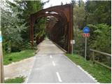 2
2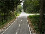 3
3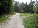 4
4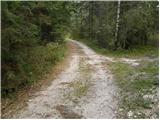 5
5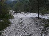 6
6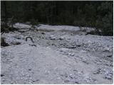 7
7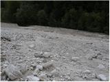 8
8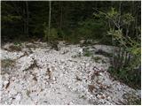 9
9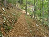 10
10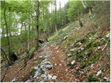 11
11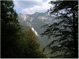 12
12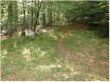 13
13 14
14 15
15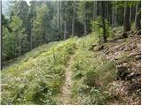 16
16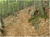 17
17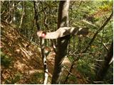 18
18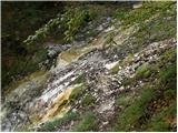 19
19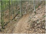 20
20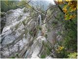 21
21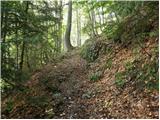 22
22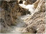 23
23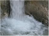 24
24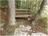 25
25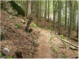 26
26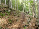 27
27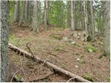 28
28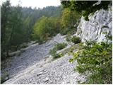 29
29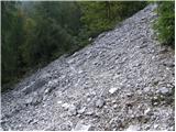 30
30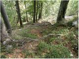 31
31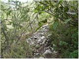 32
32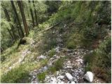 33
33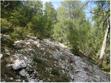 34
34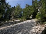 35
35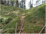 36
36 37
37 38
38 39
39 40
40 41
41 42
42 43
43