Lepena - Veliki Lemež (via Planina Zagreben)
Starting point: Lepena (490 m)
Starting point Lat/Lon: 46.3037°N 13.6814°E 
Path name: via Planina Zagreben
Time of walking: 6 h
Difficulty: difficult pathless terrain
Difficulty of skiing: no data
Altitude difference: 1552 m
Altitude difference (by path): 1710 m
Map: Julijske Alpe - zahodni del 1:50.000
Access to starting point:
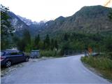
Between Trenta and Bovec in the village Soča, a road in Lepena branches off. This asphalt road we follow a little less than three kilometers, and then we come to a crossroad where right over the bridge, the road towards apartments Pretner and Hosner branches off. We go right and we park by the road before the bridge. Here is enough space only for one or two cars. A little larger parking lot is if we continue on the main road for approximately 100 meters.
Path description:
From the starting point, we continue over a bridge and we follow the road which after the bridge turns to the left. We follow the road all the way to the last house. Meanwhile when the cart track branches off to the right, we continue left and also slightly descend. When we come to the last house the road ends. At the back of the house on the right we will notice a narrow footpath.
We go on the mentioned footpath and after approximately ten meters we will by the path notice a signpost, which marks the path towards the mountain pasture Planina Zagreben. We continue on the path through the forest and we are quickly at the crossing again. To the right leads the footpath towards one more house, and we continue left where points us caption on a sign »Zagreben, Šumnik«.
Further, the path is for some time poorly beaten, therefore we have to pay attention to black red blazes which mark Walk of peace (Pot miru). When from the right join two more paths from the already mentioned house the footpath becomes again a little better beaten. After that, the path for quite some time runs through the forest by the stream Šumnik. Occasionally also a view opens up on a smaller waterfalls and pools. Higher, the path goes a little away from the stream but for some time still runs parallel with the stream. The path here all the time runs through the forest, so it doesn't offer much view. Later, the path turns to the right and it brings us to a crossing by some ruins.
Here the path which runs through the valley towards the saddle Čez Potoče branches off to the left. We continue right and the path through short clearing quickly brings us to the monument of first world war. From the starting point to the monument there is approximately 1:30 of walking.
From the monument we still follow Walk of peace, which is marked with red black blazes. The path further crosses slopes towards the west and bypasses the ridge, that runs from the peak Konj (1279m) towards the summit Brdo (1520m). Slope, which we cross becomes quite steep and on a shorter part, there is also a steel cable for help. From the path here also beautiful views opening up on peaks north from us. A little later on the path, there are two hairpin turns and at the right turn we will get to a little poorly visible crossing.
Here we leave Walk of peace, which is marked with red black blazes and go left on a worse beaten path. At the beginning of this footpath there is a carved arrow on the tree on the right side. Further, the path starts ascending a little steeper and most of the time runs slightly to the left. Here a little more attention is needed because the path is poorly visible. The path continues to ascend and brings us on abandoned and quite overgrown mountain pasture Planina Zagreben. The path leads us past the ruins on the mountain pasture and then turns right upward. Next follows only the last ascent to the hunting cottage, which we already see in front of us.
From the hunting cottage, we return few ten meters back to the first turn and go right on in the beginning very poorly visible footpath. A little overgrown path which leads us by bushes and some trees runs on the right side of the valley upwards. Bushes and trees then end and then follows an ascent on a little more panoramic path upwards. The path still all the time runs on the right side of the valley and is for some time ascending on the scree. Towards the end of the valley terrain becomes again more grassy and footpath again poorly visible.
Here we leave poorly visible footpath and go left on pathless terrain towards the saddle on the south side of the peak Brdo. Slope towards the saddle is quite overgrown with high grass and nettles, so it is recommended that we go left a little higher where the terrain is a little less overgrown.
When we reach the saddle we descend a little on the other side and we cross the slopes towards the saddle Čez Potoče. The saddle is otherwise relatively far, but we can already see it. We still cross a slope towards the southeast and we soon come in front of a shorter lane of a forest. With a forest covered slope, which is a little steeper is better to bypass on the right side, where the terrain is a little less overgrown. On the other side of the forest we come on terrain covered with numerous rocks and boulders, which are often covered with snow.
Further, we again start ascending steeper on the scree towards the saddle Čez Potoče. When ascending on the scree we can also notice quite a few remains from the first world war. Higher the terrain becomes a little more grassy and also the footpath is again a little better visible. Next follows a shorter ascent and then we soon reach the saddle Čez Potoče.
On the saddle where a relatively well-beaten footpath leads straight downwards towards the mountain pasture Planina na Polju we go left on pathless terrain. In the initial part we are ascending by the ridge on the right side. The slope is here covered with grass and is occasionally also quite steep therefore also some caution is needed. Especially in wet, the slopes can be dangerous for slipping. For a short time, we withdraw from the ridge a little more to the right side, after that follows an ascent back towards the ridge. We soon reach the secondary peak on which there are also some remains from the first world war. On the eastern secondary peak there are also some military tunnels.
From the secondary peak, we slightly descend on still mostly grassy slope, which is on this part slightly less steep. Next again follows the ascent by the right side of the ridge to the top of Vogel from which a view opens up towards the summit Veliki Lemež, which is situated ahead in the ridge. And from the path, we have otherwise for some time a nice view towards Krn and valley of river Soča.
From the top of Vogel we continue on the ridge and again descend a little. Next follows some walking on a little wider and less steep ridge, which brings us below steeper slopes of the next secondary peak. Grassy ridge here becomes very narrow and is in parts also slightly exposed therefore at the ascent quite some caution is needed. We still continue on the ridge and we soon reach the next secondary peak.
From the secondary peak, we descend on a steep slope by the ridge where otherwise runs a little worse beaten footpath. After a short descent the footpath brings us into a notch where we will on the right side notice a bigger rockfall, which happened during the earthquake in the year 1998.
From the notch, the ridge becomes again narrow and the footpath goes for a short time on the left northern side of the ridge. Next follows a short ascent on a steep and quite exposed grassy slope, which is especially in wet quite dangerous for slipping. We quickly again reach the ridge, which further becomes again less demanding. Follows an ascent on a wide grassy slope to a panoramic summit.
We descend back on the ridge to a saddle Čez Potoče where we descend left downwards past the mountain pasture Planina na Polju and lake Krnsko jezero to the mountain hut Dom v Lepeni. Next follows for approximately 45min of walking on the road back to the starting point.
From the notch below the summit it is possible to descend also by the mentioned rockfall direct towards the lake, but because of the rockfall, the descent is a little more difficult.
Pictures:
 1
1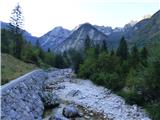 2
2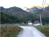 3
3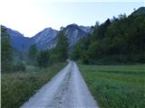 4
4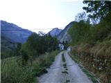 5
5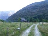 6
6 7
7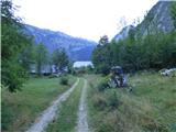 8
8 9
9 10
10 11
11 12
12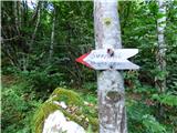 13
13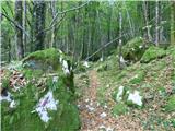 14
14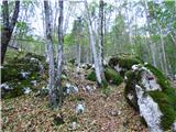 15
15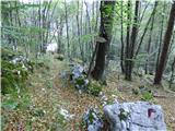 16
16 17
17 18
18 19
19 20
20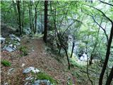 21
21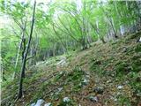 22
22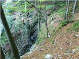 23
23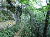 24
24 25
25 26
26 27
27 28
28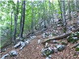 29
29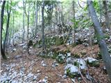 30
30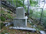 31
31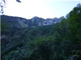 32
32 33
33 34
34 35
35 36
36 37
37 38
38 39
39 40
40 41
41 42
42 43
43 44
44 45
45 46
46 47
47 48
48 49
49 50
50 51
51 52
52 53
53 54
54 55
55 56
56 57
57 58
58 59
59 60
60 61
61 62
62 63
63 64
64 65
65 66
66 67
67 68
68 69
69 70
70 71
71 72
72 73
73 74
74 75
75 76
76 77
77 78
78 79
79 80
80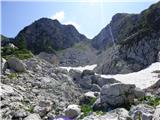 81
81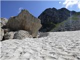 82
82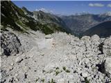 83
83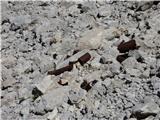 84
84 85
85 86
86 87
87 88
88 89
89 90
90 91
91 92
92 93
93 94
94 95
95 96
96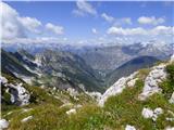 97
97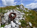 98
98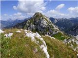 99
99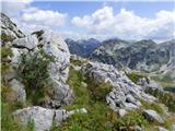 100
100 101
101 102
102 103
103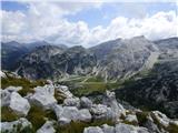 104
104 105
105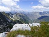 106
106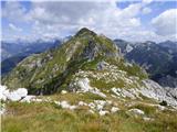 107
107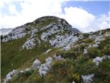 108
108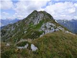 109
109 110
110 111
111 112
112 113
113 114
114 115
115 116
116 117
117 118
118 119
119 120
120 121
121 122
122 123
123 124
124 125
125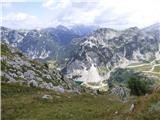 126
126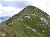 127
127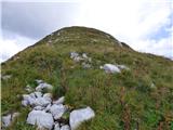 128
128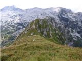 129
129 130
130 131
131 132
132 133
133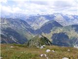 134
134