Lienzer Dolomitenhütte - Daumen
Starting point: Lienzer Dolomitenhütte (1620 m)
Starting point Lat/Lon: 46.7911°N 12.7842°E 
Time of walking: 4 h 30 min
Difficulty: extremely difficult marked way
Ferrata: C/D
Difficulty of skiing: no data
Altitude difference: 1100 m
Altitude difference (by path): 1300 m
Map:
Access to starting point:
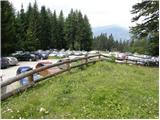
Through the Karawanks Tunnel, we drive to Austria, and then we continue driving towards Spittal and forward towards Lienz (a little after Spittal highway ends). Further, we drive on a relatively nice and wide road through Drau valley. Few kilometers before Lienz (near the settlement Unterdorf), we will notice signs for mountain hut Lienzer Dolomitenhütte, which point us to the left on a local road. The road then over a bridge crosses the river Drava / Drau and then it brings us in the village Lavant, where we continue right in the direction of village Tristach. Between village Lavant and Tristach we will come to the next crossroad, where we continue left in the direction of "Lienzer Dolomitenhütte". This road which starts ascending steeper we then follow to a large parking lot near mentioned mountain hut. The road is payable (July 2009 7€).
To Lienz we can also come, if instead of through the valley Dravska dolina we drive through the valley Gailtal (Korensko sedlo, Hermagor, mountain pass Ziljsko sedlo/Gailbergsattel), in this case, we get to valley Dravska dolina at settlement Oberdrauburg.
Path description:
From the parking lot, we continue on the road, on which in 2 minutes we get to the mountain hut Lienzer Dolomitenhütte.
From the mountain hut, we cross the fence and we continue the ascent on a panoramic road (a nice view towards serrated ridge - highest is Spitzkofel 2717 meters), which is in the initial part exposed to falling stones. The road then crosses a short lane of a forest and then it brings us on an indistinct saddle Premstall (1625 meters), where there is a smaller crossing.
We continue straight past a trough with water (left upwards Weißtein Alm) on the road which after few minutes of additional walking brings us to a smaller mountain pasture Instein Alm, on which we notice a smaller wooden cottage and a little above it chapel.
We still continue on the road, and it quickly brings us to a marked crossing, where we leave it.
We continue the ascent on a wide mountain path which starts ascending a little steeper, through a thinner forest. The path from which very nice views opening up, few times crosses a mountain road and higher brings us to a smaller wooden cottage. At the cottage, we again leave the road and we continue the ascent through gently sloping high mountain valley, which is surrounded by high peaks. A gently sloping path which runs by the torrent stream, higher turns to the right and for a short time steeply ascends. This panoramic path, we then follow all the way to the mountain hut Karlsbader Hütte (by the mountain hut is also lake Laserzsee), which we reach after few minutes of additional walking.
To the hut, we can also come on the mountain road.
From the mountain hut, we descend few 10 meters on the road, and then we notice numerous hiking signposts, which point us to the right on a footpath. Already after few steps of additional walking, the path splits into two parts. We continue left in the direction of "Roter Turm and Laserzwand" (right Sandspitzen) on the path which at first slightly ascends, and then crosses slopes towards the left. After few minutes of easy walking path steeply ascends and passes on very steep slopes of Kleine Laserzwand. Next follows 15 minutes of a steep ascent on an occasionally exposed slope (besides the risk of slipping there is also a very high risk of falling stones), and then the path slightly flattens (here from the right side joins unmarked, but less steep path, which ascends over extensive scree). We continue on a little less, but still quite a steep path, which higher brings us below the steep walls of Roter Turm, where we also come on a poorly marked crossing.
At the crossing, we continue right and already after a short ascent, we are again at the crossing. This time as well we continue right, and left upward leads the path on Roter Turm. The path further crosses a slope below the steep mountain walls of Roter Turm and then brings us to the entry of a climbing part of the path. Here the path turns left and starts ascending steeply on rocky terrain by the steel cable. Further, the path few times almost vertically ascends, and then it brings us on an indistinct peak Kleine Laserzkopf. Part of the path to the mentioned summit is marked with difficulty level A/B.
From Kleine Laserzkopf we continue right on at first still a quite gentle ridge. Next follows again almost vertical ascent with the help of steel cables and then less steep ascent on a narrow ridge to the top of Große Laserzkopf (2718 meters).
From the top, we continue on the ridge and we start descending towards the notch between the peaks Laserzkopf and Galitzenspitzen. Descent towards the notch is becoming steeper, and the path is secured only with a steel cable. After the steep descent into a notch follows even more demanding ascent. At first, we almost vertically ascend by the steel cable, and then we avoid the ridge on the northern side. Here at first in a short ascent we cross precipitous slopes towards the east, and then follows a demanding vertical ascent back towards the ridge. On this part of the path besides the steel cable we also get help from few stemples. When we come again on a ridge a short ascent follows on a ridge to the top of Galitzenspitzen.
Further, the path on the ridge few times steeply descends and ascends by the steel cable all the way to the notch below Daumen. In the notch, which is situated before the most difficult part of the path there is also a crossing of paths, so we also have the option to leave the path on the ridge and descend towards the mountain hut Karlsbader.
From the notch, we at first continue on the northern side of the mountain and few times we very steeply ascend with the help of steel cables. Next follows a vertical ascent towards the summit Daumen, which is also the most difficult spot on the entire path. This part of the path is marked with difficulty level C/D. The vertical ascent is otherwise well-secured with a steel cable, and we also get help from few stemples.
Pictures:
 1
1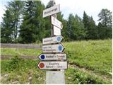 2
2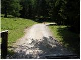 3
3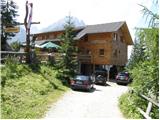 4
4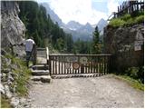 5
5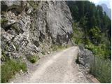 6
6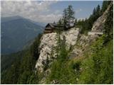 7
7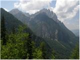 8
8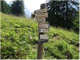 9
9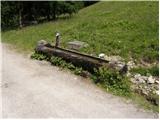 10
10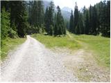 11
11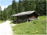 12
12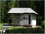 13
13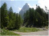 14
14 15
15 16
16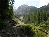 17
17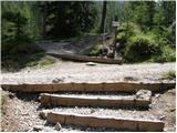 18
18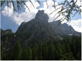 19
19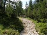 20
20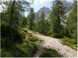 21
21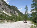 22
22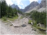 23
23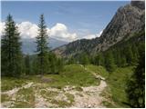 24
24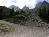 25
25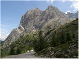 26
26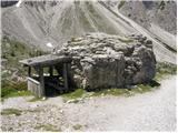 27
27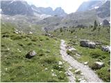 28
28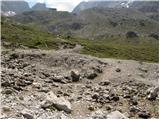 29
29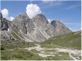 30
30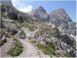 31
31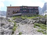 32
32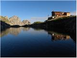 33
33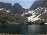 34
34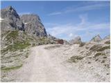 35
35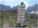 36
36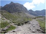 37
37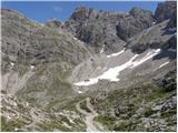 38
38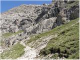 39
39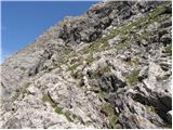 40
40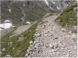 41
41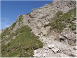 42
42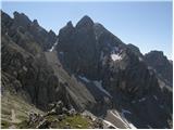 43
43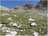 44
44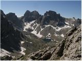 45
45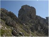 46
46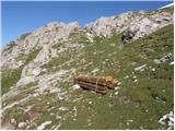 47
47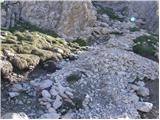 48
48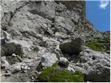 49
49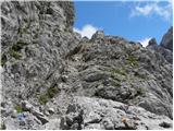 50
50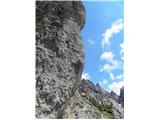 51
51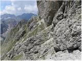 52
52 53
53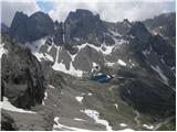 54
54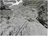 55
55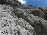 56
56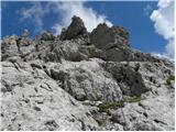 57
57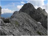 58
58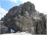 59
59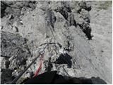 60
60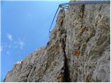 61
61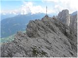 62
62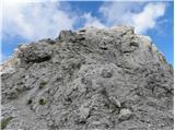 63
63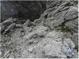 64
64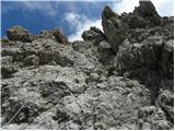 65
65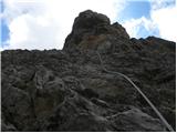 66
66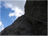 67
67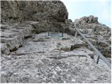 68
68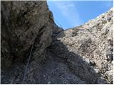 69
69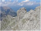 70
70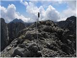 71
71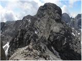 72
72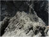 73
73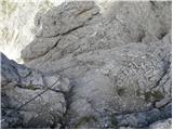 74
74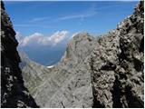 75
75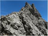 76
76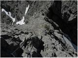 77
77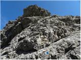 78
78 79
79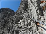 80
80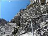 81
81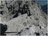 82
82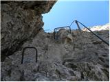 83
83 84
84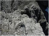 85
85