Lienzer Dolomitenhütte - Instein Alm
Starting point: Lienzer Dolomitenhütte (1620 m)
Starting point Lat/Lon: 46.7911°N 12.7842°E 
Time of walking: 20 min
Difficulty: easy marked way
Difficulty of skiing: easily
Altitude difference: 49 m
Altitude difference (by path): 49 m
Map:
Access to starting point:
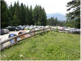
Through the Karawanks Tunnel, we drive into Austria, then continue towards Spittal and further to Lienz (the highway ends a little after Spittal). We then drive on a relatively nice and wide road through the Drau Valley. A few kilometers before Lienz (near the place Unterdorf), we will notice signs for the Lienzer Dolomitenhütte hut, which direct us left onto a local road. The road then crosses the Drava over a bridge and brings us to the village of Lavant, where we continue right towards the village of Tristach. Between the villages of Lavant and Tristach, we will come to the next intersection, where we continue left in the direction of "Lienzer Dolomitenhütte". We follow this road, which starts to ascend more steeply, to the large parking lot near the mentioned hut. The road is a toll road (July 2009 7€).
We can also reach Lienz if, instead of through the Drau Valley, we drive through the Gail Valley (Korensko sedlo, Hermagor, pass Ziljsko sedlo/Gailbergsattel); in this case, we arrive in the Drau Valley at the settlement of Oberdrauburg.
Path description:
From the parking lot, we continue on the road by which in 2 minutes we arrive at the Lienzer Dolomitenhütte mountain hut.
From the hut, we cross the fence and continue the ascent on a panoramic road (nice view of the jagged ridge - the highest is Spitzkofel 2717 m), which in the initial part is exposed to falling rocks. The road then crosses a short strip of forest and brings us to the indistinct saddle Premstall (1625 m), where there is a minor junction.
We continue straight past the trough with water (left uphill to Weißstein Alm) on the road, which after a few minutes of further walking brings us to the small alpine pasture Instein Alm, where we notice a small wooden hut and slightly above it a chapel.
Trip can be extended to: Karlsbader Hütte (1 h 40 min)
,
Kleine Gamswiesenspitze (3 h 10 min)
,
Große Gamswiesenspitze
,
Kleine Laserzwand (2 h 30 min)
,
Teplitzer Spitze (2 h 40 min)
,
Laserzwand (2 h 40 min)
,
Schöttnerspitze (2 h 40 min)
,
Galitzenspitzen (3 h 40 min)
,
Laserzkopf (3 h 10 min)
,
Daumen (4 h 10 min)
,
Große Sandspitze
Pictures:
 1
1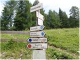 2
2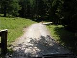 3
3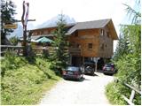 4
4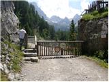 5
5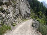 6
6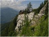 7
7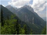 8
8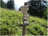 9
9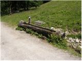 10
10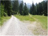 11
11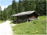 12
12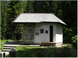 13
13