Livške Ravne - Kuk (Kolovrat)
Starting point: Livške Ravne (1115 m)
| Latitude/Longitude: | 46,19390°N 13,62810°E |
| |
Walking time: 20 min
Difficulty: easy unmarked way
Elevation gain: 128 m
Elevation difference along the route: 128 m
Map: Julijske Alpe - zahodni del 1:50.000
Recommended equipment (summer):
Recommended equipment (winter):
Views: 12.733
 | 1 person like this post |
Access to starting point:
From the road Tolmin - Bovec, at the settlement Idrsko we turn onto the road in the direction of the village Livek. Further, we drive on an ascending road to the mentioned village, and there at the intersection we turn left towards Livške Ravne. From Livške Ravne we drive a little further and then, on a somewhat larger parking lot by which there is also a table with two benches, we park.
Route description:
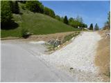
From the parking lot, we head onto a somewhat narrower macadam road, which starts moderately ascending across the initially grassy slope towards the summit Kuk. Higher, the road crosses a strip of forest and ascends steeply several times (steep spots are concreted), and it quickly brings us to the summit with increasingly beautiful views of the Krn mountain range and Slavia Friulana, in the middle of which there are a large number of antennas.
Photos:
 1
1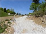 2
2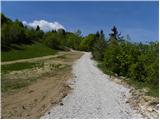 3
3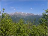 4
4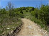 5
5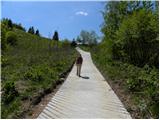 6
6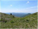 7
7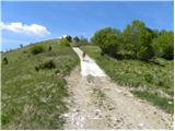 8
8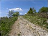 9
9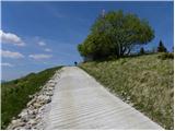 10
10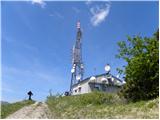 11
11 12
12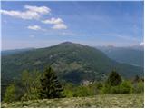 13
13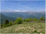 14
14
Discussion about the trip Livške Ravne - Kuk (Kolovrat)
|
| Dg9013. 06. 2017 |
Beautiful excursion with a magnificent view of the Soča valley, Krn and Kanin.
|
|
|
To post a comment you must log in:
If you do not yet have a username, you must first
register.