Starting point: Ljubelj (1058 m)
Starting point Lat/Lon: 46.4324°N 14.2602°E 
Time of walking: 1 h 45 min
Difficulty: easy unmarked way
Difficulty of skiing: partly demanding
Altitude difference: 624 m
Altitude difference (by path): 624 m
Map: Karavanke - osrednji del 1:50.000
Access to starting point:
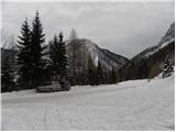
From highway Ljubljana - Jesenice, at the junction Podtabor we continue in the direction of Ljubelj and Tržič. We continue driving on a highway, after that regional road which we follow all the way to the border crossing Ljubelj. Just before the border crossing we turn left (direction Zelenica) and then after few 10 meters of additional driving, we park on a large parking lot.
Path description:
At the beginning of the parking lot signpost for Stol, Vrtača and Dom na Zelenici point us on a wide cart track which starts ascending by the torrent. When a little higher the cart track turns left, we continue straight on the mountain path which continues through the forest and soon returns on a cart track. Cart track a little higher turns right and brings us out of the forest on a ski track of the former ski slope Zelenica. Next follows a short steeper ascent on a ski slope, and then the path flattens and leads us by the foot of the scree below Begunjščica.
From the marked path soon the path which runs on a transport road branches off to the right, and we continue on "road" to the nearby hut Koča Vrtača.
At the mountain hut, the road turns right, and we continue straight in the direction of the mountain path on Zelenica. A short time we continue below the former one-seater chairlift Zelenica II, and then the path starts ascending steeper on a slope, which is partly overgrown by dwarf pines. After few hairpin turns, we return on a transport road, on which we continue with a view towards the gully Šentanski plaz.
The path ahead leads us on slopes of Spodnji plot (peak, on which they made a sport climbing path), after that from the road we turn right on a footpath which cuts a longer turn. When we return on the road we are already at the upper station of the former one-seater chairlift Zelenica II, and to the mountain hut Dom na Zelenici separates us only few steps of descent.
Before the mountain hut marked path on Begunjščica branches off to the left, and behind the hut also to the left a path on Stol, Vrtača and in Završnik, and behind the hut we continue straight on a poorly visible unmarked footpath which ascends through indistinct valley. A little higher we continue right (straight saddle Čez Pod and the peak of former ski lift Triangel), we cross a small well and we start ascending steeply on a grassy slope. Higher, we reach the ridge, which connects Vrh Ljubeljščica and Spodnji Plot, and we continue right towards Spodnji Plot. Few strides ahead path steeply ascends and it brings us to the summit of precipitous Spodnji Plot.
Pictures:
 1
1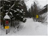 2
2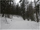 3
3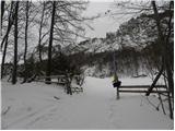 4
4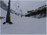 5
5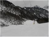 6
6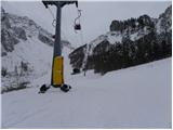 7
7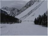 8
8 9
9 10
10 11
11 12
12 13
13 14
14 15
15 16
16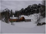 17
17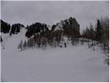 18
18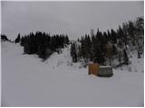 19
19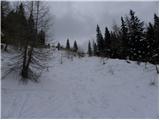 20
20 21
21 22
22 23
23 24
24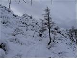 25
25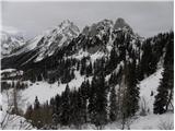 26
26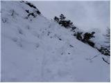 27
27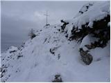 28
28 29
29