Ljubelj - Srednji vrh (above Završnica) (on the slope of Vrtača)
Starting point: Ljubelj (1058 m)
| Latitude/Longitude: | 46,4324°N 14,2602°E |
| |
Route name: on the slope of Vrtača
Walking time: 3 h
Difficulty: easy marked way
Elevation gain: 738 m
Elevation difference along the route: 738 m
Map: Stol in Begunjščica, 1 : 25.000, PZS
Recommended equipment (summer):
Recommended equipment (winter):
Views: 10.991
 | 1 person like this post |
Access to starting point:
We drive to the border crossing Ljubelj and right before it, we turn left onto a large parking lot below the chairlift to Zelenica.
Route description:
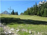
On one of the paths (marked mountain path, the path on a service road or on a border guard footpath) we ascend to the mountain hut on Zelenica. From the hut, we go some tens of meters in a gentle ascent on the path which leads to the cottage Koča pri izviru Završnice, and then we turn right onto a barely visible footpath which crosses a meadow (ski slope) and disappears in the woodlet on the opposite side. The turn-off on the path isn't marked, but the directional signpost you will spot just before stepping into the woodlet at the turn-off. This path leads to Vrtača (and Stol) and leads us all the time along the slope of Vrtača, initially in a sparse woodlet, later through dwarf pines and across scree slopes, moderately ascending and very panoramic. When we come to a fork, which is marked on a stone on the path and points right to Vrtača, left to Stol, we take the left path which leads towards Stol. From this fork onwards, the path is practically almost unmarked, but well visible and trodden. This path leads us mostly through dwarf pines, first almost horizontally, in the last part in a gentle descent, to the saddle Šija (saddle between Vrtača and Srednji vrh). Here there is a pole with old wooden directional signposts, which show the path in the direction of Vrtača and Stol. On the saddle, we take the footpath which leads left upwards to Srednji vrh (caution - there is another footpath there, which appears more trodden, but which leads along the slope downwards). The footpath is wide for the first few meters, but narrows significantly very quickly and remains so for most of the path. It leads us along the edge of the slope, smaller part in moderate, larger part in quite steep ascent. The footpath is otherwise easy to follow, but so narrow that at many places during walking we push away high grass and low bushes with our legs. Part of the footpath is covered with fine sand, there on steep sections caution is needed to avoid slipping. In less than half an hour from the saddle we arrive at a not very spacious summit, on which there is a logbook, but no stamp. The path is rewarded with wonderful views into the valley and on neighbouring peaks - Vrtača, Stol, Begunjščica, and of course also the more distant ones both in the Karawanks and in the Julian Alps and Kamnik Alps. We can return by the same path, or from the saddle Šija go downwards towards Zelenica or Smokuška planina (cottage Koča pri izviru Završnice). In the second case, there is first a considerable descent to the pasture, then again a considerable ascent to Zelenica.

Photos:
 1
1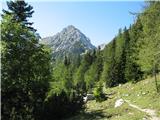 2
2 3
3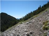 4
4 5
5 6
6 7
7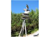 8
8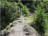 9
9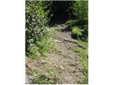 10
10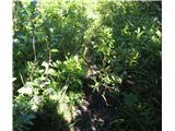 11
11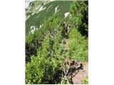 12
12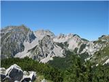 13
13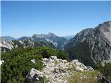 14
14 15
15
Discussion about the trip Ljubelj - Srednji vrh (above Završnica) (on the slope of Vrtača)
|
| Kokta22. 09. 2014 |
The path from Šija saddle to the summit is marked.
|
|
|
|
| ločanka26. 08. 2019 |
On the summit you might encounter vipers. Yesterday there were two of them, one approx. 2 m from the cross towards the east (right where it's a suitable spot for photographing the hut at Završnica), the other towards the opposite summit (sawed branches). Both retreated quickly, but the second forgot to pull its tail behind it, so I could photograph it.
|
|
|
|
| turbo27. 08. 2019 |
ločanka,
don't scare me. I read it quickly at first and thought: "What on earth, she encountered a 2m (two meters) long viper  Then I read it again and breathed a sigh of relief Then I read it again and breathed a sigh of relief 
|
|
|
|
| ločanka27. 08. 2019 |
turbo, but apparently right up there a specimen about 1 m long was really visible
|
|
|
|
| sla27. 08. 2019 |
I saw it just like ločanka east of the cross (it was just under a meter  ). ).
Obviously it's at home there, so let's leave it be. When I was leaving the summit, it was back at the same location, sunning itself there
|
|
|
To post a comment you must log in:
If you do not yet have a username, you must first
register.