Ljubljana (Ocvirkova ulica) - Oljska gora
Starting point: Ljubljana (Ocvirkova ulica) (294 m)
Starting point Lat/Lon: 46.10143°N 14.5829°E 
Time of walking: 20 min
Difficulty: easy unmarked way
Difficulty of skiing: no data
Altitude difference: 107 m
Altitude difference (by path): 107 m
Map: Ljubljana - okolica 1:50.000
Access to starting point:
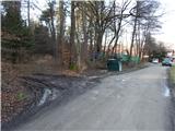
A) We leave Štajerska highway at exit Ljubljana Šentjakob, and then we follow the signs for Šentjakob and Črnuče. When we reach the main road Ljubljana - Domžale, we continue right towards Domžale. A little after the bakery Pekarna Piskač, by the crossroad, where on the right there is Pletilstvo Pislak, we continue left on street Sovretova ulica, on which we then drive to a crossroad with street Ocvirkova ulica, where there is situated a wooden cross. Here we continue right on street Ocvirkova ulica, which a little further becomes a macadam, and we are driving there past individual houses, to the last houses, before which the cart track branches off to the left, where the described path begins. We park on an appropriate place by the beginning of the cart track.
B) We leave Trzin bypass road at the crossroad with the roads Dunajska and Zasavska cesta and we continue driving towards Litija. When we reach the main road Ljubljana - Domžale, we continue left towards Domžale. A little after the bakery Pekarna Piskač, by the crossroad, where on the right there is Pletilstvo Pislak, we continue left on street Sovretova ulica, on which we then drive to a crossroad with street Ocvirkova ulica, where there is situated a wooden cross. Here we continue right on street Ocvirkova ulica, which a little further becomes a macadam, and we are driving there past individual houses, to the last houses, before which the cart track branches off to the left, where the described path begins. We park on an appropriate place by the beginning of the cart track.
Path description:
From the starting point before the last houses we go on a cart track which already after few meters changes into a footpath, and next to it we notice some unofficial marks. Through the forest, we are mostly moderately ascending, and higher we reach a marked path which starts in the center of the settlement Podgorica pri Črnučah.
When we reach the mentioned marked path we follow it to the right, and there in a gentle to moderate ascent we walk all the way to the top of Oljska gora.
Description and pictures refer to a condition in the year 2018 (January).
Pictures:
 1
1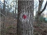 2
2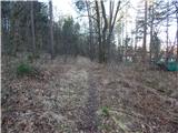 3
3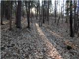 4
4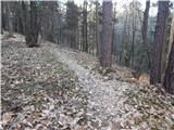 5
5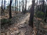 6
6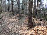 7
7 8
8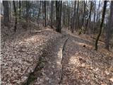 9
9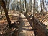 10
10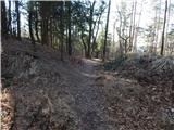 11
11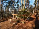 12
12