Loke - Krvavica (via Zajčeva koča)
Starting point: Loke (380 m)
Starting point Lat/Lon: 46.2139°N 15.0077°E 
Path name: via Zajčeva koča
Time of walking: 2 h 10 min
Difficulty: easy marked way
Difficulty of skiing: demanding
Altitude difference: 529 m
Altitude difference (by path): 630 m
Map: Posavsko hribovje - zahodni del 1:50.000
Access to starting point:
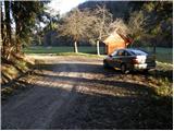
A) From highway Ljubljana - Maribor we go to the exit Vransko and we continue driving on the parallel old road towards Celje. Few kilometers we drive on the main road, and then signs for Tabor and Ojstriška vas point us to the right. Further, we drive through Ojstriška vas to the settlement Tabor, and from there we continue in the direction of village Loke. In Loke we come to a crossroad, where we continue left in the direction of the cottage Zajčeva koča (straight Krvavica) on the road which soon brings us to the next crossroad. Here we continue right in the direction of "Zajčeva koča - peš pot" (footpath) (straight - Zajčeva koča on the road) on the road which crosses a bridge and then on the other side of the meadow brings us to a smaller parking lot by the road.
B) From highway Maribor - Ljubljana we go to the exit Šentrupert, and then we continue driving on the parallel old road towards Trojane. Few kilometers we drive on the main road, and then signs for Tabor and Ojstriška vas point us to the left. Further, we drive through Ojstriška vas to the settlement Tabor, and from there we continue in the direction of village Loke. In Loke we come to a crossroad, where we continue left in the direction of the cottage Zajčeva koča (straight Krvavica) on the road which soon brings us to the next crossroad. Here we continue right in the direction of "Zajčeva koča - peš pot" (footpath) (straight - Zajčeva koča on the road) on the road which crosses a bridge and then on the other side of the meadow brings us to a smaller parking lot by the road.
Path description:
Near the parking lot, we leave the road and we continue the ascent on a cart track which from the road branches off to the left. The cart track after few meters of walking descends to a stream, crosses it and on the other side it changes into a steep footpath which is higher ascending parallel with another cart track. The path which runs through the forest higher brings us on a partly overgrown clearing behind which it turns slightly to the right and it brings us to a decaying house.
Here we continue on the right side of the house on a cart track which is diagonally ascending (this part of the path is poorly marked) and a little higher makes a left turn. A moderately steep cart track is then slowly turning right and higher brings us on meadows above which we cross a bad forest road.
We continue on a poorly marked cart track which eventually starts descending and then joins the macadam road which we follow to the right to the next crossroad. At the crossroad, which is situated in the middle of the turn, we continue right and we follow it approximately 100 meters to the spot, where a sign for cottage Zajčeva koča points us right on a wide cart track (worse road), which starts slightly descending. This cart track which runs through the forest we follow to the cottage Zajčeva koča.
From the cottage, we continue in the direction of Krvavica on the path which after the initial gentle ascent descends, and then crosses slopes towards the west. A little further, we get to the orientational problem, where the marked path turns slightly to the right (badly marked). Here we leave the cart track and we continue walking on a pleasant mountain path, which is surrounded by a dense forest. And after a short descent, the path brings us to a forest road which we follow to the left to a crossing.
Here we leave the road and we continue straight on a footpath in the direction of Krvavica (sharply left - Čemšeniška planina). After few meters of a gentle ascent, the path steeply ascends and in few minutes brings us below the rocky cliff of Krvavica which the path with nice views bypasses on the left side. Next follows a steep ascent on a slightly exposed traverse after which, the path quickly brings us to the summit of Krvavica.
Pictures:
 1
1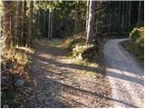 2
2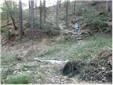 3
3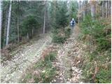 4
4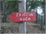 5
5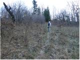 6
6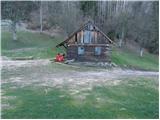 7
7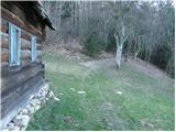 8
8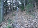 9
9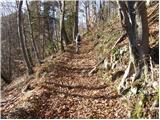 10
10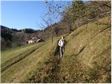 11
11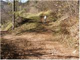 12
12 13
13 14
14 15
15 16
16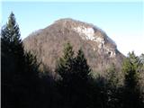 17
17 18
18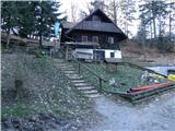 19
19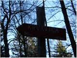 20
20 21
21 22
22 23
23 24
24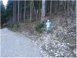 25
25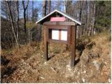 26
26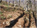 27
27 28
28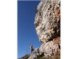 29
29 30
30 31
31 32
32