Loška Koritnica - Jalovec (via Zavetišče pod Špičkom)
Starting point: Loška Koritnica (727 m)
| Latitude/Longitude: | 46,41470°N 13,62950°E |
| |
Route name: via Zavetišče pod Špičkom
Walking time: 7 h 30 min
Difficulty: very difficult marked way
Elevation gain: 1918 m
Elevation difference along the route: 2150 m
Map: Julijske Alpe - zahodni del 1:50.000
Recommended equipment (summer): helmet, self belay set
Recommended equipment (winter): helmet, self belay set, ice axe, crampons
Views: 23.995
 | 3 people like this post |
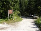
Access to starting point:
From Bovec we drive towards the Predel border crossing. In the village of Log pod Mangartom, immediately after the bridge over the Predilnica, we turn right in the direction of Koritnica. The initially asphalted, then gravel road quickly takes us to the parking lot at the beginning of the entrance to the central part of TNP.
Route description:
From the parking lot we head onto the road to the right, which is closed with a barrier. The road runs alongside the stream the whole time and crosses it several times. Towards the end the road becomes narrower and takes us past a few houses to a crossroads. We head slightly to the right on the footpath following the signs for Jalovec, Pod Špičkom, Mangrt (left Planina Brdo). The path then enters the forest and soon takes us to a marked crossroads.
We continue right following the signs for Zavetišče pod Špičkom, the path to the left leads towards Kotovo sedlo and Mangart.
The path soon takes us to a stream that we have to cross, then we climb for a short time through sparse forest. This is followed by an ascent on a grassy slope and a short ascent over scree to the entry into the climbing part of the path.
When we enter the wall, we first climb left upwards along the steel cable. The path soon becomes even steeper and climbs almost vertically several times along the steel cable with the help of numerous pitons. In the continuation we continue to ascend the steep slope with the help of steel cables, then the path turns a bit to the right and soon takes us into the forest, where the steepness eases a bit. From the forest the path takes us to a slope covered with bushes and tall grass. The bushes then end and an ascent through an increasingly beautiful valley follows. Beautiful views open up from the path towards Mangart, Jalovec and the precipitous walls of Plešivec under which we are ascending. In the last part the valley turns slightly to the right and an ascent over scree to the saddle Čez Brežice follows.
At the saddle we continue left where the inscription on the rock “Špička” directs us. First we climb up along the steel cable to the left upwards, then the path takes us to a grassy slope on which we ascend for some time. When we get below the walls of Mali Ozebnik we continue to the right and traverse the precipitous slopes along the steel cable in a gentle ascent. In some places there is a lot of gravel on the path, so additional caution is needed. The path then takes us to a short, very demanding part of the path. With the help of the steel cable and some pitons we climb vertically, then we traverse a few meters to the right across the vertical slope. In the continuation the path ascends on a somewhat less steep, but unprotected slope and an ascent over a very gravelly slope to Škrbina za Gradom follows.
From the notch we descend over scree below the walls of the peak Pelc nad Klonicami (2442 m). The path then leads us through broken terrain past numerous rocks and boulders. In the last part the path turns to the left and after a short descent takes us to Zavetišče pod Špičkom.
From here we continue right, slightly downhill in the direction of Jalovec (even more to the right leads the path towards the valley, or Zadnja Trenta and Vršič), past a rock with an interesting inscription to the entry into the more demanding part of the path.
The path ahead ascends over an initially relatively well-secured rocky rib, then steeply ascends the wall of the lesser known Veliki Ozebnik (2480 m). The steepness then gradually eases and the path turns a bit to the right, where it traverses steep and slippery slopes under Veliki Ozebnik. On this part the path is less secured and very exposed to falling stones (helmet is mandatory!). The path ahead crosses another short exposed gully and then takes us into the softer world of grass. The path ahead slightly descends and takes us to the high mountain plain called Jezerce. A short ascent follows and from the right the path from Jalovška škrbina joins us.
The path then steeply ascends again and with some protection along a path that is quite exposed in places takes us to the main ridge of Jalovec. We continue ascending along the narrow and occasionally very exposed ridge on the path that higher up takes us to the place where the path from Kotovo sedlo joins us from the left. We continue straight and the scenic ridge path quickly takes us to the summit of Jalovec.
Izhodišče - Mlaka 0:45, Mlaka - Čez Brežiče 2:35, Čez Brežiče - Škrbina Za gradom 0:55, Škrbina Za gradom - Zavetišče pod Špičkom 0:40, Zavetišče pod Špičkom - Jezerca 1:25, Jezerca - Razpotje na grebenu Jalovca 0:45, razpotje na grebenu Jalovca - Jalovca 0:05.

Along the route: Šujč (895m), Mlaka (959m), Čez Brežiče (1980m), Škrbina Za gradom (2277m),
Zavetišče pod Špičkom (2064m), Jezerca (2390m), Razpotje na grebenu Jalovca (2613m)
Photos:
 1
1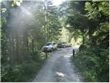 2
2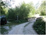 3
3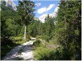 4
4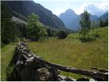 5
5 6
6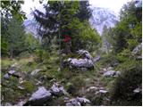 7
7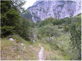 8
8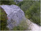 9
9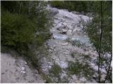 10
10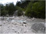 11
11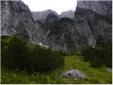 12
12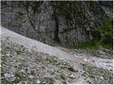 13
13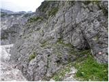 14
14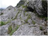 15
15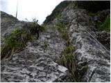 16
16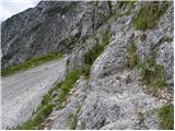 17
17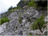 18
18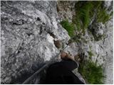 19
19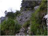 20
20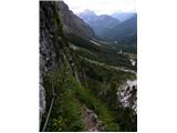 21
21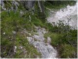 22
22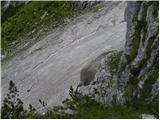 23
23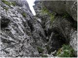 24
24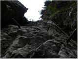 25
25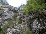 26
26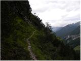 27
27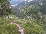 28
28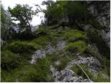 29
29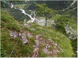 30
30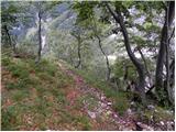 31
31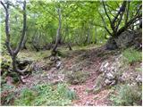 32
32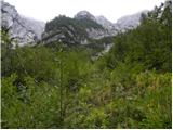 33
33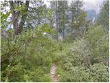 34
34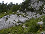 35
35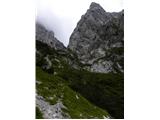 36
36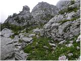 37
37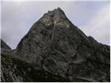 38
38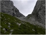 39
39 40
40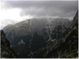 41
41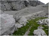 42
42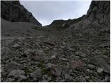 43
43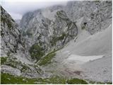 44
44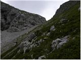 45
45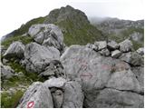 46
46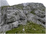 47
47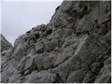 48
48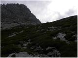 49
49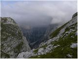 50
50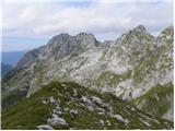 51
51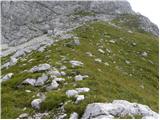 52
52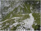 53
53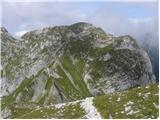 54
54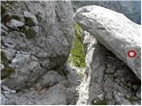 55
55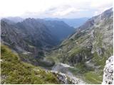 56
56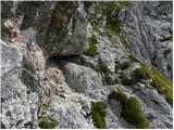 57
57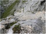 58
58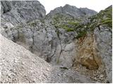 59
59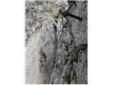 60
60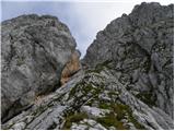 61
61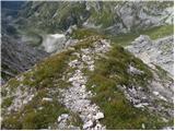 62
62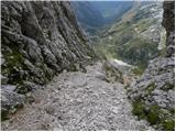 63
63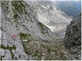 64
64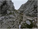 65
65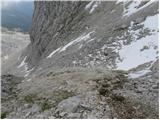 66
66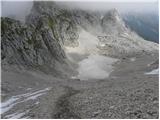 67
67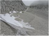 68
68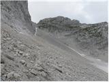 69
69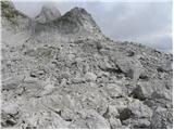 70
70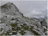 71
71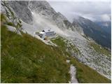 72
72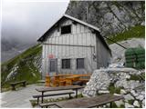 73
73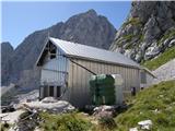 74
74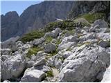 75
75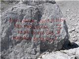 76
76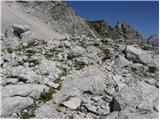 77
77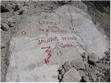 78
78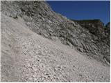 79
79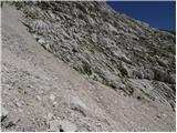 80
80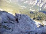 81
81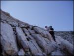 82
82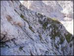 83
83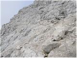 84
84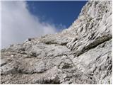 85
85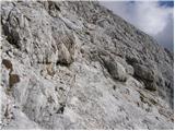 86
86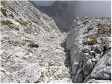 87
87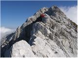 88
88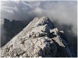 89
89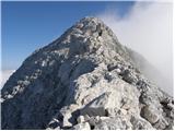 90
90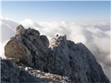 91
91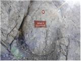 92
92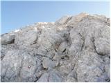 93
93 94
94
Discussion about the trip Loška Koritnica - Jalovec (via Zavetišče pod Špičkom)
|
| darinka425. 08. 2019 |
Has anyone hiked to Špička this year? Is the use of a via ferrata set recommended?
|
|
|
|
| darinka424. 08. 2020 |
On Saturday we set off from Loška Koritnica via sedlo Brežice and Škrbina za Gradom to Špička. The protections are fine. Only on one section the steel cable is thinner. The climbing part is quite steep. All four of us used self-belay sets. At sedlo Brežice clouds began to gather. Further on there is a lot of scree on the path. So be careful. And some bolts are damaged. Otherwise, someone who helped renew the bolts and cables last year wrote that rocks set thinly in the gully damage them. Otherwise a very nice path and tour.
|
|
|
|
| trdi26. 08. 2020 |
Is it possible to bypass this wall in picture 59 on the left side through the scree?
|
|
|
|
| padez26. 08. 2020 |
Don't go there because there is an active landslide in the gully above. This spot can be crossed with great caution, the ascent over the jump is secured with a chain and very rugged, equipped with pegs.
|
|
|
|
| trdi27. 08. 2020 |
Thanks for the information
|
|
|
|
| lojze18251. 08. 2021 14:48:25 |
On Friday, 30.7., to Jalovec via the described path. All passable without issues, in the lower part trimmed bushes, praise to the markers/hunters. Descent via Kotovo sedlo towards Loška Koritnica also normally passable.
|
|
|
|
| Krt4n10. 08. 2021 04:18:46 |
|
|
|
|
| kovivo19. 01. 2023 09:16:10 |
Greetings from Slovakia. We want to do this loop to Jalovec with friends in the summer.
Could you please recommend the direction:
Is it better to go - Loška Koritnica -> Čez Brežice -> Zavetišče pod Špičkom -> Jalovec -> Kotovo sedlo -> Loška Koritnica
or Loška Koritnica -> Kotovo sedlo -> Jalovec -> Zavetišče pod Špičkom -> Čez Brežice -> Loška Koritnica
Thank you very much!
|
|
|
|
| djimuzl19. 01. 2023 15:02:24 |
Maybe rather the 1st direction - at the saddle Čez Brežice I think ascent is more suitable than descent.
|
|
|
|
| darinka419. 01. 2023 16:38:45 |
Yes, from the saddle Brežice to Škrbina za Gradom it's quite a demanding ascent. Some cables are missing. Caution is needed there.
|
|
|
|
| jax19. 01. 2023 17:46:28 |
The first route is more suitable, there is more demanding terrain on the ascent, and the climb from Špička to Škrbina za Gradom is omitted. But caution is also needed on the descent, clearly.
|
|
|
|
| B219. 01. 2023 23:38:36 |
I think that ascent from Loška Koritnica towards the saddle Cez Brežice in the section across the wall is the most demanding. From the saddle to Škrbina no cable is missing, but the access right before the jump, the jump itself and the descent over the scree on the other side of the škrbina are demanding. This route is more suitable for ascent than descent.
|
|
|
|
| kovivo20. 01. 2023 13:21:15 |
Thanks to everyone for the recommendations!
|
|
|
|
| darinka420. 01. 2023 20:31:57 |
As far as I remember, we walked there from Loška Koritnica in August 2020. To the Škrbina za Gradom. I remember we had trouble in one part. Across one passage where a piece of cable and peg was missing. I don't remember exactly. Maybe they fixed it afterwards. It was also crumbly to the Škrbina.
|
|
|
|
| B220. 01. 2023 20:57:48 |
Darinka, you already wrote about this and I wrote to you that that place (jump) was repaired and the jeklenica and klin are in place. Otherwise that jump could be climbed even without repair despite the injury. But right before that jump there is a smooth slab about five meters long strewn with debris and there are quite a few bent klini which are useful for passing this critical spot. That's how it is and it will stay that way. The path is usable, very demanding, no jeklenice or klini are missing. Otherwise let's wait until the snow melts we'll see. In autumn everything was fine. This year is 2023 and you're writing about 2020... Let me add that after your visit several meters of jeklenica were added besides the existing ones. So cheerfully on the path, of course with proper equipment...
|
|
|
|
| darinka423. 01. 2023 08:49:30 |
Ha ha when you get on in years you forget many things.  But I'll check this path this year. If I'm granted. But I'll check this path this year. If I'm granted.
|
|
|
|
| kovivo7. 06. 2023 12:04:20 |
Greetings. Do you know the current condition of the trail Loška Koritnica - V koncu - Kotovo sedlo - Jalovec? We want to go there in the third week of June. I assume there's still a lot of snow from Kotovo sedlo upwards? Thank you kindly.
|
|
|
|
| funnyboy7. 06. 2023 13:27:14 |
I haven't been there, but I dare say there's still quite a bit of snow on the mentioned trail, even in the mentioned period there will definitely be some left.
|
|
|
|
| jax8. 06. 2023 07:31:26 |
Jalovec is a hike for the late season. It varies from year to year, but given the amount of white shit still visible on the hills, I'd wait until August.
|
|
|
|
| mikkeni24. 07. 2024 10:26:21 |
Has anyone gone on this path this year already, otherwise via Kotovo Sedlo then return past Špička and back to Koritnica?
|
|
|
|
| FerKa30. 07. 2024 13:45:53 |
I went up via Brežice four days ago and back via Kotovo sedlo. In the lower part of the path towards Kotovo sedlo there is an active landslide and it's hard to get through.
|
|
|
To post a comment you must log in:
If you do not yet have a username, you must first
register.