Malga Fosse - Cima Vezzana (Via Ferrata Bolver Lugli)
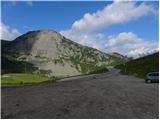
Starting point: Malga Fosse (1936 m)
Starting point Lat/Lon: 46.28933°N 11.79916°E 
Path name: Via Ferrata Bolver Lugli
Time of walking: 4 h 30 min
Difficulty: very difficult marked way
Difficulty of skiing: no data
Altitude difference: 1256 m
Altitude difference (by path): 1350 m
Map: Tabacco 22 1:25.000
Access to starting point:
From Nova Gorica, we drive into Italy and continue on the highway to the town of Portogruaro, where at the highway junction we turn in the direction of the town of Belluno. We follow the highway to the exit for Belluno, but after the town of Belluno we follow the road in the direction of the town of Feltre and then towards the town of Transacqua and the mountain pass Passo Rolle. A little before the mountain pass, we will notice a larger parking lot on the right side of the road at the mountain pasture Malga Fosse, where we park.
Path description:
From the starting point on the mountain pasture Malga Fosse we continue towards the southeast following the signs »Rifugio Rosetta, Col Verde«. The path at the beginning slightly descends on grassy slopes, then mostly in a gentle ascent crosses the slopes below the summit Cimon della Pala. The path named Sentiero dei Finanzieri later ascends somewhat steeper and brings us to flatter grassy slopes.
The path further starts slightly descending and brings us to a marked junction. Right downwards leads the path towards the ski area Col Verde, straight ahead leads the path towards the hut Rosetta, and we turn left upwards following the signs »Via Ferrata Bolver – Lugli«.
From the junction first follows a short ascent on a mostly grassy slope, which brings us to the entrance into the wall.
In the initial part, the path is not secured and therefore more caution is needed (climbing grade 1-2). The path, marked with red dots, ascends quite steeply several times, only on a shorter somewhat more exposed section is it secured with a steel cable.
Higher the path brings us to the start of the secured path named Via Ferrata Bolver Lugli. The wall becomes even steeper, and the path from here on is continuously well secured. In the very beginning the secured path ascends a steep gully left upwards, then the path slowly turns to the right. Further on the path ascends almost vertically alongside the steel cable several times, so that considerable arm strength is also needed. In the last part the climbing path runs left of a steep gully and is somewhat more exposed. When we reach the top of the wall, we continue left and after a short ascent along the ridge we reach flatter slopes where the secured path ends.
The path further turns slightly to the right and after a short easy crossing brings us to the bivouac Fiamme Gialle.
From the bivouac we continue towards the northeast and descend to the saddle Passo del Travignolo where the path from the valley Valle dei Cantoni joins from the right. At the saddle we continue straight following the signs for Cima Vezzana and begin to ascend quite steep scree upwards. The path then turns right and brings us to a smaller saddle below the summit Il Nuvolo. We continue left and then ascend for some time on a rocky slope upwards. In the last part the path turns slightly left again and follows the ascent along the panoramic ridge to the summit.
Pictures:
 1
1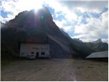 2
2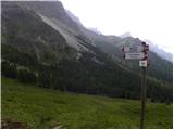 3
3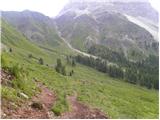 4
4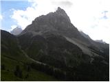 5
5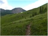 6
6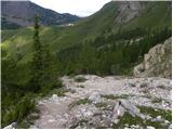 7
7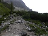 8
8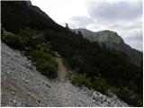 9
9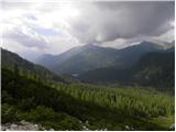 10
10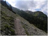 11
11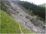 12
12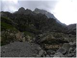 13
13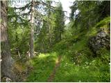 14
14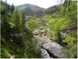 15
15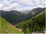 16
16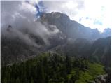 17
17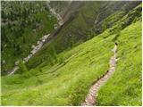 18
18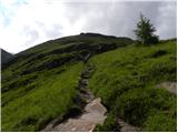 19
19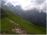 20
20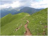 21
21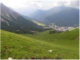 22
22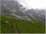 23
23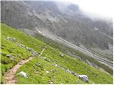 24
24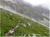 25
25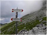 26
26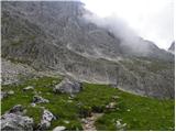 27
27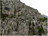 28
28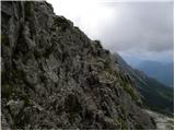 29
29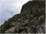 30
30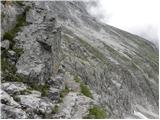 31
31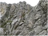 32
32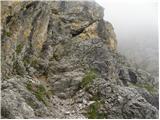 33
33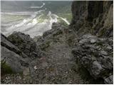 34
34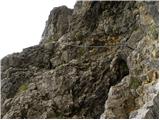 35
35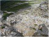 36
36 37
37 38
38 39
39 40
40 41
41 42
42 43
43 44
44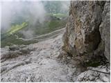 45
45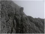 46
46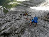 47
47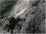 48
48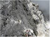 49
49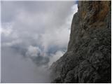 50
50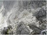 51
51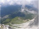 52
52 53
53 54
54 55
55 56
56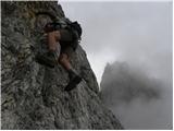 57
57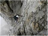 58
58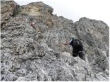 59
59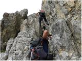 60
60 61
61 62
62 63
63 64
64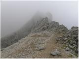 65
65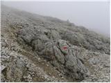 66
66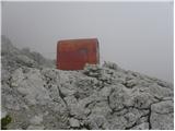 67
67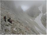 68
68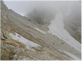 69
69 70
70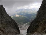 71
71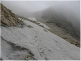 72
72 73
73 74
74 75
75 76
76 77
77 78
78 79
79 80
80 81
81 82
82 83
83 84
84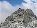 85
85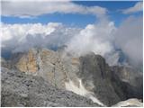 86
86