Marija Reka (Strgar Quarry) - Reška planina
Starting point: Marija Reka (Strgar Quarry) (350 m)
Starting point Lat/Lon: 46.2112°N 15.0913°E 
Time of walking: 2 h 25 min
Difficulty: partly demanding marked way
Difficulty of skiing: no data
Altitude difference: 575 m
Altitude difference (by path): 610 m
Map: Posavsko hribovje - zahodni del 1:50.000
Access to starting point:
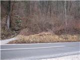
We leave the Štajerska highway at the Šentrupert exit, then follow the signs for Prebold and further signs for Podmejo and Trbovlje. Further, we drive through the Reka valley, and the starting point is located approximately 2300 meters ahead from the sign marking the beginning of the Marija Reka settlement. It is recognizable by a small parking lot by the road, situated about 10 meters before the start of the path, where we notice red hiking signposts.
Path description:
From the parking lot, we first walk across the main road to the start of the footpath, a cart track, then ascend on the path toward Dom pod Reško planino, which leads into the forest (past the former quarry on the left side). Then the path a little ahead from the quarry turns to the left and steeply ascends upwards on a badly beaten but marked footpath which in wet is very slippery!. Still a bad and overgrown path, but a little higher it brings us to a signpost (Prebold straight, and Golava and Mrzlica back), where we turn left on a marked path over a smaller ridge, after which the path starts steeply ascending again on a poorly trodden marked path, which leads us to a meadow, where we continue across the meadow, reaching a house and a hayrack, on which there is a stamp for Gradišče!
We continue on the macadam road to the chapel, where we join the usual path from Prebold, where a footpath branches off uphill from the asphalt road, quickly turning into a cart track. This path, which first slightly descends and then slightly ascends, we follow all the way to the mountain hut Dom pod Reško planino.
Before the mountain hut, we turn right and continue toward Reška planina. We quickly leave the road and proceed along a footpath, ascending to the church.
We bypass the church on the left side, and from the crossing, we continue straight toward Adijev bivak and Reška planina (left Šmiglova zidanica, Sveta planina or Partizanski vrh, Mrzlica, and Grajska vas) and follow an older cart track that turns right, and after a short traverse, it becomes a footpath. The footpath initially ascends alongside a torrent ditch, crosses it higher up, and then transitions to a steep slope over which we climb steeply. A steep ascent follows, requiring extra caution, especially during descent, to avoid slipping. Even in dry conditions, some care is needed. When we reach the ridge higher up, the path flattens. We continue left, following the signs for the stamp. After a few minutes of mostly gentle ascent along the ridge, we reach Adijev bivak on Reška planina.
We bypass the bivouac on the right side and continue toward Šmiglova zidanica and the peak. In approximately 10 minutes of gentle to moderate ascent, we reach the highest point of Reška planina.
Starting point - Dom pod Reško planino 1:30, Dom pod Reško planino - Adijev bivak 0:45, Adijev bivak - Reška planina 0:10.
Pictures:
 1
1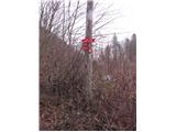 2
2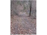 3
3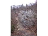 4
4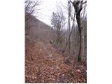 5
5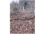 6
6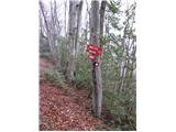 7
7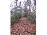 8
8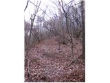 9
9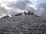 10
10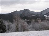 11
11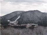 12
12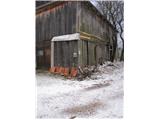 13
13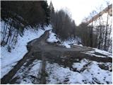 14
14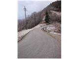 15
15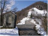 16
16 17
17 18
18 19
19 20
20 21
21 22
22 23
23 24
24 25
25 26
26 27
27 28
28 29
29 30
30 31
31 32
32 33
33 34
34 35
35 36
36 37
37 38
38 39
39 40
40 41
41 42
42 43
43 44
44 45
45 46
46 47
47 48
48 49
49 50
50