Starting point: Matavun (402 m)
Starting point Lat/Lon: 45.6627°N 13.9887°E 
Time of walking: 3 h 15 min
Difficulty: easy marked way
Difficulty of skiing: no data
Altitude difference: 625 m
Altitude difference (by path): 750 m
Map:
Access to starting point:
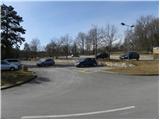
From highway Ljubljana - Koper, we go to the exit Divača, and then we continue driving in the direction of Škocjan caves. When we get to Matavun, we turn left and then we park on a large parking lot by the entrance into Škocjan caves.
Path description:
From the parking lot, we walk to a children's playground, which is situated behind the buildings of park Škocjan caves, and from there we descend on stairs to a marked crossing. From the crossing, we continue left in the direction of Divača, Vremščica, Senožeče and Nanos (right Artviže, Slavnik and Vremščica through the gorge of river Reka) and we continue the ascent on a learning path Škocjan. After few minutes, we get to a scenic viewpoint, from which a view opens up towards Vremščica, the nearby church of St. Kancijan and below it the gorge of river Reka. From the viewpoint, we follow the learning path only to the nearby bee house, and from there we continue straight on a marked path which leads forward towards Divača and Vremščica (learning path continues right). The path ahead for some time continues through the forest and then it slightly descends and it brings us to a marked crossing.
We continue in the direction of Vremščica (straight Divača) to which we have approximately 3 hours of walking. A gentle ascent follows and the path brings us to an asphalt road in the village Gradišče pri Divači. Here we continue left (possible also right) and in a semicircle we get to a crossroad, where also the right road joins. We continue straight on a marked macadam road which goes below the power line and it is descending gently towards the asphalt road Dolnje Ležeče - Famlje. The mentioned road, we carefully cross, and then we continue towards the nearby Divača airport. After few minutes, the road turns right, and we continue straight towards the airport. After 100 meters of additional walking, we get to the entrance on an airport runway, which the marked path crosses, and then continues by the airport runway and further to the edge of the forest (passage past the entrance on an airport runway and ahead by the airport runway, all the way to the edge of the forest is forbidden).
On the other side of the airport, signs for Vremščica point us to the left on a cart track which continues through ample karst meadows. Eventually, the path returns into the forest and it brings us to a railway track.
On the other side of the track, we come through a low underpass, after which the path turns slightly to the right and then gently ascends to a marked crossing, where it joins the path from Senožeče.
Here we go right and we continue on a bad road which continues with some short ascents and descents, and it runs by the foot of Vremščica. When the worse road passes into for some time dense forest, it brings us to a crossroad, where we join the wider road (to here possible also with a car - starting point Podgora).
The mentioned road, we only cross and we continue the ascent on a marked path, which at first ascends through a lane of a forest and then gradually passes on more panoramic grassy slopes. Further, we are ascending on a relatively steep and partly grassy cart track, from which beautiful views opening up towards the valley of river Reka and surrounding hills. Higher, the cart track turns to the right, and we continue straight on a footpath which higher turns to the left and crosses a lane of a low forest. The path then returns on a panoramic slope and ascends diagonally on the ridge of Vremščica, where it joins the bad road which we follow to the right. We walk on the road only few steps, and then blazes point us slightly to the right on a footpath which continues through a pine forest. The forest quickly ends, and the path returns on the road which we soon leave. We continue on a marked path, which for some time continues through the forest, and for some time on panoramic, mostly grassy slopes. Eventually we get to a crossing, where from the right also the path from the village Famlje joins (also the path from Škocjan caves through the gorge of river Reka).
Here we continue slightly left on a less distinct cart track which gradually passes into the forest and changes into an easy to follow footpath. A little higher also the path from Senožeče joins, and we continue straight and we ascend through one more lane of a forest. Higher the forest gets thinner, and an increasingly panoramic path quickly brings us to the summit of Vremščica.
On the way: Gradišče pri Divači (465m), Podgora (487m)
Pictures:
 1
1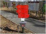 2
2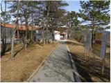 3
3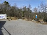 4
4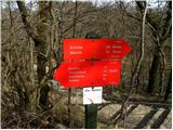 5
5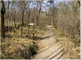 6
6 7
7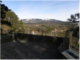 8
8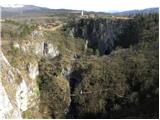 9
9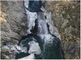 10
10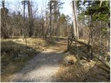 11
11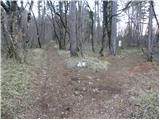 12
12 13
13 14
14 15
15 16
16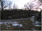 17
17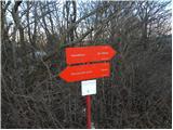 18
18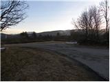 19
19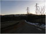 20
20 21
21 22
22 23
23 24
24 25
25 26
26 27
27 28
28 29
29 30
30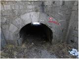 31
31 32
32 33
33 34
34 35
35 36
36 37
37 38
38 39
39 40
40 41
41 42
42 43
43 44
44 45
45 46
46 47
47 48
48 49
49 50
50 51
51 52
52 53
53 54
54 55
55 56
56 57
57 58
58 59
59 60
60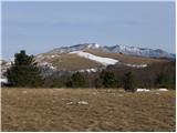 61
61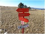 62
62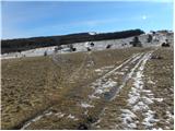 63
63 64
64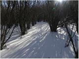 65
65 66
66 67
67 68
68 69
69 70
70 71
71 72
72 73
73 74
74 75
75 76
76