Mesnice - Županov vrh (via Reber)
Starting point: Mesnice (806 m)
Starting point Lat/Lon: 45.9066°N 14.4311°E 
Path name: via Reber
Time of walking: 45 min
Difficulty: easy unmarked way
Difficulty of skiing: no data
Altitude difference: 193 m
Altitude difference (by path): 215 m
Map: Ljubljana - okolica 1:50.000
Access to starting point:
A) From highway Ljubljana - Koper we go to the exit Brezovica, and then we continue driving in the direction Podpeč (to Podpeč we can also come from Črna vas or Ig). In Podpeč we continue in the direction of Borovnica, Krim and Rakitna and continue driving for a short time by the edge of Ljubljana marshes, and then signs for Rakitna point us to the left on a steep ascending road. The road then leads us through Preserje, where it also starts descending. After a short descent, we continue left in the direction of Krim and Rakitna, and then mostly ascending road we follow to a crossroad, where the road towards Krim branches off to the left. At the crossroad there's enough space, where we can park.
B) First, we drive to Cerknica, and then we continue driving in the direction of Begunje, when we get to Begunje we follow the signs for Rakitna. From Rakitna we continue driving on the main road towards the settlement Preserje, and we are driving there to the crossroad, where a road towards Krim branches off to the right. At the crossroad there's enough space, where we can park.
Path description:
From the starting point, we continue on the macadam road towards Krim, which quickly brings us into the forest, through which it is gently ascending. After a good 10 minutes of walking, we will right above the road notice a grassy slope, and the road after it brings us to the turn-off of cart track from the road to the right (beginning of the cart track is only few meters before the road sign 18.5 km).
We continue on the mentioned cart track which is short time ascending by the edge of the forest and then turns right, on an already mentioned grassy slope. Through a grassy slope we ascend diagonally towards the right, and with a view on part of Karawanks and the highest peaks of Kamnik Savinja Alps, we soon again step in the forest. In the forest, at the smaller crossing, we continue on the left ascending cart track which we follow to the spot, where it brings us on a some kind of a ridge and there is the next crossing.
This time as well we continue on the left upper cart track, and there after few 10 meters of additional walking, we come out of the forest on panoramic gentle grassy slope. Through a meadow, the cart track is a little poorly visible and we continue there to the upper part, or to the spot, where the cart track passes on the right side of the slope (on a cart track we get to Rakitna).
When we enjoyed the views, which in good weather reach all the way to Triglav, we continue slightly left, on a footpath which goes through a lane of bushes in the forest. The path, by which we further notice few blue-yellow blazes, mostly continues on the ridge, where we soon reach indistinct and with a forest covered peak Reber (923 meters).
We continue on forest ridge path, which is with the exception of the initial light descent, mostly lightly ascending. When the path entirely flattens, it brings us out of the forest, from where a nice view opens up towards the nearby Krim and Kamnik Savinja Alps. When the path returns into the forest, from the right joins another path from Rakitna, and we continue on a cart track which a little ahead turns left on a grassy slope of Županov vrh. Next follows some of gentle walking, and then the path moderately ascends to the nearby peak, from which a nice view opens up, which reaches on all sides, in good weather up to Snežnik.
Description and pictures refer to a condition in the year 2015 (January).
On the way: Reber (923m)
Pictures:
 1
1 2
2 3
3 4
4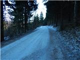 5
5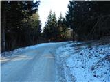 6
6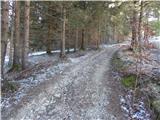 7
7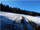 8
8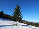 9
9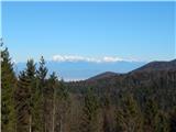 10
10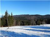 11
11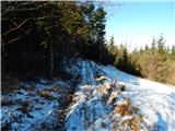 12
12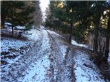 13
13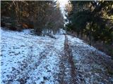 14
14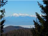 15
15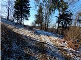 16
16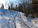 17
17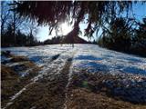 18
18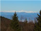 19
19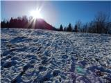 20
20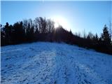 21
21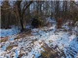 22
22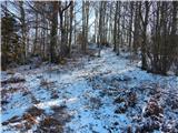 23
23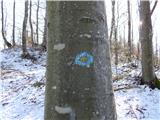 24
24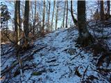 25
25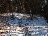 26
26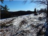 27
27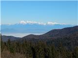 28
28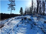 29
29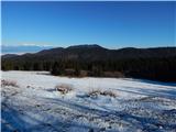 30
30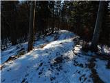 31
31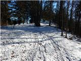 32
32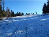 33
33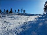 34
34 35
35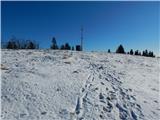 36
36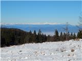 37
37 38
38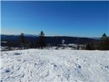 39
39