Mojstrana - Grančišče (north path)
Starting point: Mojstrana (641 m)
Starting point Lat/Lon: 46.4624°N 13.9339°E 
Path name: north path
Time of walking: 30 min
Difficulty: partly demanding unmarked way
Difficulty of skiing: no data
Altitude difference: 203 m
Altitude difference (by path): 210 m
Map: Kranjska Gora 1:30.000
Access to starting point:
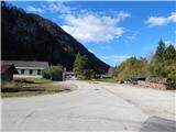
A) We leave Gorenjska highway at exit Jesenice - zahod (Hrušica), and then we continue driving towards Kranjska Gora. We will soon get to a crossroad, where signs for Mojstrana and Vrata point us to the left on a local road. On the road, we drive past the church of St. Klemen and smaller ski slope, and after the bridge over Triglavska Bistrica we get to a crossroad, where we continue left. Some 10 meters further, in front of store Mercator we continue slightly right, and then on the road we drive to buildings of company Sigor d.o.o. (used to be factory Kovinska oprema (KO-OP) Mojstrana. We park on an appropriate place nearby.
B) First, we drive to Kranjska Gora, and then we continue driving towards Jesenice. After the settlement Belca we get to a hamlet Na Belah (part of Dovje), where we leave the main road and we continue driving right in the direction of Mojstrana and Vrata. On the road through a bridge over the river Sava Dolinka we drive in Mojstrana, where in front of store Mercator we continue slightly right, and then on the road we drive to buildings of company Sigor d.o.o. (used to be factory Kovinska oprema (KO-OP) Mojstrana. We park on an appropriate place nearby.
Path description:
From the starting point, we continue on a macadam road which continues by buildings of company, and there without changes in altitude we walk to a smaller boulder. From the road, from which there is a nice view towards Dovška Baba, Borovje, Planica and more, few 10 meters after the mentioned boulder we continue left in the forest on a beaten, but further unmarked footpath. On initial a little rough terrain, where we ascend straight upwards, the footpath turns right and it ascends diagonally on a side ridge. When we reach the mentioned ridge path turns left and continues on a ridge. On one part pretty steep path, then from the ridge passes on for some time more plain terrain, where it turns a little to the left. Next follows a diagonal ascent to the main ridge, where the path becomes quite panoramic and in parts exposed. With a view on Mojstrana, Dovje and Karawanks we are gradually gaining height, and the path after few minutes on occasionally exposed path brings us on vegetated secondary peak of Grančišče. From the secondary peak follows a descent, after that a short ascent to panoramic Grančišče.
Description and pictures refer to a condition in the year 2014 (October).
Pictures:
 1
1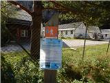 2
2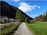 3
3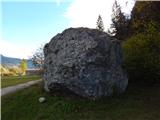 4
4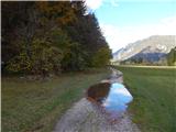 5
5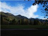 6
6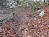 7
7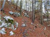 8
8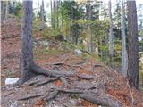 9
9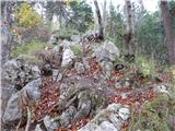 10
10 11
11 12
12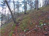 13
13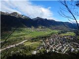 14
14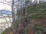 15
15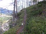 16
16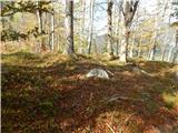 17
17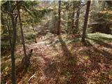 18
18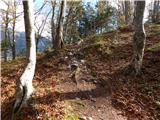 19
19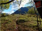 20
20 21
21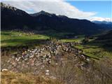 22
22