Molnarjev breg - Planina Osredek (by road)
Starting point: Molnarjev breg (1200 m)
Starting point Lat/Lon: 46.2803°N 14.5359°E 
Path name: by road
Time of walking: 45 min
Difficulty: easy unmarked way
Difficulty of skiing: no data
Altitude difference: -100 m
Altitude difference (by path): 45 m
Map: Kamniške in Savinjske Alpe 1:50.000
Access to starting point:
A) From highway Ljubljana - Jesenice we go to the exit Vodice, and then we continue driving to a first traffic light crossroad in Vodice, where we continue left in the direction of Cerklje na Gorenjskem and Brnik. When we get to the main roundabout in Spodnji Brnik we continue driving in the direction of Cerklje and ski slope Krvavec. At the end of the settlement Cerklje na Gorenjskem we leave the main road which continues towards Velesovo and Visoko and we continue driving slightly right on a road in the direction of the ski slope Krvavec. Further, we get to the village Grad, where signs for settlement Ambrož pod Krvavcem point us to the right on a steep asphalt road (straight bottom station of the cable car on Krvavec and Štefanja Gora). When the steepness on a steep road decreases a little, we will get to a crossroad, where we continue left in the direction of the settlement Ambrož pod Krvavcem (straight settlement Ravne, Apno and Šenturška Gora). A little further, the road for some time descends a little and then it is ascending through occasionally quite panoramic slopes. Higher, we get to Ambrož pod Krvavcem, where on the left side we bypass church of St. Ambrož and tourist farm Pr Ambružarju. From the tourist farm ahead road passes into the forest and relatively steeply ascends diagonally. When we get to left zig zag, we are at the starting point, where on an appropriate place, at the smaller crossroad we park.
B) From highway Jesenice - Ljubljana we go to the exit Kranj - east, and then we continue driving towards Brnik, Komenda and Mengeš. When we get to the main roundabout in Spodnji Brnik we continue driving in the direction of Cerklje and ski slope Krvavec. At the end of the settlement Cerklje na Gorenjskem we leave the main road which continues towards Velesovo and Visoko and we continue driving slightly right on a road in the direction of the ski slope Krvavec. Further, we get to the village Grad, where signs for settlement Ambrož pod Krvavcem point us to the right on a steep asphalt road (straight bottom station of the cable car on Krvavec and Štefanja Gora). When the steepness on a steep road decreases a little, we will get to a crossroad, where we continue left in the direction of the settlement Ambrož pod Krvavcem (straight settlement Ravne, Apno and Šenturška Gora). A little further, the road for some time descends a little and then it is ascending through occasionally quite panoramic slopes. Higher, we get to Ambrož pod Krvavcem, where on the left side we bypass church of St. Ambrož and tourist farm Pr Ambružarju. From the tourist farm ahead road passes into the forest and relatively steeply ascends diagonally. When we get to left zig zag, we are at the starting point, where on an appropriate place, at the smaller crossroad we park.
Path description:
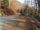
From the starting point, we go on the forest road which crosses slopes of Molnarjev breg. We are slightly ascending on the road, and then we get to a smaller crossing, where we continue slightly left on the upper road (bottom road or cart track soon ends), by which we also notice blazes. Next follows few minutes of a diagonal ascent, on the road from which occasionally a view opens up. A little further, the road again splits, and we again choose the left upper road, and from there only few 10 strides ahead steep cart track branches off to the left. We continue on the road, and from there in the right turn in the direction of straight marked footpath branches off. The road which is then descending, soon turns back towards the left and leads us past a gate. During the descent, we cross a marked path, which from the road recently branched off, and we continue on the road in diagonal descent all the way to the upper part of the mountain pasture Osredki. From the upper part of the mountain pasture, we continue right and in a minute or two of additional walking, we get to shepherd huts on the mountain pasture Osredek.
Description and pictures refer to a condition in the year 2015 (November).
Pictures:
 1
1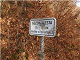 2
2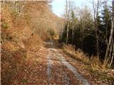 3
3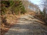 4
4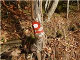 5
5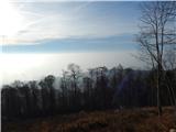 6
6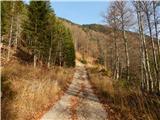 7
7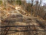 8
8 9
9 10
10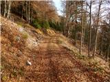 11
11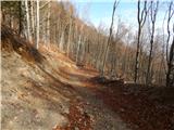 12
12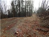 13
13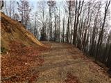 14
14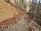 15
15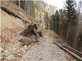 16
16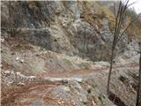 17
17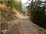 18
18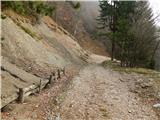 19
19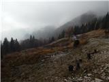 20
20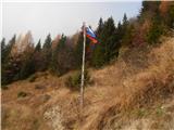 21
21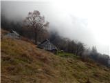 22
22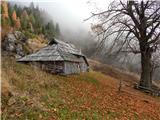 23
23 24
24