Mönichkirchen - Berggasthof Mönichkirchner-Schwaig
Starting point: Mönichkirchen (1006 m)
Starting point Lat/Lon: 47.51217°N 16.03173°E 
Time of walking: 35 min
Difficulty: easy marked way
Difficulty of skiing: no data
Altitude difference: 179 m
Altitude difference (by path): 179 m
Map:
Access to starting point:
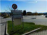
We leave the highway A2 Graz - Vienna / Wien at exit Pinggau, Friedberg, then from the nearby roundabout we take the exit in the direction of the mentioned settlements and Vienna and Graz. A few kilometers ahead at the crossroads of regional roads we follow the signs for Vienna and Mönichkirchen. Further on, we drive on Wechsel Straße, the mentioned road which is mainly ascending, which we leave at the exit for Mönichkirchen. Next follows driving through the settlement to a larger parking lot above the settlement, which is situated at the foot of the ski slope.
Path description:
On the right, eastern side of the parking lot the asphalt road continues, alongside which there are still a few parking lots, and we ascend along it beside the ski slope. After a few minutes we arrive at a marked junction, where the path towards Mönichkirchner-Schwaig splits into two parts.
We continue slightly left (straight ahead path along the road) and continue along the right side of the ski slope (path across the ski slope leads past the Studentenkreuz cross). Next follows an ascent along a trail that leads along the edge of the forest, all the time near the ski slope. Higher up, we carefully cross a macadam road, because during the summer season descents take place on it with vehicles adapted for use on snowless ski slopes.
For a few minutes we still ascend along the edge of the ski slope, then we return to the road, where we continue left and walk to Berggasthof Mönichkirchner-Schwaig.
Description and pictures refer to the condition in October 2022.
Pictures:
 1
1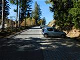 2
2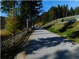 3
3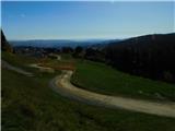 4
4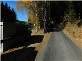 5
5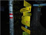 6
6 7
7 8
8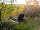 9
9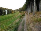 10
10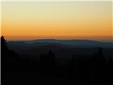 11
11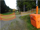 12
12 13
13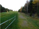 14
14 15
15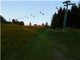 16
16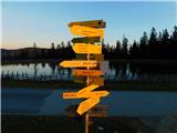 17
17 18
18 19
19