Mönichkirchen - Hochwechsel (via Steinerne Stiege)
Starting point: Mönichkirchen (1006 m)
Starting point Lat/Lon: 47.51217°N 16.03173°E 
Path name: via Steinerne Stiege
Time of walking: 3 h 30 min
Difficulty: easy marked way
Difficulty of skiing: no data
Altitude difference: 737 m
Altitude difference (by path): 840 m
Map:
Access to starting point:
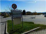
We leave the highway A2 Graz - Vienna / Wien at exit Pinggau, Friedberg, after that from the nearby roundabout we go to the exit in the direction of the mentioned settlements and Vienna and Graz. Few kilometers ahead at the crossroad of regional roads we follow the signs for Vienna and Mönichkirchen. Further, we drive on Wechsel Straße, and the mentioned road which is mainly ascending we leave at the exit for Mönichkirchen. Next follows driving through the settlement, to a larger parking lot above the settlement, which is situated at the foot of the ski slope.
Path description:
On the right, eastern side of the parking lot continues the asphalt road, by which there are few parking lots, and we are ascending there by the ski slope. After few minutes, we get to a marked crossing, where the path towards Mönichkirchner-Schwaig splits into two parts.
We continue slightly left (straight - path on the road) and we continue on the right side of the ski slope (path across the ski slope leads past the cross Studentenkreuz). Next follows an ascent on a footpath which leads us by the edge of the forest, and all the time near the ski slope. Higher, we carefully cross a macadam road, because in the time of the summer season descents with vehicles adapted for the use on the snowless ski slope are taking place.
Few minutes we are still ascending by the edge of the ski slope, and then we return on the road, where we continue left and we walk to Berggasthof Mönichkirchner-Schwaig.
We continue in the direction of the mountain hut Hallerhaus and Vorauer Schwaig and further we are ascending on the right side of another ski track, where we are accompanied with some rare trail blazes. Next follows few minutes of a steeper ascent on a cart track which is ascending on a ski slope, and then we join the cart track which still continues on a ski slope. Further, occasionally beautiful views opening up, and we follow the marked path to the hut Hallerhaus.
We bypass the cottage on the left side and we follow the signs for Hochwechsel. The path ahead leads through the forest, and at few crossings we follow the blazes. A little higher we leave the forest and we get to the mountain hut Kulinarik zur Stoa Alm, from which a nice view opens up mainly towards the northeast.
We bypass the mountain hut and the upper station of the cableway on the left side and we return into the forest, through which we are for few minutes steeply ascending. Higher the forest gets thinner and a view opens up a little, and we continue a little further and we get to the indistinct peak Steinerne Stiege.
Next follows some descent through the forest and then we get to a clearing, from where a view opens up towards the mountain Schneeberg, which with the second-highest peak Kaiserstein is considered to be the northernmost and at the same time also easternmost two-thousander in the Alps. The path ahead returns into the forest and splits.
We continue straight across the cart track on the path in the direction of peaks Hochwechsel and Niederwechsel (left on a cart track - hut Vorauer Schwaig. Further, we are ascending diagonally, short time still through the forest and then gradually on a more and more panoramic grassy slope. Higher, we two more times cross a grazing fence, and we follow the marked path all the way to a crossing near the peak Niederwechsel, where from the left joins the path which leads past the mountain hut Vorauer Schwaig.
Here we go right and in few steps we ascend on a rocky and panoramic peak.
We continue towards the northwest in the direction of the summit Hochwechsel, where we are at first lightly descending on panoramic grassy slopes. Lower, we reach an indistinct saddle between the both peaks, and few minutes ahead we get to a marked crossing, where from the left joins the path past the mountain hut Vorauer Schwaig and few other starting points.
We continue straight and we start at first gently, and then moderately ascending. This path we then follow to the mountain hut Wetterkoglerhaus am Hochwechsel, where we step on the road. At the beginning of a parking lot we cross the road and we walk to few steps distant peak.
The starting point - Mönichkirchner-Schwaig 0:35, Mönichkirchner-Schwaig - Hallerhaus 0:30, Hallerhaus - Stoa Alm 0:15, Stoa Alm - Steinerne Stiege 0:15, Steinerne Stiege - Niederwechsel 0:50, Niederwechsel - Hochwechsel 1:05.
Description and pictures refer to a condition in October 2022.
Pictures:
 1
1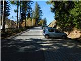 2
2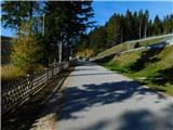 3
3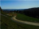 4
4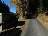 5
5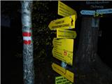 6
6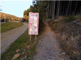 7
7 8
8 9
9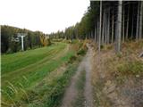 10
10 11
11 12
12 13
13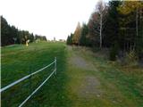 14
14 15
15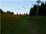 16
16 17
17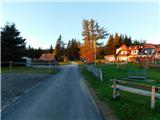 18
18 19
19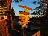 20
20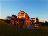 21
21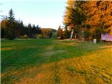 22
22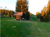 23
23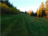 24
24 25
25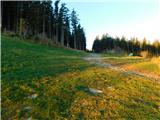 26
26 27
27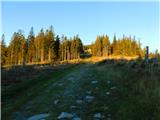 28
28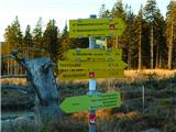 29
29 30
30 31
31 32
32 33
33 34
34 35
35 36
36 37
37 38
38 39
39 40
40 41
41 42
42 43
43 44
44 45
45 46
46 47
47 48
48 49
49 50
50 51
51 52
52 53
53 54
54 55
55 56
56 57
57 58
58 59
59 60
60 61
61 62
62 63
63 64
64 65
65 66
66 67
67 68
68 69
69 70
70 71
71 72
72 73
73 74
74 75
75 76
76 77
77 78
78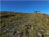 79
79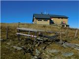 80
80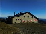 81
81 82
82 83
83 84
84