Moravske Toplice - Gravel pit Ivanci
Starting point: Moravske Toplice (190 m)
Starting point Lat/Lon: 46.6851°N 16.21835°E 
Time of walking: 1 h 30 min
Difficulty: easy marked way, easy unmarked way
Difficulty of skiing: no data
Altitude difference: -13 m
Altitude difference (by path): 5 m
Map: Pomurje 1:40.000
Access to starting point:
A) We leave Pomurska highway at exit Gančani, and then we follow the signs for Bogojina and Moravske Toplice. In Bogojina we go left and we drive to Moravske Toplice, where a little before the end of the settlement, we turn left towards Prekmurska vas Ajda (we turn left after the store Mercator, which is on the left side of the road). We park about 100 meters ahead on a large parking lot before holiday cottages.
B) We drive to Murska Sobota, and then we follow the signs for Moravske Toplice. When we get to Moravske Toplice, immediately at the beginning of the settlement, we turn right towards Prekmurska vas Ajda. We park about 100 meters ahead on a large parking lot before holiday cottages.
Path description:
From the parking lot, we continue towards the south and the road soon turns left and for some time turns towards the east. We soon again continue towards the south, and when the road turns left again, we go slightly right on a narrower asphalt road which continues by the golf fields. The path ahead leads us also past gravel pit Tešanovci or pond Moravske Toplice, and when we get to a crossroad we go left. Only a little further from our path to the right European footpath E7 branches off (also the path E7 gets close to gravel pit Ivanci), and we continue straight to the next crossroad, where we go once again left. For a short time, we walk by a little wider road, and after the inn Oaza Grill we go right on a cart track, by which there are signs for Pannonian trail. Next follows a longer walk on a cart track, where we go past some hunting observatories, and at a smaller crossing, we go straight in the direction of Pannonian trail. Such a path, where there are mainly on the left side of the path larger fields, we follow to a crossroad near the cemetery Ivanci, where we go right (left - Bogojina).
We continue on the asphalt road which leads us past the cemetery, and then we go left on a cart track, on which we continue all the way to the embankment at gravel pit Ivanci. When we ascend on an embankment a nice view opens up towards the gravel pit.
Description and pictures refer to a condition in November 2022.
On the way: Gramoznica Tešanovci (188m)
Pictures:
 1
1 2
2 3
3 4
4 5
5 6
6 7
7 8
8 9
9 10
10 11
11 12
12 13
13 14
14 15
15 16
16 17
17 18
18 19
19 20
20 21
21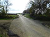 22
22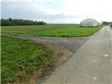 23
23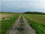 24
24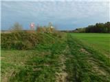 25
25 26
26 27
27