Starting point: Možnica (598 m)
Starting point Lat/Lon: 46.3904°N 13.5875°E 
Time of walking: 5 h
Difficulty: difficult marked way
Difficulty of skiing: more demanding
Altitude difference: 1528 m
Altitude difference (by path): 1540 m
Map: Julijske Alpe - zahodni del 1:50.000
Access to starting point:
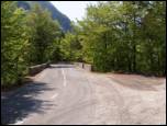
From Bovec, we drive towards the border crossing Predel, but only to a spot, where the road branches off to the left into a valley Možnica (turn-off from the main road is located immediately after the bridge over the river Koritnica, approximately 4 km after fortress Kluže and only a little before we come in the village Log pod Mangartom). We park at the beginning of the road into a valley Možnica, further driving is forbidden.
Path description:
From the parking lot, we continue on a macadam road which at first crosses a torrent stream and then it ascends on avalanche slopes. Higher, the road passes into the forest, and we follow it good half an hour, to the spot, where it makes a sharp right turn. Right in the middle of the turn, we leave the road which leads towards hut Dom v Možnici and we continue straight on a little worse road in the direction of Jerebica. Only a little further, the road ends, and we continue the ascent on a gently sloping mountain path. This gently sloping path we follow approximately 20 minutes, and then we continue sharply right (straight unmarked path towards the gable of Možnica). The path ahead steeply ascends, and we get help from some fixed safety gear, which help us to overcome the steep rocky section. The path then flattens a little and gradually passes on overgrown slopes, on which we are then ascending (in the morning dew we will get fairly wet). The increasingly panoramic path after good 3 hours of walking, it brings us on a saddle Jezersko sedlo (Italian Sell del Lago), where we cross on the Italian side of the mountain.
Here we continue right, on a still overgrown path, which higher slightly descends, and then it is gently ascending. Further, we cross steep grassy slopes, which are mainly in wet dangerous for slipping and after them in additional 20 minutes we ascend to the summit of Jerebica.
On the way: Jezersko sedlo (1720m)
Pictures:
 1
1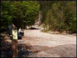 2
2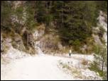 3
3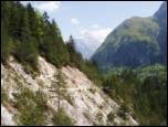 4
4 5
5 6
6 7
7 8
8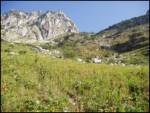 9
9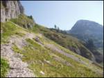 10
10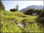 11
11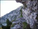 12
12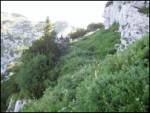 13
13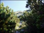 14
14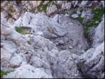 15
15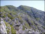 16
16 17
17