MP Hodoš - Border stone A 115
Starting point: MP Hodoš (235 m)
Starting point Lat/Lon: 46.82214°N 16.34184°E 
Time of walking: 4 h 15 min
Difficulty: easy marked way
Difficulty of skiing: no data
Altitude difference: 118 m
Altitude difference (by path): 250 m
Map:
Access to starting point:
We drive to Murska Sobota, and then we follow the road towards the Hodoš border crossing. We park a little before the border crossing on an asphalt parking lot on the left side of the road by an empty building.
Path description:
From the parking lot, we continue towards Hungary. At the former Kompas store, we turn left and proceed along the national border, following the footpath by the border stones. A little further, the path widens into a cart track, and we continue straight, walking between the field on the left and the forest on the right. The path and national border then turn eastward, where the path continues through the forest. The forest path persists even as it turns back towards the north. Eventually, the path, which is mostly gently ascending, turns westward. At border stone A 202, we reach two successive crossings.
First, a path from Hungary joins from the right, specifically from the settlement Sola (Glava Zale) / Szalafő. A few steps further, a path from the Mladinski dom Hodoš joins from the left.
Here, the path veers slightly to the right and begins descending on the Slovenian side of the national border. When the descent ends, we cross a border stream and swampy area via a small wooden bridge. The path then continues on the Hungarian side of the national border, where we follow Hungarian signs. For quite some time, we walk slightly to the right of the national border in a lane of clearing, where the path is somewhat overgrown in parts but remains relatively easy to follow and marked. Later, we reach the border stones again and, passing a small natural lake, arrive in a few minutes at the historical park Határkőpark, situated by border stone A 180.
At the park, we cross a macadam road and continue following the blazes and border stones. The path ahead passes again for some time on the Hungarian side of the border and continues with several shorter ascents and descents. Also, when the path returns to the border stones, we descend slightly and ascend slightly several times, and then we reach a marked crossing with multiple signposts.
We continue straight (left Dolenci, right Andovci - Orfalu) and soon reach the border crossing Budinci, where we continue straight along the national border (left Slovenia, right Hungary). For a short time, we still walk on the asphalt road, and when the road turns left towards the northernmost hamlet in Slovenia, we continue straight and proceed on a cart track that soon splits. Straight continues the path along the national border, and to the right, a path branches off, which continues parallel on the Hungarian side of the border. We can continue along the national border, which also leads us past the former JLA guardhouse, or on the Hungarian side, which takes two minutes longer. Both paths join at the border stone A 115, which is located at the northernmost point of the Republic of Slovenia.
Border crossing Hodoš - Határkőpark 2:00. Határkőpark - border stone A 115 2:15.
The description refers to conditions in February 2024, and the pictures are from March 2021 and February 2024.
Pictures:
 1
1 2
2 3
3 4
4 5
5 6
6 7
7 8
8 9
9 10
10 11
11 12
12 13
13 14
14 15
15 16
16 17
17 18
18 19
19 20
20 21
21 22
22 23
23 24
24 25
25 26
26 27
27 28
28 29
29 30
30 31
31 32
32 33
33 34
34 35
35 36
36 37
37 38
38 39
39 40
40 41
41 42
42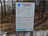 43
43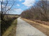 44
44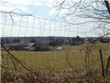 45
45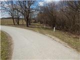 46
46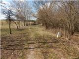 47
47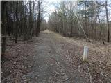 48
48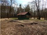 49
49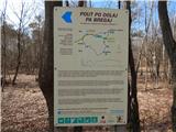 50
50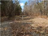 51
51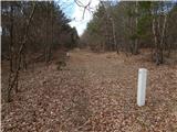 52
52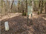 53
53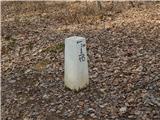 54
54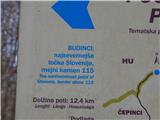 55
55