Mrzli studenec - Malo Kladivo
Starting point: Mrzli studenec (1280 m)
Starting point Lat/Lon: 46.4146°N 14.3314°E 
Time of walking: 2 h
Difficulty: partly demanding marked way
Difficulty of skiing: demanding
Altitude difference: 756 m
Altitude difference (by path): 800 m
Map: Karavanke - osrednji del 1:50.000
Access to starting point:
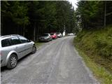
From the Ljubljana–Jesenice motorway, take the Ljubelj exit. Continue to the centre of Tržič and follow the road through the Dolžanova Gorge to the village of Jelendol, where signs for the mountain pastures Kofce, Šija and Pungrat direct us to the left. The road then loses its asphalt surface and begins to ascend steeply. Follow this road at the junctions towards the Kofce pasture. When you notice signs for Kofce and the chapel beside the road, park in the parking area beside the road (approx. 4.7 km from Jelendol).
If you miss this starting point, you can also reach the Dom na Kofcah hut via two nearby paths, which are well marked (also possible via a worse road).
Path description:
From the parking lot, we head onto the footpath towards the Dom na Kofcah hut and the chapel. The relatively steep path brings us, after approximately 20 minutes of walking, out of the forest onto a clearing at the edge of which we notice the chapel.
We continue on the cart track, which ascends over a belt of forest and brings us higher onto the grassy slopes of the Kofce pasture. From here to the mountain hut on Kofce we have only a few minutes of pleasant walking.
From the mountain hut, we continue towards Veliki vrh and Kladivo along an initially somewhat less visible path, which begins ascending across a panoramic meadow. After 15 minutes of walking from the Dom na Kofcah hut, we reach a nice viewpoint by the cross.
The path then descends slightly and brings us in a few minutes to the steeper slopes of Košuta. The path then ascends through a belt of dwarf pines, where it brings us to a junction. We continue right (straight Veliki vrh) along the path to which an unmarked but signed path from the Šija pasture joins after just a few metres. We continue left uphill on the path, which ascends steeply and quickly brings us to an exposed passage. Without fixed safety gear we cross a short but crumbly and slightly exposed ledge, after which we enter a belt of dwarf pines. The path ahead ascends through a short belt of dwarf pines, then continues along the side ridge of Košuta. The increasingly panoramic and fairly steep path joins the ridge path higher up.
We continue right towards Kladivo (left Veliki vrh, straight upwards Kofce gora 10 steps) along a path which begins slightly descending along the edge of the ridge. The very panoramic ridge path, which runs on and beside the main ridge, is slightly exposed in some places further on, but in dry conditions the passages cause no problems.
A little further ahead, the path approaches the indistinct summit (Malo Kladivo), to which a short steep ascent brings us.
Starting point - Kofce 30 minutes, Kofce - Kofce gora 1:00, Kofce gora - Malo Kladivo 30 minutes.
Pictures:
 1
1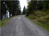 2
2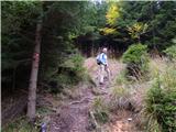 3
3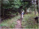 4
4 5
5 6
6 7
7 8
8 9
9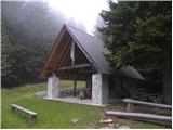 10
10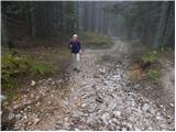 11
11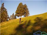 12
12 13
13 14
14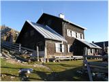 15
15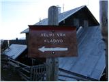 16
16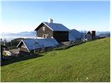 17
17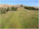 18
18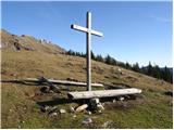 19
19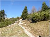 20
20 21
21 22
22 23
23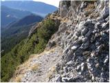 24
24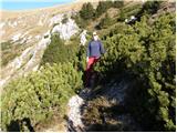 25
25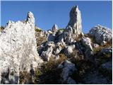 26
26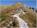 27
27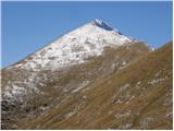 28
28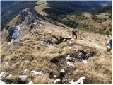 29
29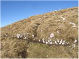 30
30 31
31 32
32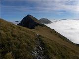 33
33 34
34 35
35 36
36 37
37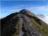 38
38 39
39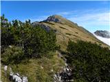 40
40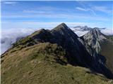 41
41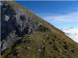 42
42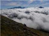 43
43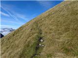 44
44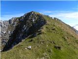 45
45 46
46 47
47