Muta (Spodnja Muta) - St. Lorenzen ob Eibiswald
Starting point: Muta (Spodnja Muta) (330 m)
Starting point Lat/Lon: 46.6128°N 15.167°E 
Time of walking: 2 h 55 min
Difficulty: easy marked way
Difficulty of skiing: no data
Altitude difference: 617 m
Altitude difference (by path): 725 m
Map: Koroška 1:50.000
Access to starting point:
A) First, we drive to Dravograd, then continue driving in the direction towards Maribor. After crossing Mučka Bistrica, we turn left into the settlement Muta, where we then park at an appropriate place in the middle of the settlement Spodnja Muta. Some parking lots are intended only for residents.
B) We drive to Maribor, then we follow the signs for Dravograd. Somewhat after the settlement Zgornja Vižinga, we turn right in the direction of the settlement Muta, where we then park in the center of Spodnja Muta on an appropriate parking lot. Some parking lots are intended only for residents.
Path description:
We start the path at Cesta na Primož, along it we easily ascend towards the northeast. After a few minutes we arrive at a crossroads, where the hiking signpost for Bricnik directs us left, but we quickly arrive at the beginning of the settlement Sv. Primož nad Muto. At the next crossroads the blazes direct us left, then we ascend diagonally across the panoramic grassy slope. When a little higher the road turns right, it loses the asphalt surface and transitionally enters the forest, where it makes a right serpentine. Soon we return from the forest, where the path leads past the homestead Sušek, somewhat above the homestead from the crossroads we continue straight or slightly right. Along the macadam road we bypass the turn-off to the tourist farm Breznik, at the next crossroads, at the sign for farm Janež, we leave the road and continue on the marked path, which transitionally steeply ascends through the forest, but when it levels out, it joins the macadam road. We continue along the panoramic road, from which a nice view opens towards Pohorje, Uršlja gora, Peca, and in the distance Kamniško Savinjske Alpe are also visible. The buildings at farm Pentat we bypass on the left side, then we reach an asphalt road, which we just cross and continue towards Bricnik (direction sign for Zavetišče Onuk - Glavar points right, but it is also better for this goal to continue towards Bricnik). An ascent through the forest follows, when we reach homestead Žaucer we bypass it on the right side. A few-minute diagonal ascent towards the right and left serpentine follow, after which we again reach the asphalt road and marked junction.
From the junction we continue straight towards Bricnik (left church of sv. Primož, right Zavetišče Glavar) and ascend to the forest. Through the forest we ascend diagonally towards the right and initially walk on a cart track, which we soon leave as the blazes direct us right of the cart track. Also along the hiking trail we ascend in the same direction, higher another path joins us, which leads past Zavetišče Glavar. A few more minutes of ascent follow, where at junctions we follow the blazes, then the path levels out and brings us to the top of Bricnik.
From Bricnik we continue on the marked path in the direction towards sv. Jernej, where we first gently, then more steeply descend along the cart track. Lower we reach the macadam road, which continues without major changes in elevation, and at the crossroads we follow it in the direction of sv. Jernej. After a somewhat larger marked crossroads the path brings us out of the forest onto panoramic meadows, where to the right a path branches off to homestead Lanc-Onuk, to the left a nice view opens towards Uršlja gora, Raduha and Peca. We continue along the road, from which a nice view also opens towards the church of sv. Lovrenc, which is located on the Austrian side of the state border. After a few minutes of further walking we reach the tourist farm Odernik, where the road ends.
We continue through the yard, then the path leads us along a gentle cart track, along which we arrive at a marked junction, next to which there is a wooden shrine.
From the junction we continue slightly right in the direction towards sv. Lovrenc (slightly left sv. Jernej). Just a little further from the junction we cross the state border, a few more 10 steps ahead we reach the road, which we follow uphill. From the road an Austrian path to the church of sv. Jernej sharply branches off to the left, we continue past houses and a chapel to the next marked junction. We continue slightly right and walk along the asphalt road to the settlement Sv. Lovrenc / St. Lorenzen, where the church of sv. Lovrenc is located and somewhat below it the church of sv. Lenart.
Muta - Bricnik 1:50, Bricnik - sv. Lovrenc 1:05.
Description and pictures refer to the condition in 2018 (October).
Pictures:
 1
1 2
2 3
3 4
4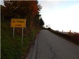 5
5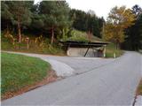 6
6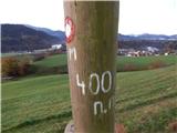 7
7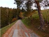 8
8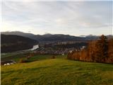 9
9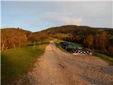 10
10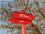 11
11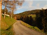 12
12 13
13 14
14 15
15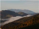 16
16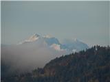 17
17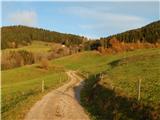 18
18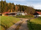 19
19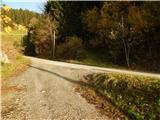 20
20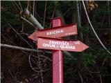 21
21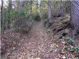 22
22 23
23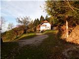 24
24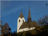 25
25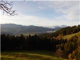 26
26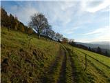 27
27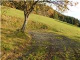 28
28 29
29 30
30 31
31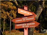 32
32 33
33 34
34 35
35 36
36 37
37 38
38 39
39 40
40 41
41 42
42 43
43 44
44 45
45 46
46 47
47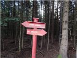 48
48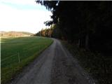 49
49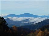 50
50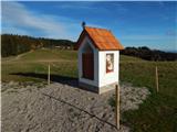 51
51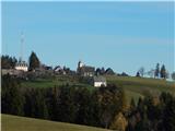 52
52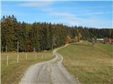 53
53 54
54 55
55 56
56 57
57 58
58 59
59 60
60 61
61 62
62 63
63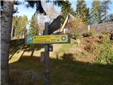 64
64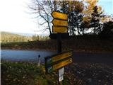 65
65 66
66 67
67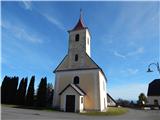 68
68