Na razpotju - Koča na Klemenči jami
Starting point: Na razpotju (770 m)
Starting point Lat/Lon: 46.392°N 14.6273°E 
Time of walking: 1 h 10 min
Difficulty: partly demanding marked way
Difficulty of skiing: more demanding
Altitude difference: 438 m
Altitude difference (by path): 438 m
Map: Kamniške in Savinjkse Alpe 1:50.000
Access to starting point:
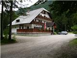
We drive to Luče (to here from Mozirje or over Kranjski rak) and continue towards Logarska dolina. Soon after the village Solčava we come to a crossroads, where the road branches off to the left to Logarska dolina. We turn left towards Logarska dolina (toll payment) and drive along the road to the signs for the Koča na Klemenči jami. We park on the parking lot near the pension Na razpotju. In front of the pension only guests are allowed to park.
Path description:
From the parking lot, we head onto the forest road in the direction of Klemenča jama. After a few minutes of walking a wide path branches off to the left towards Klemenča jama. We take this path, which starts to ascend. The quite steep path soon brings us to steep slopes, where with the help of the steel cable we cross a slightly exposed gully. The path, which continues ascending, soon brings us to the spot where a wall blocks the path. In front of us we see a cave and above it a marker that directs us into the cave. When we step into the cave we see that it is not a cave, but a nicely made tunnel through which we continue. In the tunnel the steel cable helps us, but we need it more on the descent than on the ascent. On the other side, along the wide path in a gentle ascent, we cross an exposed ledge. The path ahead goes into the forest and continues ascending on steep slopes, which are dangerous for slipping when wet. Further over a small bridge we cross another gully, then the path brings us to a less steep section, where the path from Dom Planincev joins. We continue gently uphill on the wide path, which soon brings us out of the forest. Only a short ascent on the grassy slope to the Koča na Klemenči jami follows.
From the hut we can continue to the thickest larch in Slovenia. We head left into the forest, where we follow the signs for the larch. To the larch we have less than ten minutes of walking through the forest.
Pictures:
 1
1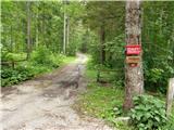 2
2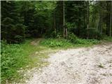 3
3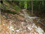 4
4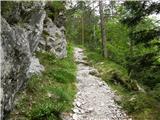 5
5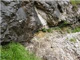 6
6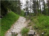 7
7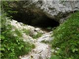 8
8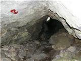 9
9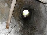 10
10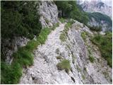 11
11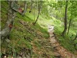 12
12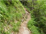 13
13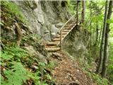 14
14 15
15 16
16 17
17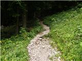 18
18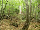 19
19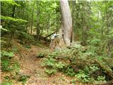 20
20