Na Razpotju - Rjavčki vrh (Planinšca)
Starting point: Na Razpotju (770 m)
Starting point Lat/Lon: 46.392°N 14.6273°E 
Time of walking: 3 h
Difficulty: partly demanding marked way, easy pathless terrain
Difficulty of skiing: no data
Altitude difference: 1128 m
Altitude difference (by path): 1128 m
Map: Kamniške in Savinjske Alpe 1:50.000
Access to starting point:
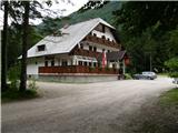
We drive to Luče (to here from Mozirje or over Kranjski Rak) and forward towards the valley Logarska dolina. Soon after the village Solčava we come to the crossroad, where a road to valley Logarska dolina branches off to the left. We turn left towards the valley Logarska dolina (toll payment) and drive on the road to signs for mountain hut on Klemenča jama. We park on a parking lot near the boarding house Na Razpotju. In front of the boarding house only guests are allowed to park.
Path description:
From the parking lot, we go on the forest road in the direction of Klemenča jama. After few minutes of walking wide path branches off to the left towards Klemenča jama. We go on this path which starts ascending. A pretty steep path soon brings us on steep slopes, where with the help of steel cables we cross slightly exposed gully. The path which is still ascending soon brings us to the spot, where a mountain wall interrupts the path. We notice in front of us a cave and above it a blaze, which points us into a cave. When we step into a cave we see, that it is not a cave, but nicely made tunnel through which we continue. In tunnel we get help from a steel cable, which we need more at the descent as at the ascent. On the other side on the wide path we in a gentle ascent cross exposed ledge. The path ahead goes into the forest and is still ascending on steep slopes, which are in wet dangerous for slipping. Ahead over a small bridge we cross one more gully, and then the path brings us on a less steep part of the path, where joins the path from the mountain hut Dom Planincev. We continue slightly upwards on a wide path, which soon brings us out of the forest. Next follows only a shorter ascent on a grassy slope to the mountain hut Koča na Klemenči jami.
From the mountain hut, we continue straight in the direction of Ojstrica on the path which after few ten meters goes into the forest. The path which is moderately to steeply ascending through the forest higher brings us below the rocky cliff, which are not too crumbly. The path then avoids cliffs to the right and it brings us to a crossing, where we continue straight towards Škarje, and to the left very demanding path Kopinškova pot on Ojstrica branches off. The path then still crosses slopes towards the west, and then it comes out of the forest and turns slightly to the left. Here starts ascending a little steeper by scree, then turns to the right and it ascends towards the saddle below Rjavčki vrh (1898 meters).
On the saddle (possible also already a little before) we leave the marked path and we continue the ascent right on easier pathless terrain. After approximately 10 minutes of ascent on a partly grassy slope, we reach dwarf pined Rjavčki vrh, from which a nice view opens up on mountains above the valley Logarska dolina.
Pictures:
 1
1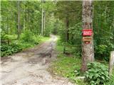 2
2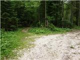 3
3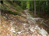 4
4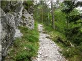 5
5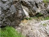 6
6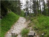 7
7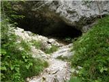 8
8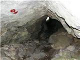 9
9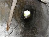 10
10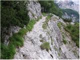 11
11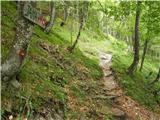 12
12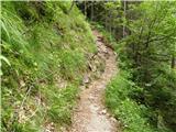 13
13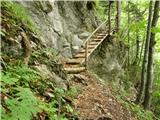 14
14 15
15 16
16 17
17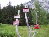 18
18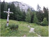 19
19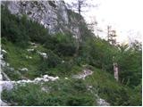 20
20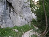 21
21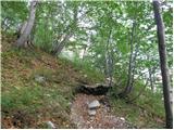 22
22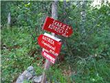 23
23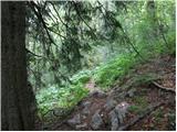 24
24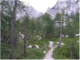 25
25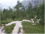 26
26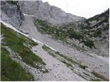 27
27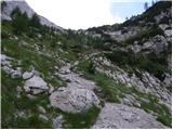 28
28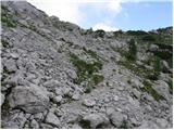 29
29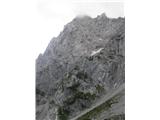 30
30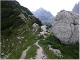 31
31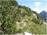 32
32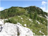 33
33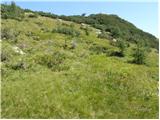 34
34 35
35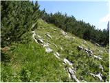 36
36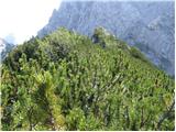 37
37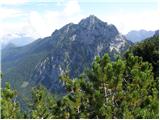 38
38