Olimje - Plešivec (Rudnica)
Starting point: Olimje (264 m)
Starting point Lat/Lon: 46.1503°N 15.56237°E 
Time of walking: 1 h 30 min
Difficulty: easy marked way
Difficulty of skiing: no data
Altitude difference: 422 m
Altitude difference (by path): 430 m
Map:
Access to starting point:
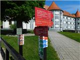
We drive to Podčetrtek, then follow the signs for Olimje, where we park in the parking lot by the Minorite Monastery Olimje.
Path description:
From the parking lot, we continue ahead, and at the end of the parking lot, the path splits. To the left, a path branches off towards Sveti Andrej and Virštanj, but we continue straight in the direction of cottage Koča pri Čarovnici and other destinations. When Olimje ends, the path leads us past the Turistični center Jelenov greben, and then the road gradually transitions into the forest. Through the forest, we continue to moderately ascend, and then we quickly arrive at cottage Koča pri Čarovnici, which is situated on the left side of the road.
From the Koča pri čarovnici cottage, we continue on the asphalt road, which shortly leads us to a marked crossroad where we turn right (left lake Zmajevo jezero, hunting bivouac, and Plešivec) towards Plešivec, the tower of health and joy, Tinsko, and Zavetišče Šmarnica cottage. The path ahead crosses a torrent stream and gradually leaves the forest. We continue on the road, which leads us past a meadow and brings us to a hamlet where there is a marked crossroad.
From the crossroad, we continue on the left road towards Plešivec and the tower of love (right the tower of health and joy) and, passing another homestead, arrive in the forest where the next crossroad is.
This time, too, we go left towards Plešivec (right the tower of health and joy and some other destinations).
The path ahead leads us along a macadam road, which splits a few minutes further.
We choose the slightly right path (slightly left the lake on Olimska gora) and continue on the road to a smaller saddle, where we go left (right a short unmarked path to Lendrše).
The path ahead leads us for a short time along a cart track, then starts ascending steeply through a slightly overgrown clearing, from which a beautiful view opens up. When we return to the forest higher up, the path flattens, and we quickly reach a crossing, where we join the path from Olimje.
Here we go right and in two minutes of further walking, we reach Plešivec, the highest peak of Rudnica.
Olimje - Koča pri čarovnici 0:30, Koča pri čarovnici - Plešivec 1:00.
Description and pictures refer to conditions in April 2024.
Pictures:
 1
1 2
2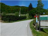 3
3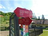 4
4 5
5 6
6 7
7 8
8 9
9 10
10 11
11 12
12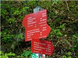 13
13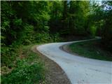 14
14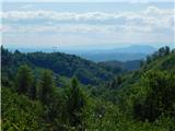 15
15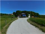 16
16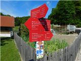 17
17 18
18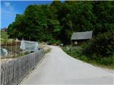 19
19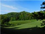 20
20 21
21 22
22 23
23 24
24 25
25 26
26 27
27 28
28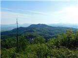 29
29 30
30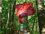 31
31 32
32 33
33 34
34 35
35 36
36