Oplotnica - Črno jezero on Pohorje (via Sveti Trije Kralji)
Starting point: Oplotnica (370 m)
Starting point Lat/Lon: 46.38692°N 15.44683°E 
Path name: via Sveti Trije Kralji
Time of walking: 3 h 35 min
Difficulty: easy marked way
Difficulty of skiing: no data
Altitude difference: 826 m
Altitude difference (by path): 970 m
Map: Pohorje 1:50.000
Access to starting point:
A) From highway Ljubljana - Maribor we go to the exit Slovenske Konjice, and then we follow the signs for Slovenske Konjice. From the roundabout after OMV gas station we turn to the first exit right towards Slovenska Bistrica, towards Slovenska Bistrica we drive to the turn-off of the road to the left towards Oplotnica and Osankarica. We turn towards Oplotnica and on the road we drive to the center of the settlement, where we park on one of the many parking lots in the settlement.
B) From highway Maribor - Ljubljana we go to the exit Slovenska Bistrica - south, and then we follow the signs for Slovenske Konjice. Soon after Slovenska Bistrica we turn right in the direction of Oplotnica, and then we drive to the center of Oplotnica, where we park on one of the many parking lots in the settlement.
Path description:
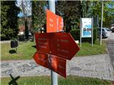
From the center of the settlement, we go on the path in the direction of Osankarica, lake Črno jezero and Tri Kralji and we at first walk on a sidewalk past Mercator store, primary school Pohorje battalion Oplotnica to pizzeria Salama, where we go left and then immediately right, so that we bypass the pizzeria on the right side.
The path ahead starts visibly ascending on a narrower asphalt road which leads us past occasional houses, and when we already get to the settlement Lačna Gora, a nice view opens up also towards Oplotnica and surrounding hills.
Higher, at the cross, signs for lake Črno jezero point us right, where we go also past the last house, behind which we continue the ascent on a macadam road, and from there we soon go left into the forest on a marked footpath. Through the forest, we ascend steeper, a little higher we cross a macadam road which we recently left and then we in a moderate ascent get to the church of St. Mohor and Fortunat.
At the church, we return to the road, and there we continue towards the north. The road quickly changes into a cart track which at first leads through the forest and then through a panoramic grassy part, where for some time it descend a little.
When in the village Kebelj we reach an asphalt road, we cross it diagonally towards the right, and then we go left in the direction of the lake Črno jezero, the nearby house we bypass on the right side. Next follows few minutes of panoramic ascent on a grassy slope, and when for few steps we ge to the end of the asphalt road, from the right joins also the path with the starting point at the cemetery in the village Kebelj.
We continue straight on a marked cart track which before the entrance into the forest turns right and continues by the edge of the forest, and from the mentioned cart track, the blazes point us to the left on a narrow cart track which continues through the forest. Through the forest, we follow the blazes, and when the path turns a little to the right, after a shorter crossing from the right joins also the other path from the settlement Kebelj.
Here we go left and we quickly get to the ruins of Kebelj castle or Castle Zajec.
We bypass the ruins on the left side and we follow the blazes to the nearby asphalt road, where we go straight upwards. Only a little further, the asphalt road on which we continue turns right, and to the left the path branches off towards Osankarica (path Kebeljska transverzala). We leave the asphalt road only a little further, where signs for lake Črno jezero point us to the left into the forest. Next follows a shorter ascent through the forest and then past a lot of litter we reach the nearby homestead (from the opposite direction there is also a warning for dangerous dog). At the homestead, the road becomes asphalted and we quickly return on a little wider asphalt road, on which we continue the ascent. After few minutes, the blazes point us to the left on a grassy cart track, on which we are ascending by the edge of the forest, and higher past the house we again step on the asphalt road which brings us to the next marked crossing.
We continue right in the direction of Sveti Trije kralji and lake Črno jezero (left - lake Črno jezero - path via Kos) and we continue on the road to a crossroad near the NOB monument.
From the crossroad, we go right towards the access path, and at the sign for dead-end street we go left on a marked footpath which continues through the forest. Next follows approximately 20 minutes of ascent through the forest, where we follow the blazes, and then we reach a road which we follow for few 10 strides to the right, where we get to Hotel Jakec, above which there is the church of Holy Three Kings.
From the church of Holy Three Kings we continue in the direction of the lake Črno jezero and the path Urškina pot and we quickly get to the nearby ski slope, by which we short time continue, and then we cross it (while the ski slope operates we cross the ski track and ski lift - above the cableway and ski slope). The path ahead leads us past the weather station ARSO, and we still follow the blazes, and on connecting ski track in few minutes we get to another ski track, which we also cross (by the ski slope upwards Veliki vrh). Next follows also a crossing of a ski lift and one more ski track, and then the path comes into the forest, where after few minutes of additional walking, we get to the cross, by which there is a learning board of the path Urškina pot. The path ahead slowly descends and it brings us to a marked crossing, where we choose the left path (straight - Šumik and Ruška koča), where we continue in the direction of Osankarica and lake Črno jezero. Further, we are still gently to moderately descending and we follow the blazes. When the descent ends, we get to a crossing near the lake Črno jezero.
We continue straight (left Oplotnica - path via Kos) and in few steps we get to the lake.
Oplotnica - Sveti Mohor 0:45, Sveti Mohor - Castle Zajec 0:40, Castle Zajec - Sveti Trije Kralji 1:20, Sveti Trije kralji - lake Črno jezero 0:50.
Description and pictures refer to a condition in April 2022.
Pictures:
 1
1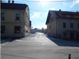 2
2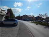 3
3 4
4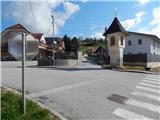 5
5 6
6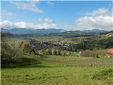 7
7 8
8 9
9 10
10 11
11 12
12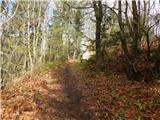 13
13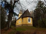 14
14 15
15 16
16 17
17 18
18 19
19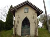 20
20 21
21 22
22 23
23 24
24 25
25 26
26 27
27 28
28 29
29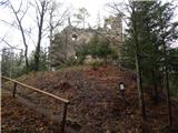 30
30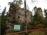 31
31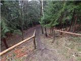 32
32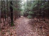 33
33 34
34 35
35 36
36 37
37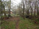 38
38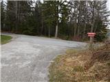 39
39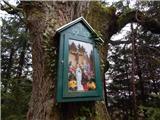 40
40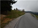 41
41 42
42 43
43 44
44 45
45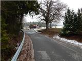 46
46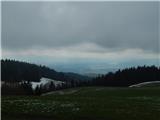 47
47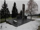 48
48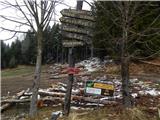 49
49 50
50 51
51 52
52 53
53 54
54 55
55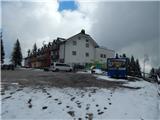 56
56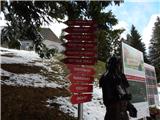 57
57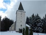 58
58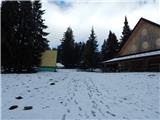 59
59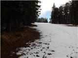 60
60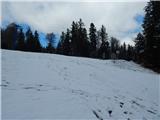 61
61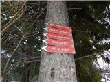 62
62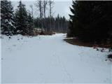 63
63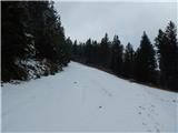 64
64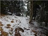 65
65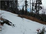 66
66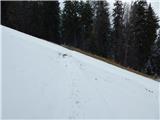 67
67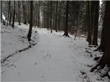 68
68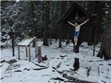 69
69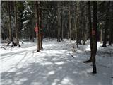 70
70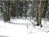 71
71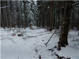 72
72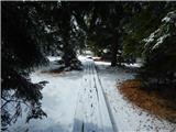 73
73 74
74 75
75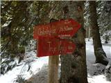 76
76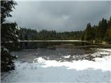 77
77