Starting point: Otlica (815 m)
Starting point Lat/Lon: 45.927°N 13.9098°E 
Time of walking: 40 min
Difficulty: easy marked way
Difficulty of skiing: no data
Altitude difference: 42 m
Altitude difference (by path): 75 m
Map: Goriška - izletniška karta 1:50.000
Access to starting point:
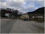
A) From central Slovenia, we first drive to Logatec, then continue driving in the direction of Idrija. At Kalca near Logatec, we turn left in the direction of Col, then continue driving on a winding road towards Col. In Col, we turn right and then after 100 m left in the direction of Predmeja. Further, we drive on an occasionally somewhat narrower and also partly still winding road, which we follow to the settlement Otlica, where at the church of the Guardian Angels we turn left in the direction of Otliško okno. We park about 50 meters further on the parking lot by the cemetery.
B) We drive to Idrija, from there we continue driving towards Logatec. In the settlement Godovič, we leave the main road towards Logatec and continue driving right in the direction of Črni Vrh, Col and Ajdovščina. We follow the mentioned road to Col, where signs for Predmeja direct us to the right. Further, we drive on an occasionally somewhat narrower and also partly still winding road, which we follow to the settlement Otlica, where at the church of the Guardian Angels we turn left in the direction of Otliško okno. We park about 50 meters further on the parking lot by the cemetery.
C) From the expressway Razdrto - Nova Gorica, we take the exit Ajdovščina and follow the road further towards the village Lokavec (to Lokavec we come from the center of Ajdovščina, or from the old road Ajdovščina - Nova Gorica, where at the settlement Cesta we turn right). From Lokavec, we continue driving on an ascending winding road in the direction of Predmeja. When the road flattens somewhat, we come to a crossroads, where we continue right towards Predmeja and Col. On the road towards Col, we drive to Otlica, where at the church of the Guardian Angels we turn right towards the nearby cemetery. We park on the parking lot by the cemetery.
Path description:
Warning! Due to private property, it is no longer possible to reach the summit via the path described below!
From the parking lot, we continue on the right side of the cemetery along a narrower asphalt road towards Otliško okno. We walk on the road only for a short time as signs for Otliško okno direct us left onto a grassy cart track, which a little further crosses a strip of bushes, then along the grazing fence we quickly arrive near the nearby house. Here we continue right onto a wider cart track, along which in a few steps we arrive at a marked junction.
From the junction, we continue left (right Predmeja and Čaven) and continue the path a few tens of meters left of the edge of the Gora plateau. After a short gentle descent, we reach the edge of the plateau, where the path from the source of Hublja joins us from the right.
Here we continue slightly left and ascend to the place where a short path branches off to the left to the stone snail (the snail is the idea and work of architect Damjan Popelar, who in his artistic work tries to connect nature and culture).
We continue straight (left stone snail 2 minutes) and after a few tens of further steps we arrive at the information boards above Otliško okno.
From the boards, we continue right and descend to the nearby window, through which a nice view opens up.
From the window, we continue along the path in the direction of Sinji vrh. The path ahead quickly emerges from the forest and takes us to panoramic slopes, along which we ascend along the edge of the cliffs in the southeastern direction. After approximately 10 minutes of walking from the window, the path splits into two parts. At the place where the grazing fence makes a sharp left turn, we leave the wide path and head right onto the poorer but marked path, which after five minutes of ascent brings us to Navrše.
Pictures:
 1
1 2
2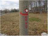 3
3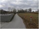 4
4 5
5 6
6 7
7 8
8 9
9 10
10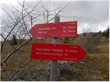 11
11 12
12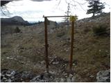 13
13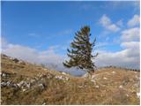 14
14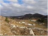 15
15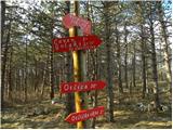 16
16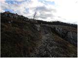 17
17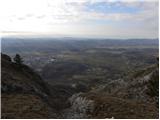 18
18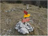 19
19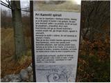 20
20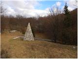 21
21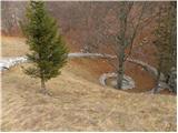 22
22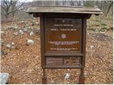 23
23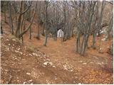 24
24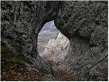 25
25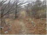 26
26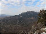 27
27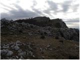 28
28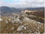 29
29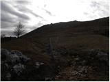 30
30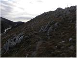 31
31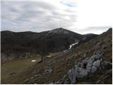 32
32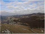 33
33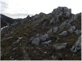 34
34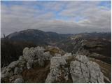 35
35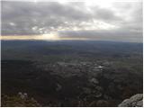 36
36