Palafavera - Monte Civetta (Via Normale)
Starting point: Palafavera (1507 m)
Starting point Lat/Lon: 46.40196°N 12.10119°E 
Path name: Via Normale
Time of walking: 6 h 20 min
Difficulty: very difficult marked way
Difficulty of skiing: no data
Altitude difference: 1713 m
Altitude difference (by path): 1800 m
Map: Tabacco 15 1:25.000
Access to starting point:
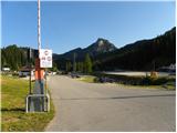
Through the border crossing Rateče we drive to Trbiž / Tarvisio, where we take the highway in the direction of Vidma / Udine. We leave the highway at the exit for Tolmezzo and follow the road to the mentioned place. From Tolmezzo we continue in the direction of the settlement Ampezzo and mountain pass Passo della Mauria. The road then starts descending and brings us to the Cadore valley, where we continue left towards Cortina d'Ampezzo. Further on, we follow the signs for Cortina d'Ampezzo to the place Venas di Cadore. A little before the end of the mentioned place we turn left towards the place Forno di Zoldo. The road then through the pass Cibiana brings us to the valley Val di Zoldo, where we continue right towards the pass Staulanza. We follow the ascending road to the place Palafavera, where we park on a large parking lot by the mountain hut Rifugio Palafavera. The parking lot is located on the left side of the road by the ski slope.
Path description:
From the parking lot at the mountain hut Rifugio Palafavera we continue towards the south and then turn right onto the macadam road following the signs »Rifugio Coldai, Forcella D'Alleghe«. After a few meters the road brings us to a junction where we continue right on the macadam road closed to traffic. The road then ascends on and alongside the ski slope, during the ascent beautiful views open up mainly towards the summits Monte Pelmo and Civetta. Later the road brings us to the western side of the peak Col Marino della Travesera. Here the quite flat road runs on the ski slope and then brings us to the mountain pasture Malga Pioda at the saddle Forcella D'Alleghe.
On the mountain pasture where there is a junction we continue left on the footpath following the signs »Rif. A. Sonnino al Coldai«. Initially still very wide, the path starts to ascend slowly in long zigzags towards the slopes of the peak Cima di Coldai. The path then turns left and crosses the slopes ascending towards the south, bringing us below the cargo cableway. Here the path turns right and then ascends more steeply on the slope below the cableway. When we reach the upper station of the cargo cableway, the path becomes flat and quickly brings us to the hut.
A little behind the hut where there is a junction we continue left following the signs »Sent. Tivan, Ferr. Alleghesi«, straight ahead the path leads towards the lake Lago Coldai. The path then for quite some time crosses relatively steep slopes towards the south and on a shorter section steel cables assist us. Such a path then brings us to the saddle below the summit Schinal del Bech.
On the saddle where there is a junction we continue straight ahead, right leads the secured path Via Ferrata Alleghesi. The path further continues crossing the slopes towards the south and thereby descends slightly. Later the path brings us again to a junction and right on the rocks we will notice inscriptions »Via Normale, R. Torrani«.
At the junction we continue right and cross the torrential gully. Further the path ascends traversely mostly on relatively steep scree slopes and brings us to the head of the cirque. Here we continue right upwards and the path becomes somewhat more demanding. The path here is marked with red dots and further on ascends somewhat more steeply several times along the steel cable upwards. Here and there staples also assist us, less demanding sections are not secured.
Higher the path turns somewhat to the left and continues ascending relatively steeply. Due to the accumulated stones on the path, somewhat more caution is needed in places. Later the slope becomes less steep and the path brings us to the hut Rifugio Torrani.
From the hut we continue slightly right following the signs »Cima« and initially ascend along the steel cable upwards. Later the path is no longer secured and ascends quite steeply all the way. In the last part of the path, when the slope becomes somewhat steeper, more caution is needed due to stones and sliding sand. Such a path then continues all the way to the summit.
Pictures:
 1
1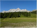 2
2 3
3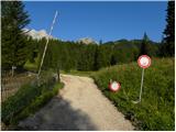 4
4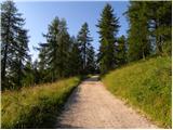 5
5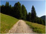 6
6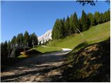 7
7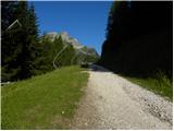 8
8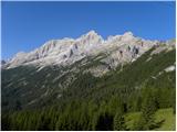 9
9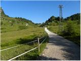 10
10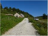 11
11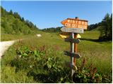 12
12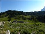 13
13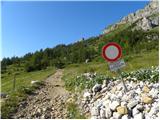 14
14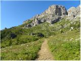 15
15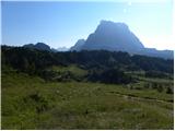 16
16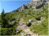 17
17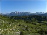 18
18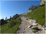 19
19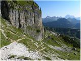 20
20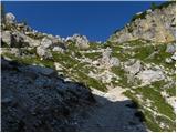 21
21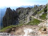 22
22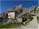 23
23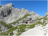 24
24 25
25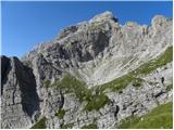 26
26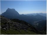 27
27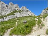 28
28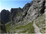 29
29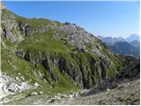 30
30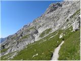 31
31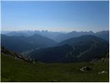 32
32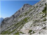 33
33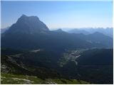 34
34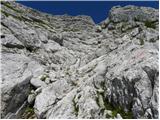 35
35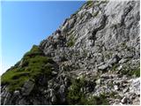 36
36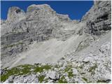 37
37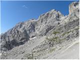 38
38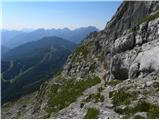 39
39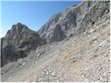 40
40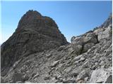 41
41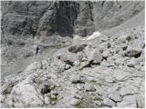 42
42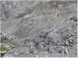 43
43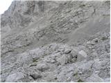 44
44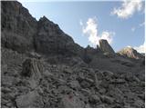 45
45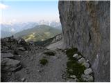 46
46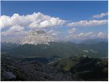 47
47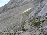 48
48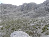 49
49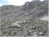 50
50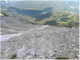 51
51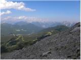 52
52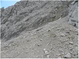 53
53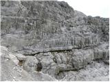 54
54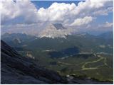 55
55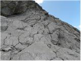 56
56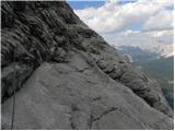 57
57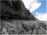 58
58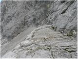 59
59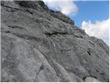 60
60 61
61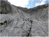 62
62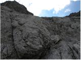 63
63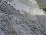 64
64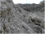 65
65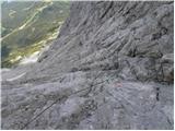 66
66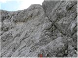 67
67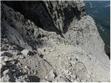 68
68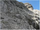 69
69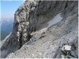 70
70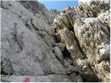 71
71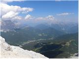 72
72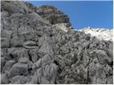 73
73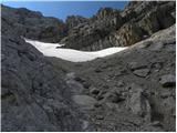 74
74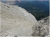 75
75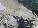 76
76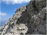 77
77 78
78 79
79 80
80 81
81 82
82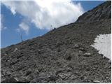 83
83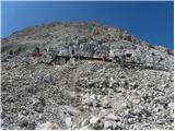 84
84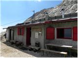 85
85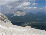 86
86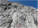 87
87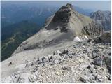 88
88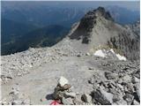 89
89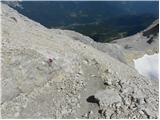 90
90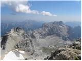 91
91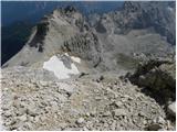 92
92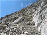 93
93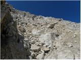 94
94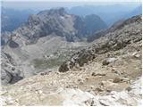 95
95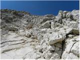 96
96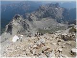 97
97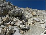 98
98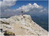 99
99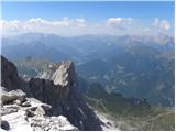 100
100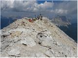 101
101