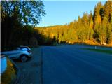
parking below Weinebene - Bärentalhütte (Golica / Koralpe)
Starting point: parking below Weinebene (1541 m)
Starting point Lat/Lon: 46.82918°N 15.01511°E 
Time of walking: 35 min
Difficulty: easy marked way
Difficulty of skiing: no data
Altitude difference: 89 m
Altitude difference (by path): 105 m
Map:
Access to starting point:
A) Over one of the border crossings with Austria (Korensko sedlo, Karawanks Tunnel, mountain pass Ljubelj, mountain pass Jezerski vrh, mountain pass Pavličev vrh) we drive to Austria, and then we continue driving on the so-called south highway towards Gradec / Graz. On the mentioned highway we drive to the settlement Volšperk / Wolfsberg, where we leave the highway, and when we get to the old or regional road we continue driving in the direction of the settlement St. Gertraud. In the settlement St. Gertraud we notice signs for Alpine mountain pass Weinebene, which point us to the right on an ascending asphalt road. On the mentioned road, we drive approximately 18 km, and then we get to the mentioned alpine mountain pass, which is situated at an altitude 1668 meters. From the mountain pass, we start descending towards the settlement Lonč / Deutschlandsberg, and only a little after the left hairpin turn we park on a marked parking lot on the right side of the road.
B) Over the border crossing Holmec or Vič we drive to Austria, and then we continue driving towards the settlement Volšperk / Wolfsberg. From Volšperk we continue on a regional road in the direction of the settlement St. Gertraud. In the settlement St. Gertraud we notice signs for Alpine mountain pass Weinebene, which point us to the right on an ascending asphalt road. On the mentioned road, we drive approximately 18 km, and then we get to the mentioned alpine mountain pass, which is situated at an altitude 1668 meters. From the mountain pass, we start descending towards the settlement Lonč / Deutschlandsberg, and only a little after the left hairpin turn we park on a marked parking lot on the right side of the road.
C) First, we drive to Maribor, and then we continue driving on the highway towards the border crossing Šentilj and ahead on Austrian highway towards Gradec / Graz. We leave the mentioned highway at exit for settlement Lipnica / Leibnitz. When we leave the highway at the roundabout, we continue in the direction of the settlement Lipnica / Leibnitz and further we drive south from the village Gralla, which is today already some kind of peripheral part of Lipnica. Further, the road leads us past industrial zone, and at the roundabout by store Hofer we continue "straight" on the second exit in the direction of the settlement Lonč / Deutschlandsberg. Further, we for some time drive on the main road, and after the village Graschach we turn right in the direction of the settlement Lonč / Deutschlandsberg. In a roundabout right next to the settlement Lonč / Deutschlandsberg, we continue "straight" in the direction of the alpine mountain pass Weinebene. From here on, the road starts ascending steeper, and we follow it approximately 17 km, and then still before the right hairpin turn, on the left side we notice a parking lot, where we park.
Path description:
From the parking lot, we go on a side road in the direction of the mountain hut Grünangerhütte and mountain pasture Bärentalalm, and the side road crosses slopes below the main road. Asphalt at the side road quickly ends and we get to a crossing, where we continue on the upper right road (on a slightly left road leads one of the paths to the hut Grünangerhütte). Next follows a relatively short ascent, and from the right joins also the path from the parking lot Reihkehre - Glashütten, which is situated above the hairpin turn mentioned in the access to the starting point. Follows some more of the crossing, mostly in a gentle ascent, and then the path once again splits. To the left another path branches off towards the before mentioned mountain hut, and we go slightly right and continue on the macadam road which ascends a little steeper, and there in few minutes we get to the mountain hut Bärentalhütte.
Description and pictures refer to a condition in October 2022.
Pictures:
 1
1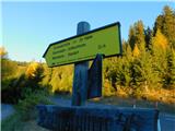 2
2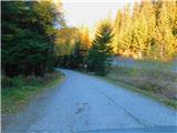 3
3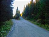 4
4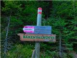 5
5 6
6 7
7 8
8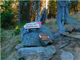 9
9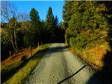 10
10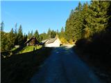 11
11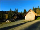 12
12