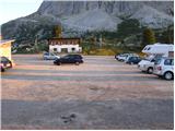
Starting point: Passo Falzarego (2105 m)
Starting point Lat/Lon: 46.5186°N 12.0096°E 
Time of walking: 2 h 30 min
Difficulty: very difficult marked way
Difficulty of skiing: no data
Altitude difference: 544 m
Altitude difference (by path): 600 m
Map:
Access to starting point:
First, we drive to Cortina d'Ampezzo (to here possible over a border crossing Rateče or Predel to Trbiž / Tarvisio and then on a highway in the direction of Videm / Udine to exit Tolmezzo. From Tolmezzo we follow the road in the direction of village Ampezzo and mountain pass Passo Mauria. The road then descends and it brings us to a crossroad, where we continue left (possible also right) in the direction of Cortina d'Ampezzo. At all next crossroads, we follow the signs for Cortina d'Ampezzo.
Or from Primorska side, where we drive on a highway in the direction of Trst / Trieste. Further, we drive on Italian highway in the direction of Padova, but only to a highway junction, where we continue in the direction of Veneto and Belluno. Near Belluno the highway ends, and at the next crossroads we continue in the direction of Cortina d'Ampezzo and then we follow the signs for Alpine mountain pass Passo di Falzarego. This ascending road we then follow to a large parking lot on the mentioned mountain pass.
To Cortina d'Ampezzo we can also come from the direction of Austria (direction Karawanks Tunnel, Spittal, Lienz, Sillian, Dobbiacho / Toblach, Cortina d'Ampezzo, Passo Falzarego).
Path description:
From the mountain pass Falzarego we go towards the south on the path 441 (direction Rifugio Averau and Rifugio Nuvolau), which starts ascending on gentle grassy slopes. After a short ascent, we come on an unmarked crossing, where less noticeable footpath branches off to the right, which leads towards the summit or ridge Col Galina, we continue slightly left on a wide and still marked path. The path from which beautiful views are opening up on Sas de Stria, Lago Piccolo, Tofana di Rozes, Averau and Croda Negra, higher brings us to a marked crossing, where the path on Croda Negra branches off to the right.
We continue in the direction of the mountain hut Averau on the path which gradually passes on the east slopes of Croda Negra. Here the path for some time entirely flattens and then through a large bridge crosses a deep torrent gully. After the bridge path starts ascending steeply, and then it suddenly flattens and passes on more plateau terrain. The path ahead ascends through a smaller torrent gully and only few 10 meters ahead brings us to the next crossing.
We continue left (right Croda Negra) and we continue the ascent through a steep gully, and the path higher for some time passes on steep slopes, and then turns to the left and entirely flattens. After a short descent, we come at the marked crossing, where from the left joins the path from a mountain hut Col Gallina, and we continue right, where after few 10 strides of additional walking, we get to a saddle Forcella Averau (2435 meters). Here the path descends to steep walls of the nearby peak Averau, where we then cross a scenic and for falling stones dangerous slopes. The path from which a beautiful view opens up on Marmolada and its glacier, for some time steeply ascends, and then passes on the scree over which we walk to the nearby mountain hut (mountain hut Averau is currently renovated, data August 2010).
From the mountain hut, we go left and we continue on the mountain road. Already after few meters caption »Ferrata Averau« point us left upwards. After that, the path at first crosses scree on the eastern side of the mountain and soon turns to the left where we enter the climbing part of the path. At the beginning of the climbing path we ascend steeply by the steel cable over a steep wall, and then we come to a crossing. Left slightly easier path vertically ascends on stemples through a draught-hole. And right path also ascends almost vertically, only that there isn't any stemples on the path. It should be noted, that the left path is often wet and also snow stays a little longer time. After a short steep section of the path both paths join again and then follows a crossing with the help of steel cables to the right. The climbing part of the path quickly ends and we soon come on less steep upper slopes of the mountain. In the last part, the path isn't demanding anymore and we soon reach a very scenic peak.
Pictures:
 1
1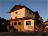 2
2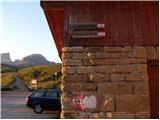 3
3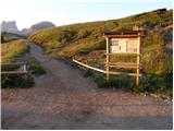 4
4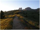 5
5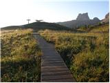 6
6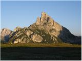 7
7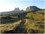 8
8 9
9 10
10 11
11 12
12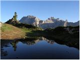 13
13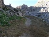 14
14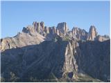 15
15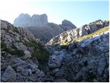 16
16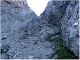 17
17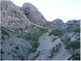 18
18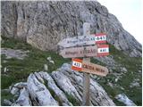 19
19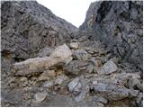 20
20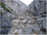 21
21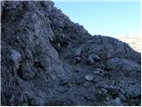 22
22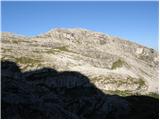 23
23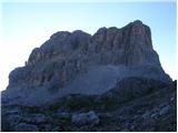 24
24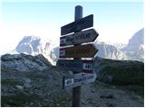 25
25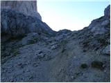 26
26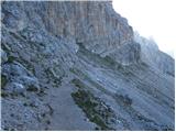 27
27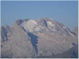 28
28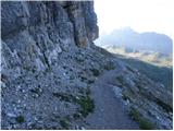 29
29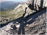 30
30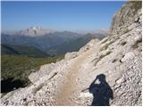 31
31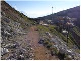 32
32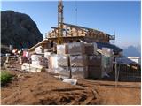 33
33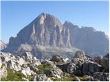 34
34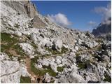 35
35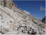 36
36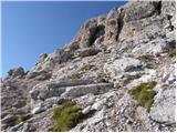 37
37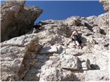 38
38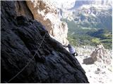 39
39 40
40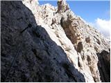 41
41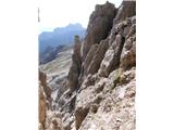 42
42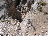 43
43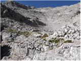 44
44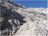 45
45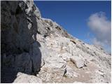 46
46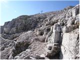 47
47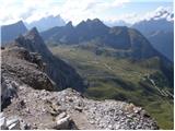 48
48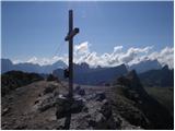 49
49