Passo Gardena - Col Toronn
Starting point: Passo Gardena (2121 m)
Starting point Lat/Lon: 46.54984°N 11.80847°E 
Time of walking: 2 h
Difficulty: easy pathless terrain
Difficulty of skiing: no data
Altitude difference: 534 m
Altitude difference (by path): 580 m
Map: Tabacco 07 1:25.000
Access to starting point:
A) From Kranjska Gora over Korensko sedlo to Austria, where at the first larger intersection we continue left towards Podklošter / Arnoldstein and Trbiž / Tarvisio. At the end of the settlement Podklošter signs for Šmohor / Hermagor direct us right onto a regional road, along which past the mentioned settlement we drive to the end of the Gailtal valley, or more precisely to the settlement Kötschach-Mauthen, where we turn right towards the settlement Oberdrauburg. The route then leads us over the Alpine pass Gailbergsattel (982 m), after which we descend into the mentioned settlement. After crossing the bridge over the river Drau, we continue left towards the settlement Lienz. In the main roundabout in Lienz we continue "left" in the direction of the settlement Sillian and Italy. Further, we cross the border between Austria and Italy, and we follow the main road past settlements Dobbiaco / Toblach, Villabassa / Niederdorf, Monguelfo - Tesido / Welsberg - Taisten, Brunico / Bruneck. Just a little after the last-mentioned settlement, past which a bypass road leads, we turn left into the Alta Badia valley. Further, we drive through the mentioned valley and in the settlement La Villa we turn right towards the pass Passo Gardena. Further, we follow the ascending road all the way to the pass Passo Gardena where we park on a paid parking lot (4€ – June 2012).
B) From Nova Gorica we drive into Italy and further on the highway to the settlement Portogruaro, where at the highway junction we turn in the direction of the settlement Belluno. We follow the highway to its end (we do not turn towards the settlement Belluno), then we continue the drive towards Cortina d'Ampezzo. When we arrive in Cortina d'Ampezzo, we follow the signs for the Alpine pass Passo Falzarego. At the pass Passo Falzarego (2105 m) we turn right in the direction of Alta Badia and first ascend to the neighbouring pass Passo Valparola (2192 m), from there we descend into the mentioned valley. In the settlement La Villa we turn left towards the pass Passo Gardena. Further, we follow the ascending road all the way to the pass Passo Gardena where we park on a paid parking lot (4€ – June 2012).
Path description:
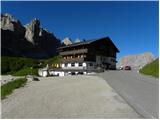
From the Passo Gardena pass we head north on the footpath following the signs »Baita Jimmy Hütte«. The path leads us across grassy slopes from which there is a wonderful view of the Sella mountain group to the south and towards Sassolungo to the west. The path across grassy slopes then soon brings us to the road. We continue right on the macadam road, which we follow all the way to the Jimmy Hütte hut.
From the hut we continue on the footpath towards the northeast and begin to ascend through dwarf pines. The path soon brings us out of the dwarf pines and continues relatively steeply ascending. Higher the path then turns left and follows the ascent to the notch Forcella Cier where a view opens towards the north.
On the saddle we cross the fence, then in a slight descent we cross scree fields. Such a path then brings us to a marked junction where the path through the Val de Chedul valley joins from the left.
From the junction the path again begins to ascend gently and continues crossing the slopes towards the northeast. Later the path turns slightly left and follows a somewhat steeper ascent to the notch Forcella de Crespeina.
On the notch where a view opens on a larger part of the Puez mountain group we continue right following the signs »Variante Sas Ciampac«. The path then crosses scree fields below the slopes of the Col Toronn peak.
When the path approaches the ridge, we leave the marked path and head right onto pathless terrain. Here we first cross the slopes to the right, but when they become somewhat less steep we head left upwards. The ascent to the summit is quite steep in some places, so some caution is needed. To the panoramic summit only a shorter, slightly less steep ascent follows.
Pictures:
 1
1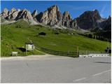 2
2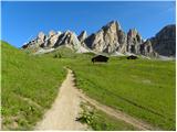 3
3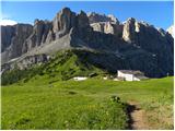 4
4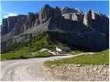 5
5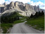 6
6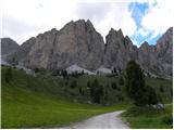 7
7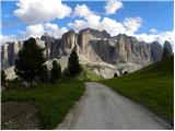 8
8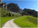 9
9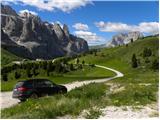 10
10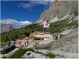 11
11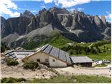 12
12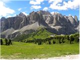 13
13 14
14 15
15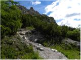 16
16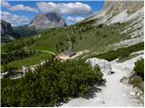 17
17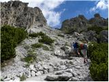 18
18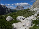 19
19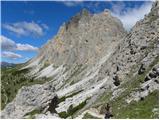 20
20 21
21 22
22 23
23 24
24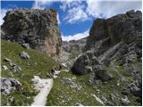 25
25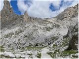 26
26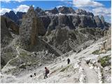 27
27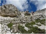 28
28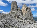 29
29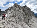 30
30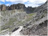 31
31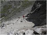 32
32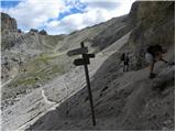 33
33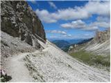 34
34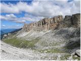 35
35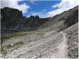 36
36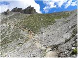 37
37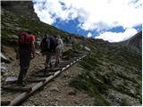 38
38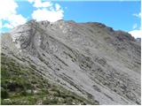 39
39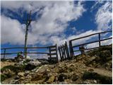 40
40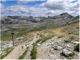 41
41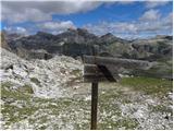 42
42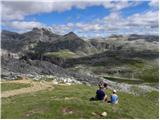 43
43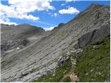 44
44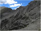 45
45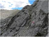 46
46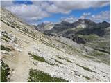 47
47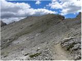 48
48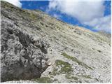 49
49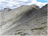 50
50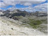 51
51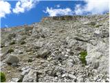 52
52 53
53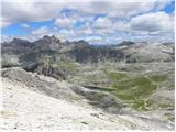 54
54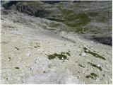 55
55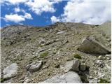 56
56 57
57 58
58 59
59