Pecol - Cima di Terrarossa
Starting point: Pecol (1510 m)
Starting point Lat/Lon: 46.4092°N 13.4376°E 
Time of walking: 2 h 45 min
Difficulty: easy unmarked way
Difficulty of skiing: more demanding
Altitude difference: 921 m
Altitude difference (by path): 921 m
Map: Julijske Alpe - zahodni del 1:50.000
Access to starting point:
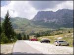
a) From Kranjska Gora we drive across the Rateče border crossing to Trbiž / Tarvisio. In Trbiž we continue left in the direction of Bovec and follow the road to the intersection near Rabeljsko jezero. Here we continue right in the direction of Nevejski preval (Na Žlebeh) / Sella Nevea. When the road already starts descending towards Reklanska dolina, in a sharp left turn a narrow and steep road branches off to the right towards Montaževa visoka planota / Altopiano del Montasio (at the intersection there are signs in Italian). We then follow this road to the large marked parking lot, which is located a few hundred meters before the Pecol cheese dairy (further driving is prohibited).
b) From Bovec we drive to the Predel border crossing, from which we descend to the Italian side. A little after Rabeljsko jezero we arrive at an intersection where we continue left in the direction of Nevejski preval (Na Žlebeh) / Sella Nevea. When the road already starts descending towards Reklanska dolina, in a sharp left turn a narrow and steep road branches off to the right towards Montaževa visoka planota / Altopiano del Montasio (at the intersection there are signs in Italian). We then follow this road to the large marked parking lot, which is located a few hundred meters before the Pecol cheese dairy (further driving is prohibited).
Path description:
In the intersection at the end of the parking lot we continue right towards the "Rifugio di Brazza" hut. We leave the gentle road that climbs across the Pecol plateau at the place where barely visible markings direct us left onto the footpath, which we then follow in moderate ascent to the mountain hut. From the hut we continue in the direction of "Cima di Terrarossa" along the gentle path that ascends across grassy slopes. Just a few dozen steps from the hut we come to an unmarked fork where we continue on the right path (left Montaž). The increasingly scenic path takes us higher to the steep slopes of Špik Hude police. Here, due to the considerable number of ibex that often dislodge rocks, it is wise to put on a helmet. We continue ascending along the old military mule track, which is not marked. The moderately steep path along which we can constantly observe numerous ibex takes us higher to a marked fork where we continue on the left path in the direction of "Terrarossa" (right "Ceria Merlone"). The still unmarked path takes us a little further to the next marked fork, where we continue right (left Montaž). The increasingly rocky path then takes us to a smaller notch in the main ridge. We continue left and then after another good 5 minutes of walking along the scenic summit slope we step onto the summit of Špik Hude police.
The path is not marked but is indicated at the forks, so there are no major orientation difficulties.
Pictures:
 1
1 2
2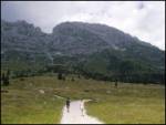 3
3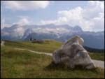 4
4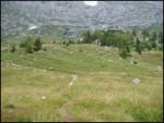 5
5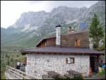 6
6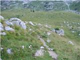 7
7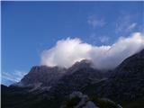 8
8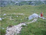 9
9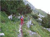 10
10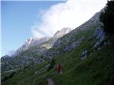 11
11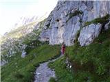 12
12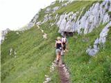 13
13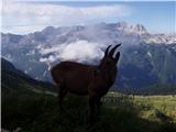 14
14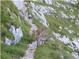 15
15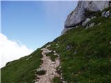 16
16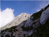 17
17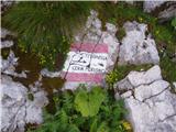 18
18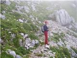 19
19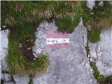 20
20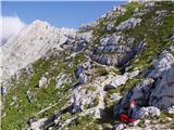 21
21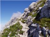 22
22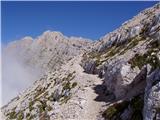 23
23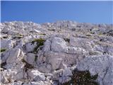 24
24 25
25