Pecol - Foronon del Buinz / Špik nad Nosom (Ceria Merlone)
Starting point: Pecol (1510 m)
Starting point Lat/Lon: 46.4092°N 13.4376°E 
Path name: Ceria Merlone
Time of walking: 3 h 45 min
Difficulty: very difficult marked way
Difficulty of skiing: no data
Altitude difference: 1021 m
Altitude difference (by path): 1050 m
Map: Julijske Alpe - zahodni del 1:50.000
Access to starting point:
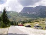
A) From Kranjska Gora over the border crossing Rateče we drive to Trbiž / Tarvisio. In Trbiž we continue left in the direction of Bovec and we follow the road to the crossroad near the lake Rabeljsko jezero. Here we continue right in the direction of Nevejski preval (Na Žlebeh) / Sella Nevea. When the road already starts descending towards the valley Reklanska dolina, in sharp the left turn, a narrow and steep road towards Montaževa visoka planota / Altopiano del Montasio branches off to the right (by the crossroad there are signs in Italian language). We follow this road to a large marked parking lot, which is situated few 100 meters before the cheese cottage Pecol (further driving is forbidden).
B) From Bovec, we drive to the border crossing Predel, from which we descend on the Italian side. Only a little after the lake Rabeljsko jezero we come to a crossroad, where we continue left in the direction of Nevejski preval (Na Žlebeh) / Sella Nevea. When the road already starts descending towards the valley Reklanska dolina, in sharp the left turn, a narrow and steep road towards Montaževa visoka planota / Altopiano del Montasio branches off to the right (by the crossroad there are signs in Italian language). We follow this road to a large marked parking lot, which is situated few 100 meters before the cheese cottage Pecol (further driving is forbidden).
Path description:
At the crossroad at the end of the parking lot, we continue right towards the mountain hut "Rifugio di Brazza". Gentle road which is ascending over mountain pasture Pecol we leave at the spot, where poorly visible blazes point us to the left on a footpath which we then in a moderate ascent follow to the mountain hut. From the mountain hut, we continue in the direction of "Cima di Terrarossa" on a gently sloping path, which is ascending on grassy slopes. Only few ten strides from the mountain hut, we come on an unmarked crossing, where we continue on the right path (left Montaž). The increasingly panoramic path higher brings us on steep slopes of Špik Hude ledge. Here because of significant number of ibexes, which often triggering stones it is good to put on a helmet. Further, we are ascending on an old military mule track, which isn't marked. A moderately steep path by which we can all the time observe numerous ibexes higher brings us to a marked crossing, where we continue right following the signs "Ceria Merlone", left leads the path on Špik Hude police.
The path Ceria Merlone in the beginning leads on a little overgrown military mule track and crosses grassy slopes below Špik nad Tratico / Cime Gambon towards the east. Later, the path turns slightly to the left and it ascends towards the notch Škrbina nad Tratico. From the notch, we continue right and at first, we cross short scree and then we enter into rocky part of the path. A little faded blazes lead us on natural passages on the south side of the mountain where we then few times steeply ascend by the steel cable. Further, the path runs on rugged rocks and occasionally we also get help from some steel cable. Such a path brings us on the secondary peak of Špik nad Nosom where there is also a large cairn. We continue on a panoramic main ridge, which we soon avoid slightly to the right. Next follows traversing on a slightly exposed ledges on the south side of the ridge and then the last ascent towards the summit of Špik nad Nosom.
Pictures:
 1
1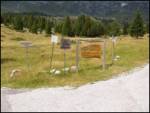 2
2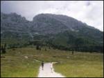 3
3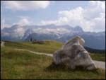 4
4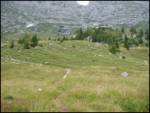 5
5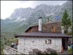 6
6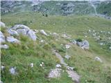 7
7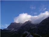 8
8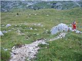 9
9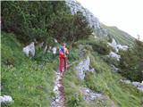 10
10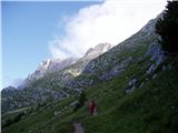 11
11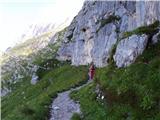 12
12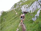 13
13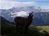 14
14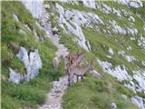 15
15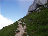 16
16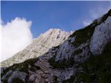 17
17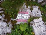 18
18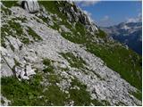 19
19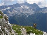 20
20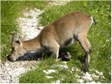 21
21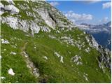 22
22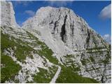 23
23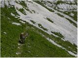 24
24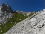 25
25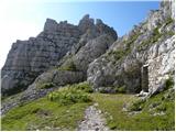 26
26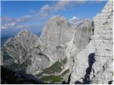 27
27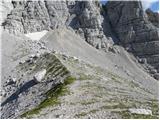 28
28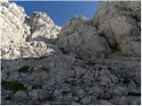 29
29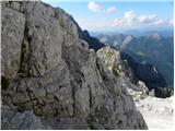 30
30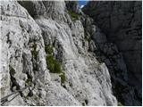 31
31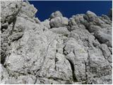 32
32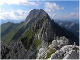 33
33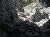 34
34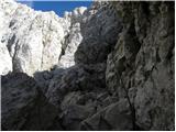 35
35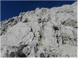 36
36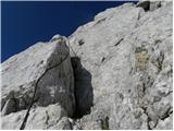 37
37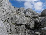 38
38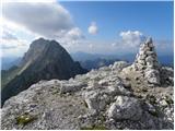 39
39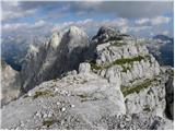 40
40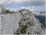 41
41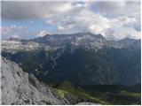 42
42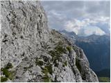 43
43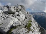 44
44 45
45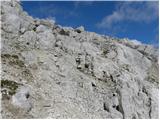 46
46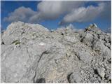 47
47