Pecol - Jôf di Montasio/Montaž (over Pipan's ladder)
Starting point: Pecol (1510 m)
| Latitude/Longitude: | 46,40920°N 13,43760°E |
| |
Route name: over Pipan's ladder
Walking time: 3 h 30 min
Difficulty: very difficult marked way
Via ferrata: B
Elevation gain: 1243 m
Elevation difference along the route: 1250 m
Map: Julijske Alpe - zahodni del 1:50.000
Recommended equipment (summer): helmet, self belay set
Recommended equipment (winter): helmet, self belay set, ice axe, crampons
Views: 237.871
 | 16 people like this post |
Access to starting point:
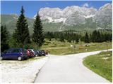
A) From Kranjska Gora over the border crossing Rateče we drive to Trbiž / Tarvisio. In Trbiž we continue left in the direction of Bovec and we follow the road to the crossroad near the lake Rabeljsko jezero. Here we continue right in the direction of Nevejski preval (Na Žlebeh) / Sella Nevea. When the road already starts descending towards the valley Reklanska dolina, in a sharp left turn, a narrow and steep road towards Montaževa visoka planota / Altopiano del Montasio branches off to the right (by the crossroad there are signs in Italian language). We follow this road to a large marked parking lot, which is situated a few 100 meters before the cheese cottage Pecol (further driving is forbidden).
B) From Bovec, we drive to the border crossing Predel, from which we descend on the Italian side. Only a little after the lake Rabeljsko jezero we come to a crossroad, where we continue left in the direction of Nevejski preval (Na Žlebeh) / Sella Nevea. When the road already starts descending towards the valley Reklanska dolina, in a sharp left turn, a narrow and steep road towards Montaževa visoka planota / Altopiano del Montasio branches off to the right (by the crossroad there are signs in Italian language). We follow this road to a large marked parking lot, which is situated a few 100 meters before the cheese cottage Pecol (further driving is forbidden).
Route description:
From the parking lot on the mountain pasture Pecol we go on a narrow road which runs right towards the mountain hut Rifugio di Brazza. Soon signs point us to the left on a footpath, on which through meadows in good 15 minutes we reach the mountain hut. At the crossroad, which is only a few tens of meters above the mountain hut we go on the left path, which runs towards the saddle Forca dei Disteis (2201m), and the right path runs to Špik Hude police (2420m). From the crossroad at first we descend a few meters and then in a gentle ascent, we cross meadows below the mountain walls of Montaž and if we are lucky we can also notice Alpine marmots, and there's quite a lot of them around here. Soon from our left side joins the direct path from the mountain pasture Pecol, which is a few minutes shorter than this past the mountain hut. Here the path already ascends a little steeper and soon brings us to the already mentioned saddle where there is usually a lot of ibexes. To the saddle, we need from the starting point a little less than two hours. At the saddle, the path turns to the right over the scree and we soon come again to a crossroad. Left less visited and a little more demanding path runs towards the bivouac Suringar (2430m). We go on the right path which still crosses scree and it brings us to the memorial plaques, where we enter into the rocky part of the path. Here the path becomes demanding, some easy climbing is needed, we also get help from some steel cables, but less than we are maybe used to in Slovenian mountains. After that, the path turns a little to the left, where we cross smaller scree and we are soon in front of the most difficult, but also the most secured part of the path. First approximately 10 meters with the help of stemples and steel cables, we ascend almost vertically, after that follows 60m high Pipan's ladder, which is a little raised from ground and also almost vertical. When we climb the ladder we only have a few meters to the ridge on which we go to the left. The path on the ridge is no longer so demanding and in 20 minutes brings us to the summit. However, on the path on the ridge caution is still needed, because the ridge is quite exposed, we also have to be careful not to trigger stones, and there is quite a lot of them. The peak is very panoramic and has enough space. On the summit stands also a cross and bell on which mountaineers ring for luck.

Photos:
 1
1 2
2 3
3 4
4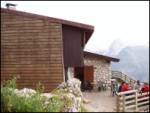 5
5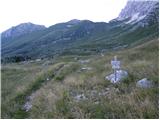 6
6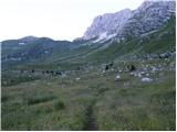 7
7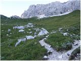 8
8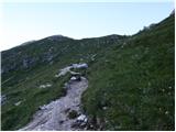 9
9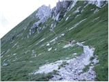 10
10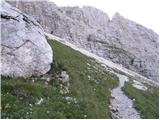 11
11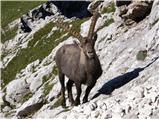 12
12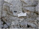 13
13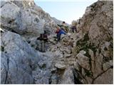 14
14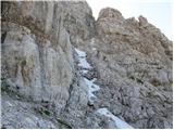 15
15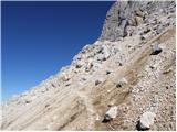 16
16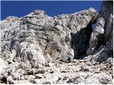 17
17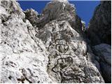 18
18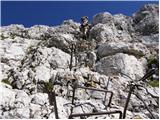 19
19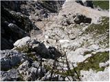 20
20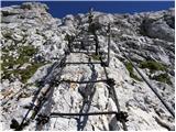 21
21 22
22 23
23 24
24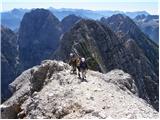 25
25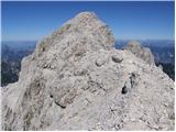 26
26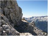 27
27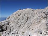 28
28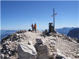 29
29
Discussion about the trip Pecol - Jôf di Montasio/Montaž (over Pipan's ladder)
Show older messages
|
| zlatorog29. 08. 2007 |
Along the described path to the top of Montaž, instead of returning the same way, however, below the scree before Pipanova lestev (which is really first league), then branch off to the LEFT ferrata, along which first horizontal crossing of the adjacent Špika, then descent to the saddle and re-ascent (also along a 15-meter ladder)
|
|
|
|
| zlatorog29. 08. 2007 |
Soon the ferrata ends and the path 15 min below the summit, Špika hude police (Cima di Terra Rossa 2420m) joins the normal path.
The LEFT ferrata is 1:30 hours long and quite airy. From the top of Špika hude police to planina Picol is another 1:30 hours.
The circular tour is super in nice weather, during which you see countless ibex and chamois!
|
|
|
|
| velijo8. 10. 2007 |
Unfortunately I was on Montaž only once before and even then clouds descended all the way to the meadows. I saw the sun again at the end of Pipan's ladder, so I can admire this mountain only from net photos. Under Pipan's ladder and on it I realized that you need to buy a helmet, because pebbles were whistling around me so much that it was quite eerie. If one hit me on the ladder itself, I would probably have fallen down, so I recommend a via ferrata kit. Rating, in my opinion 9, because compared to our mountains, markings and paths this in Italy is somewhat less well maintained
|
|
|
|
| jamesjoyce9. 10. 2007 |
This Sunday we were at the summit via Pipan's ladder, and returned via Findenegg ridge. The latter is a quite narrow, crumbly in places trail and I really recommend great caution and attention to all descending this way. And in general it's good to put a helmet on, on this mountain there is really quite a lot of rockfall. The panorama of the south side is really one of the most beautiful in the Julian Alps.
|
|
|
|
| Gost11. 10. 2007 |
How much snow was there on the path? On Sunday I would go from the Pecol pasture with children to Špik Hude police. Thanks in advance for the answer.
|
|
|
|
| fpetel15. 03. 2008 |
What about up via Findeneggov ozebnik and down via Pipanovo lestev - is this variant more recommendable.
|
|
|
|
| triglavski5. 03. 2008 |
Certainly, but until summer it's still far.
|
|
|
|
| Linebite10. 07. 2008 |
After a long postponement, once due to the weather, the second time due to the long drive, we finally decided and went to Montasio's embrace this Saturday. We started from Pecol pasture and climbed via Pipan ladder. Although fog occasionally rolled in and obscured the unique view, the ascent was pure pleasure. Fixed protection impeccable. We descended also via the ladder, then continued the descent on the LEFT. Fantastic, really great, the fixed protection is in excellent condition, renewed, though loose "Italian style", which comes in handy at certain spots. Helmet and climbing harness for belaying also come in handy.
The left route certainly not for vertigo sufferers, actually Montasio deserves respect and so do all approaches to it.
best regards to all and safe steps
Good luck
|
|
|
|
| ponebsek31. 08. 2008 |
From Planina Pecol via Findeneggov ozebnik. Return via Pipanova lestev. Walking time approx. 7 hours.
I recommend in late August or early September days. I did the tour on 30.8.
The ozebnik (read Mihelič or Mašer) is unsecured, a bit crumbly at the top, but generally okay. Beautiful chimney climbing, up to grade II in places, mostly grade I.
Return via the usual path over Pipanova lestev can be a bit boring in comparison. Especially on weekends waiting in line for the ladder...
The ladder can be bypassed, but the path around is even more unnecessary.
The entire tour requires full gear, helmet, possibly also a self-belay kit (e.g. Pipanova lestev). The tour is not too strenuous and not for those afraid of heights. Highly recommended.
|
|
|
|
| acjom11. 07. 2009 |
Is there still snow on this trail? 
|
|
|
|
| triglavski11. 07. 2009 |
The webcam is not working, the image is from June 9.
|
|
|
|
| Lj11. 07. 2009 |
On 30.6. on the path from planina Pecol to the neighboring Špik we crossed 2 small snowfields on steep slopes, the path itself is quite damaged by avalanches. Given the weather from then until today and the difficulty of the path to Montaž, I assume the conditions might be quite wintry. Good luck!
|
|
|
|
| sk219. 07. 2009 |
Today I completed the route Pecol - Špik Hude plice - Leva path - Pipanova lestev - Montaž - Bivak Surignar - Pecol. There is snow on the path between Montaž and Bivak and between bivak and wall exit. It bypasses all injuries of two short sections between bivak and wall exit. I advise against the path past the bivak because it is extremely crumbly and unprotected, in fog practically untraceable.
LP
|
|
|
|
| sportnick1. 07. 2011 |
On Tuesday my colleague and I set off for Montaž from planina Pecol via the path over Pipanova lestev. The path is incredibly beautiful, practically dry throughout, except a few small snow patches which we cross without trouble. Safety is ensured by fixed cables, which in my layman's opinion were installed relatively recently. Pipanova lestev is of course a unique experience. On the way we encountered at least 20 chamois and ibex. In short, one of the nicer hikes I've done in our immediate vicinity.
|
|
|
|
| guba14. 07. 2011 |
How many meters long is Pipan's ladder?

|
|
|
|
| klm14. 07. 2011 |
135 rungs, with approx. 35 cm spacing between them, which means 48 m.
|
|
|
|
| lepenatka14. 07. 2011 |
Nice tour. Done yesterday. If you go a bit your own way, it's even better. To Pipan's ladder it's better to go up the direct gully below it. Melišce, which is marked as a path, isn't exactly pleasant, especially not for the descent. No crowds.
Marmots, ibexes and gentians and plenty of other flowers.
|
|
|
|
| guba18. 07. 2011 |
16.7.2011 I was on Montaž. On Pipanova lestev it was so cold I don't know what to say, otherwise the tour was interesting especially the descent on scree
|
|
|
|
| videc3. 08. 2011 |
On 2.8. we did a wonderful circular tour Pecol - Špik Hude police - Ferrata Leva - Pipanova lestev -Montaž -Findeneggov glacier - Pecol. The whole path took almost 7 hours. Ferrata Leva surprisingly well protected for Italian standards, yet not for vertigo sufferers. On descent over the glacier we hit some small snow patches, no major issue. Greater problem is rockfall danger and poor path marking.
|
|
|
|
| IgorZlodej3. 08. 2011 |
Usually one goes the other way around.
|
|
|
|
| videc4. 08. 2011 |
In principle I agree, but I like this variant more since in this variant you gradually increase the whole tour by difficulty and interest. besides ascents over screes are not really to my liking I prefer them on descents...
|
|
|
|
| IgorZlodej4. 08. 2011 |
I have also done it in the opposite direction, but I don't like the descent through Findenegg, so I descended from Leva and climbed back up to Velika polica and to the summit, and descended past Pipanova, because the descent on the lojtra is not very interesting to me
|
|
|
|
| Matjaz_6513. 08. 2011 |
a few more of my photos ... from the ascent through Findenegg glacier ... and descent via Pipan ladder 
|
|
|
|
| mailman13. 08. 2011 |
Bravo Matjaž!!! Nice pictures and dangerous tour!!
|
|
|
|
| mailman13. 08. 2011 |
Bravo Matjaž!!! Nice pictures and dangerous tour!!
|
|
|
|
| carlla16. 08. 2011 |
....I'm interested how many hours are needed for ascent through Findeneggov ozebnik and if the trail is well marked because I've never been there...
lp
|
|
|
|
| IgorZlodej16. 08. 2011 |
I need 3 hours and 15 min, there is no trail through Findeneggov ozebnik, it's pathless terrain marked with faded cairns, locally UIAA II.
|
|
|
|
| Okmodko16. 08. 2011 |
I'm wondering how dangerous this Pipanova lestev is, and whether it's really a very demanding path or not, and which Slovenian path it could be compared to?
|
|
|
|
| urbancek17. 08. 2011 |
Do you really need a via ferrata set if you're taking the easiest path or the chamois trail? Isn't this the easiest route to Montaž? Thanks for the reply.
|
|
|
|
| dedo2417. 08. 2011 |
We were up there on Sunday. It's good to have a via ferrata set because stones are falling all the time, some from chamois, some from people. The gravel on the path is more of a problem. The ladder isn't scary, maybe for someone who's never climbed one. You can check out our photos /www.pdmaticams-drustvo.si/
|
|
|
|
| urbancek17. 08. 2011 |
Isn't a helmet enough against falling stones?
|
|
|
|
| facko17. 08. 2011 |
In principle yes. Depends on the size of the stone. A stone the size of an egg from 50m height - thanks - no.
|
|
|
|
| urbancek17. 08. 2011 |
That's clear to me, but I don't understand what the via ferrata set has to do with falling stones...
|
|
|
|
| facko17. 08. 2011 |
Less of a joke, more seriously: if you use both - stone hits the helmet, you get dizzy a bit and fall only one meter lower and not 10m ...
To return to the question above about the easiest path to Montaž: the easiest goes about 10m to the right of Pipan's ladder and you can use it for descent if there's a crowd on the "ladder". I'm not sure if it's specially marked because it's been a while since I was there. But it's thoroughly marked with chamois ... (well you know with what) And this "Pipan's ladder" is more of an attraction for the brave, as Mr. Stanko Klinar commented in the book "100 Slovenian Peaks".
|
|
|
|
| boris130. 08. 2011 |
On Sunday we went along the Pipanovi lestvi path, I must say it's marked rather poorly, as for the ladder it's a small adrenaline test otherwise really beautiful valley with lots of wildlife marmots ibex cows and the like. It must be said that the terrain is quite crumbly so without helmet and other gear it's not recommended to go up. There were families with children and I can say they really took good care of their safety compared to what I saw at Cjajnik in Austria. Go and convince yourselves that Montaž is really nice.
|
|
|
|
| mary22. 06. 2012 |
Hello! Has anyone hiked this path and the "Left" path to Špik Hude police recently and can say if there is still any snow on the path? Thanks, Lp
|
|
|
|
| IgorZlodej22. 06. 2012 |
Read my description in Forum/Current conditions; as I saw on the A.E. Leva path, there is no snow.
|
|
|
|
| mary25. 06. 2012 |
Yesterday walked the described path to Montaž and then crossing via the Leva path to Špik Hude police.. No more snow on the path
|
|
|
|
| katja8731. 07. 2012 |
On Saturday, 28.7.2012, we went with the family to Montaž via Pipanovo lestev.
The day was sunny and beautiful for such an ascent. On the way we met quite a few chamois, which luckily didn't trigger any rocks
Pipanova lestev is really adrenaline-filled, as it constantly sways and that's 60m. At the same time it's a bit harder if you're belayed on it with a self-belay harness, but it's still better, since safety comes first.
At the top there were mostly Slovenians, and we also met a large group from some mountaineering club at the summit.
Pictures from the hike can be viewed on the website of Planinsko društvo Matica Murska Sobota: http://www.mojalbum.com/pdmaticams/20120729-montaz/foto/19905018
|
|
|
|
| NEIC00819. 08. 2012 |
18.8.2012.... Interesting path. Along the ridge, especially if windy, not for the vertiginous. Lots of rocks rolled by chamois..A few the size of a soccer ball ''whizzed'' by. In such cases a helmet helps little, still, no helmet no go..
|
|
|
|
| jakas10. 09. 2012 |
10.9.12 we were up there, super tour, nice nature, ibexes almost too many . Agree with others, stones are the only problem here.
|
|
|
|
| Okmodko13. 06. 2013 |
Are the grassy slopes under Montaž, Zabuš and Strma peč already dry? I mean before the start of all the cables...
|
|
|
|
| Potohodnik23. 07. 2013 |
Yes, it drags a bit to that saddle (2h). Then you have the calvary: no ropes, all the way to the lojtra. ATTENTION: right below the lojtra there's bullshit: some scree dangerous for stones (falling) and it's very annoying. On the ridge you'd need a rope again. You meet chamois all the time. You also have marmots.
|
|
|
|
| ms_primoz23. 07. 2013 |
Interesting, last year I was on Montaž...not a single stone problem...
now I'm starting to wonder, was I really on Montaž?
|
|
|
|
| aljoša123. 07. 2013 |
I was on Montaž today with my cousins. That scree below the lojtra is really annoying, besides on that same scree there's also an extensive steep snowfield that you have to cross to get to that vertical part before the lojtra. The fixed protections are otherwise in excellent condition.
|
|
|
|
| anamis30. 07. 2013 |
I was on Montaž on Sunday. None of the remaining snowfields pose an obstacle on the ascent. It's also possible to calmly climb through the scree. Of course, most people go straight up - I did too, but on the way down I saw that the path is actually laid out more in zig-zag. The problem was the stones flying by that missed me twice well. Therefore, it's necessary to step carefully so as not to endanger other people.
|
|
|
|
| superoxide28. 08. 2013 |
Here is a short video of the ascent to Montaž. We ascended via the glacier and descended via Pipanova lestev. Personally, this is one of my favorite circular trails. Quite adrenaline-packed and not too long a tour. http://www.youtube.com/watch?v=8s5fMfiNqXY
|
|
|
|
| Ivana RI28. 10. 2013 |
hello! Do you know if there is snow on the top? Will crampons be needed this weekend? Thanks
|
|
|
|
| acjom1. 08. 2014 |
Are the grassy slopes towards Montaž and towards the ladder already snow-free?
|
|
|
|
| klm2. 08. 2014 |
info from yesterday: first snowfield at the top of the first scree below the cliffs, second on the upper scree below the entry to the wall to Pipanova...
|
|
|
|
| acjom2. 08. 2014 |
But is it passable without gear (ice axe, crampons)?
|
|
|
|
| klm2. 08. 2014 |
Ice axe is highly recommended, snow softens quickly.
|
|
|
|
| Igor838. 08. 2014 |
So no one carries winter gear up unnecessarily.. the path is nicely passable, snow no longer obstacle. Descent recommend in LEFT direction (steep ledges), for me personally even nicer part than the ascent via Pipanova ladder.
|
|
|
|
| toni19671. 09. 2014 |
I'm interested in the difficulty through Pipanovo lestev compared to Hanzova on Mala Mojstrovka
|
|
|
|
| VanSims1. 09. 2014 |
Pipanovo lestev is hard to compare to Hanzova on MM, since there are no ladders there. Otherwise, if we compare the whole path (without the ladder itself, which you can also avoid if you're afraid of heights), it seems to me on the level of the path through Prag, so easier than Hanzova on MM. The Medvedovi skali would correspond to the pegs and cables before the ladder itself (the path that bypasses the ladder also bypasses that).
The problem is that you have to go down the same path, which is a bit more tricky.
|
|
|
|
| Keko1. 09. 2014 |
I might not fully agree. The path to Montaž via Pipanova lestev can be quite dangerous for slipping. The rocks are very polished in places by hikers, which is dangerous especially on the descent, as it is also the easiest descent.
At Mojstrovka you can descend via a much easier path. On this path I witnessed someone's slip on the descent. If someone hadn't grabbed their backpack, it would have ended very badly, as they would have ended up a couple hundred meters lower. The path to Montaž is still not as secured as to Mala Mojstrovka. The path therefore requires quite a bit of caution.
|
|
|
|
| Zebdi2. 09. 2014 |
Hanzova doesn't have any such difficult detail as that wall under Pipanova lestev, on the other hand the "difficulties" drag on longer than on the path to Montaž. Hanzova can also be dangerous for slipping (mud, scree on places with smoothed rocks), and besides it has more exposed sections. But Keko is right that Mojstrovka has a much easier descent than Montaž. Personally, the path to Montaž didn't seem poorly protected to me, the descent via Hanzova seems more awkward to me than the descent via Pipanova.
|
|
|
|
| zoranp6821. 10. 2014 |
hi. On 19.10.2014 I was on Montaž. Up and down via Pipan. For me personally the part above the ladder to the top of the ridge is more dangerous because it crumbles.
|
|
|
|
| Ljubljančan31. 10. 2014 |
Today was a great day to visit the mountain, attaching some photos, tomorrow I hope to process a short video that will show the condition of the path and dangers.
Montaz
Personally, I think the passage, which is just a couple of meters, is the most difficult/awkward section, otherwise it's really a nice tour, definitely worth visiting these days.
|
|
|
|
| acjom31. 10. 2014 |
I'm wondering if there's any snow on the path
|
|
|
|
| Ljubljančan1. 11. 2014 |
There is almost no snow, except for a few patches. The first snow appears on the scree before entering the rocky section (3m), but it is well trodden (see picture 11 in description).
There is a little frozen snow at the end of the gully (see picture 14 in description), but it can be nicely gripped and there are no problems.
Further on, you can avoid the snow until the ridge, where there is some but nothing dangerous (link in previous post).
Best regards R
|
|
|
|
| Potohodnik6. 12. 2014 |
I read some comments a bit and recalled the memory and read my comment a bit higher. I described the ascent a bit poorly. As for the surroundings: Montaž is excellent. The ascent is very nice despite the scree, but I think it's right not to change their home with fixed cables.
|
|
|
|
| primozs21. 12. 2014 |
Yesterday visited Montaž (Špik nad policami).
Snow starts at 1800 meters. Mandatory use of crampons and two ice axes. Snow is unconsolidated and one must be very careful. Road to the alpine pasture passable, no snow on the roadway.
|
|
|
|
| Merymery25. 07. 2016 |
Hello, I see that no one has commented for a long time, I'm wondering if anyone has recently visited Montaž or if there's still any snow on the path. Regards
|
|
|
|
| Merymery26. 07. 2016 |
thumbs up climber thanks I'll check as we plan to visit Montaž at the end of the week
|
|
|
|
| cebelicaU6. 09. 2017 |
Hi, does anyone know if there's already snow up there? Is the path still more or less dry? LP
|
|
|
|
| švedrc9. 09. 2017 |
The path is completely dry.
|
|
|
|
| inot5. 07. 2018 |
02.07.2018 from planina Pecol via Pipan ladder. On the path there are some snowfields that can be crossed without winter gear, awkward only the snowfield right below Pipan ladder. The snowfield can be bypassed, there was also a variant path under the snowfield approx. 10 m, which is becoming more dangerous every day because the ice layer is very thin
|
|
|
|
| trdi7715. 07. 2018 |
14.7.2018 - we also started from the Pecol pasture via Pipan's ladder. There's still a little snow just before entering the wall, right below Pipan's ladder just two patches of snow left, which allow safe passage. At the top of Pipan's ladder there's a lot of loose rock and you need to be careful as you can easily trigger a rockfall. No one ahead of us and we got a "shipment" from locals "chamois". I was surprised how many there were at the top.
I was a bit disappointed with the path marking and there could be an extra cable in some places towards the summit, more for peace of mind than necessity.
Otherwise a nice tour with great views.
|
|
|
|
| devill16. 07. 2018 |
14.7. around 15:00 helicopter rescue took place, we heard calls for help and I'm wondering if there's any news? Hope nothing tragic?
|
|
|
|
| sAleska17. 07. 2018 |
I was at Montaž on Friday, July 13th. Weather excellent. Practically no people. Just one German-speaking father with his 8 and 10-year-old sons. Regarding snow, trdi77 already said it - you can actually bypass those few snow patches. I didn't notice any rocks above the ladder at all, nor did I trigger even one on the whole path. But ibex (not chamois) were constantly triggering them, and quite large ones. Luckily I wasn't in the fall line. Regarding markings I had no problems, especially not with the fixed cables - for me even if they weren't there. But such an assessment is really very subjective. Good luck to all who will go there.
|
|
|
|
| Drago197517. 08. 2018 |
Hello, yesterday 17/8/18 I was on Montaž around 13:00, descent at 15:00. To the parking lot 2h15min. Pipan's ladder is more of an attraction than a difficulty. Big crowd on the glacier and helmet mandatory at least, because stones fly from the top of the glacier. I spent up/down/lying/photographing/etc 10 hours. The tour is exceptionally beautiful. Time is my ally and the day was sunny. I greet the mountaineer who will read this (don't know the name...sorry) best regards to all
|
|
|
|
| Drago197517. 08. 2018 |
oh and I'd add this, otherwise my observations were already written by trdi77, namely missing wire ropes or some holds "right from the top of Pipan's ladder along the ridge to the summit. And also very poorly marked trail with red dots. Easy to get off track. Good luck and best regards
|
|
|
|
| SilvestrO27. 08. 2018 |
Reading this above..., Drago, I think you got a bit mistaken and were on Montažu 16.8.18...., and we talked, a bit on the way up and again when I was returning from the summit, we met under Pipanova lestev. You took a lot of photos, where are the pictures?
Best regards
|
|
|
|
| miratan11. 10. 2018 |
Hello,
interested if anyone has been to MONTAŽ recently. I'd like to go this weekend 13 or 14 October, interested in conditions - snow?
|
|
|
|
| danielenidoma11. 10. 2018 |
We two were there on 4.10. Up via the ice field, there was quite a lot of snow over the ice field .. down via Pipanovo. There were a few snow patches yes, but nothing particularly noteworthy or that would pose any difficulty. Now with high temperatures anyway, so I think most has melted.
Good luck!
|
|
|
|
| Ksandi14. 10. 2019 |
Yesterday, 13.10. my colleague and I first went along Leva path to Pipanova lestev and over it to the summit of Montaž. Very nice path.
|
|
|
|
| Fulcrum24. 09. 2020 |
Last Saturday I was for the first time on Montaž via this path. The path (No. 663, if I remember correctly) is marked only up to Pipanova lestev, from there on you only occasionally spot a faded red dot. The most demanding sections are well secured with cables; still, one must be careful as the path is very crumbly and rocks can easily be triggered. 
|
|
|
|
| J.P.17. 08. 2021 08:50:21 |
Exceptionally beautiful areas. Up and down via Pipanovo, for return we chose the traverse (ferata Leva) to the notch then down to the hut. The traverse was the highlight of the day as the wall is really special. Helmet mandatory here all the time. Safe steps, Lp
|
|
|
|
| SimonT19. 06. 2022 18:29:30 |
The path was CLOSED yesterday, 18.6.2022, (probably for a few more days). The ridge above Pipan ladder too. The guys are seriously repairing the safety gear and culture dictates not to throw rocks on their heads in thanks. Unfortunately, there were also models at the top of Montaz who even boasted that they went over the CLOSED path. The Italians working there loudly warned the "guests", mentioned Holy Mary in all forms but apparently it wasn't clear enough for some Kranj hard-headed and ill-mannered dolts . .
|
|
|
|
| haridautovic27. 06. 2022 18:50:12 |
Works on Pipan will be completed on 15.7.2022/Yesterday I did this ascent over the glacier, the path is really very demanding, since today the works are paused I went to check what's been done. They've nicely secured the ridge path with new cables, some pegs all the way to Pipan. Also the exit from Pipan goes directly up under the rock and not over the scree, excellent,, there's also a reserve route towards the top of the hill, I continued there myself and descended via the path that leads to the top of the hill to the entrance to Pipan. The old Pipan has already been cleared and will go to scrap metal.
|
|
|
|
| ejas123413. 07. 2022 17:10:52 |
Hello
I'm interested in Montaz
Is it possible as a loop and where is better up and where down
I would go from Pecol pasture
Thank you very much for answers.
|
|
|
|
| mirank13. 07. 2022 17:25:10 |
No need to think much, up via Findeneg glacier and down Pipan, if you add ferrata Leva to Šhš you win
|
|
|
|
| ejas123413. 07. 2022 20:29:32 |
OK
I'll check how it looks
Thanks
|
|
|
|
| garmont13. 07. 2022 20:43:30 |
Maybe this too:
In Findeneg quite serious climbing…
On Pipanova the ladder swings a lot and is 60m high…
On Leva steep ledges and quite some ironware…
So for experienced.
|
|
|
|
| mirank13. 07. 2022 20:46:58 |
Just check yourself how much experience with such things you have, you know best. Good luck and steady step
|
|
|
|
| jax14. 07. 2022 08:34:59 |
@garmont
Haven't been yet, but from photos the new Pipan ladder feels much more stable than the old one. So I'd speculate it swings much less now.
|
|
|
|
| dprapr14. 07. 2022 09:13:21 |
It was quite solid before too.
Only danger was scree and rocks above it sent down by careless Montaz visitors onto the ladder. Not safest to climb if someone above you.
|
|
|
|
| mikkeni27. 10. 2022 08:00:39 |
Has anyone done this route this week maybe? Snow and such?
|
|
|
|
| garmont13. 08. 2023 12:02:37 |
After the renovation the ladder is more sturdy, hardly sways. However, they rerouted the path continuation above the ladder completely new. The path is very exposed and goes straight up the wall, almost to the ridge. SVK is pretty much mandatory.
|
|
|
|
| nejka0230. 10. 2024 11:37:07 |
Has anyone been there recently by chance? Are crampons needed, is there snow? Thanks for info
|
|
|
|
| KMiha30. 10. 2024 12:11:18 |
|
|
|
|
| drugi žagar15. 12. 2025 17:06:30 |
Is the path to Montaž via Pipanova lestev using via ferrata gear more demanding than the path to Grintovec via Mlinarsko sedlo without gear? (Mainly interested in how exposed and slippery the sections without present protections are). Planning the ascent next summer.
Thanks for help.
|
|
|
|
| Loerst17. 12. 2025 09:01:21 |
In short - no. Regardless of the above description, my feeling was that there are lots of protections and they were in excellent condition and I didn't miss them anywhere. Just don't forget helmets, because stuff really flies down often, sometimes due to chamois, sometimes due to clumsy tourists.
|
|
|
|
| Vrhovka26. 06. 2026 18:32:11 |
Which path do you recommend for the descent, also via Pipanovo lestev?
|
|
|
|
| mirank27. 06. 2026 14:45:27 |
It always depends on experience. Given that I am somewhat at odds with returning by the same route, I usually use the one through Finedeneggov ozebnik for the ascent and the descent in the mentioned direction. You can also do the descent by the normal route, which runs a bit more to the east of Pipanova lestev. How passable it is now is questionable, because I haven't seen anyone in that direction for years.
|
|
|
|
| kozuc28. 06. 2026 07:33:25 |
The normal route is rather poorly marked, but it is doable if you want to avoid the crowd on the ladder. However, at the top at the beginning everything is quite suspicious, because instead of going down the ladder you continue transversely across that scree, then soon at one place you have to jump down about a meter and a half from a rock ledge. Well, at least that's how I solved that puzzle. I assume there used to be some piton for assistance there? Then the path goes a short way along the northern side of the ridge, after which you reach steep meadows, where a narrow path in zigzags takes you down.
|
|
|
|
| saqo29. 07. 2026 16:49:42 |
How much time did you need for the ascent at an average pace (please do not chime in as some pros, but ordinary average mortals)? It is marked as 3.5h, but apparently more is needed, since there is usually also a crowd on the ladder..
|
|
|
|
| mrkralj3. 08. 2026 06:51:33 |
I needed a few minutes less than 4h. It depends on the crowd on the ladders, the skill of securing and of course the crowd in front. The pace was moderate WITHOUT BREAKS. only 15 min for a snack. The path is very nicely marked and maintained. The ladders are all new.
|
|
|
|
| Roberto-MMLM3. 08. 2026 18:28:58 |
Is there any snow up there? I assume SVK is necessary, and a helmet absolutely.
I wouldn't carry ice axes and crampons if not needed.
I'm quite used to it, 14 days ago on Jalovec and this weekend on Škrlatica.
Are there many cables? From the pictures I see, it would be necessary to clip in only on the ladder, am I wrong?
Can the route be extended to some other peak, I'm not familiar with this area.
|
|
|
|
| ljubitelj gora3. 08. 2026 22:04:57 |
I didn't notice it on Špik nad Nosom, yeah some have complete sets, others don't, you take it because these aren't walks.
|
|
|
|
| Tomco4. 08. 2026 18:15:19 |
Practical advice - when going somewhere for the first time and you're not sure how it will be, take the complete set. If you won't need to clip in, you'll know for next time.
Helmet is self-evident, for winter I'm convinced you don't need it.
The extension can be after the via ferrata Leva to Špik some difficult ledges, but at current temperatures on the descent it will probably be too hot.
|
|
|
|
| mirank4. 08. 2026 21:21:41 |
On the left after 12h you have no shade anywhere, below 2000m asl on these slopes in these conditions it's already very warm. At 13h it showed 29 to me on the parking lot in the shade. Asking for winter equipment at such temperatures at these altitudes is completely out of place
|
|
|
|
| saqo14. 08. 2026 07:37:47 |
User Turbo: why then does it say here on hribi.net that the path is only 3:30h? it seems to me like a big discrepancy..on your application it says fast pace 5:24, they only state 3h
|
|
|
|
| velocy14. 08. 2026 08:48:31 |
My wife and I (who is kind of an average hiker when it comes to pace) took 3:35 to reach the top.
|
|
|
|
| velocy14. 08. 2026 08:50:21 |
There's obviously something very wrong with that app that Turbo uses...
|
|
|
|
| velocy14. 08. 2026 11:19:51 |
Turbo, I sincerely apologize for my stupid comment - I overlooked that the descent is included in the times.
|
|
|
To post a comment you must log in:
If you do not yet have a username, you must first
register.